Arlington Peak (California)
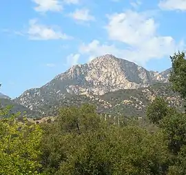
Arlington Peak is a 3,258-foot (993 m) high peak within the Santa Ynez Mountains located north of Santa Barbara, California.[1] The peak is adjacent to the south of La Cumbre Peak and to the southeast of Cathedral Peak.[2]
| Arlington Peak | |
|---|---|
 | |
| Highest point | |
| Elevation | 3,258 ft (993 m) |
| Prominence | 75 ft (23 m) [1] |
| Coordinates | 34°28′58″N 119°42′52″W |
| Geography | |
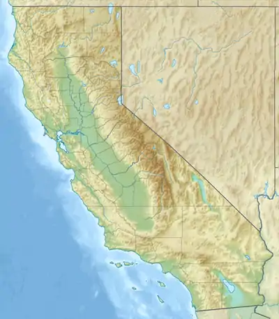 Arlington Peak Location in California  Arlington Peak Arlington Peak (the United States) | |
| Location | Santa Barbara County, California, U.S. |
| Parent range | Santa Ynez Mountains |
| Topo map | USGS Santa Barbara |
| Climbing | |
| Easiest route | Trail |
The name of the peak purportedly originated in 1889 from the staff of the Arlington Hotel who referred to the area comprising the three peaks as The Arlington Crags.[3]
Geology
Arlington Peak is primarily composed of Matilija Sandstone[4]
References
- "Arlington Peak, California". Peakbagger.com. Retrieved 2021-02-01.
- "Arlington Peak". SummitPost.org. 2006.
- "Arlington Peak". Santa Barbara Outdoors. 18 Dec 2014.
- Norris, Robert M. (2003). The geology and landscape of Santa Barbara County, California. Santa Barbara, California: Santa Barbara Museum of Natural History. pp. 80–81. ISBN 0-936494-35-2.
This article is issued from Wikipedia. The text is licensed under Creative Commons - Attribution - Sharealike. Additional terms may apply for the media files.