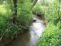
Badsey Brook
The Badsey Brook also known as the Broadway Brook is a small brook that flows through Worcestershire, England. It is a lower tributary of the River Avon which it joins near Offenham upstream of Evesham. Its principal tributary is the Bretforton Brook.[1][2][3]
| Badsey Brook | |
|---|---|
 Badsey Brook near Childswickham | |
 Location within Worcestershire | |
| Location | |
| Country | England |
| Counties | Worcestershire |
| Physical characteristics | |
| Mouth | |
• location | River Avon |
• coordinates | 52.1072°N 1.9287°W |
| Basin size | 102 km2 (39 sq mi) |
| Discharge | |
| • location | Offenham |
| • average | 0.68 m3/s (24 cu ft/s) |
Course
It rises on the flanks of the Cotswold Hills near Snowshill, and flows in a north-westerly direction through Broadway, and Childswickham before turning north and passing Wickhamford where it is crossed by the A44. The brook is then joined by a couple of minor tributaries, before flowing through Badsey then Aldington where it meets the Bretforton Brook. Turning north-west, it flows past Offenham Cross where it is bridged by the B5410, to join the Warwickshire Avon south of Offenham.[1]
Hydrology
The flow of the Badsey Brook has been measured, in its lower reaches at Offenham since 1968. The gauging station was initially a flume, later changed to a weir.[4] This long-term record shows that the catchment of 96 square kilometres (37 sq mi) to the gauging station yielded an average flow of 0.68 cubic metres per second (24 cu ft/s).[5] The highest river level recorded at the station occurred on 21 July 2007, with a height of 3.65 metres (12.0 ft), and the second highest of 3.14 metres (10.3 ft) in April 1998.[4] The catchment upstream of the station has an average annual rainfall of 653 millimetres (25.7 in) and a maximum altitude of 317 metres (1,040 ft) at Broadway Hill near the source of the brook.[6] Land use within the basin is mainly agricultural, consisting of arable, horticulture and grassland with some woodland.[6]
Floods
The Badsey Brook along with the Avon and its other tributaries was badly affected by the 2007 floods. To help prevent flooding in the future a flood storage area is planned to be constructed in Broadway.[7]
See also
References
- "Broadway-Badsey Bk - source to conf R Avon". Catchment Data Explorer. Environment Agency. Retrieved 25 April 2016.
- "Bretforton Bk - source to conf Broadway-Badsey Bk". Catchment Data Explorer. Environment Agency. Retrieved 25 April 2016.
- "Littleton Bk - source to conf Bretforton Bk". Catchment Data Explorer. Environment Agency. Retrieved 25 April 2016.
- "54023 - Badsey Brook at Offenham Info". National Rivers Flow Archive. Centre for Ecology & Hydrology. Retrieved 25 April 2016.
- "54023 - Badsey Brook at Offenham Daily Flow Data". National Rivers Flow Archive. Centre for Ecology & Hydrology. Retrieved 25 April 2016.
- "54023 - Badsey Brook at Offenham Catchment Info". National Rivers Flow Archive. Centre for Ecology & Hydrology. Retrieved 25 April 2016.
- "Badsey Brook flood risk management scheme". Government Digital Service. Environment Agency. Retrieved 27 April 2016.