Banjar, India
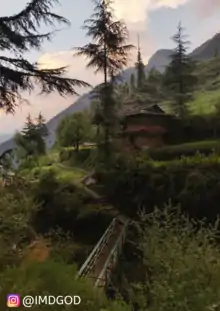
Banjar is a town in Kullu district in the state of Himachal Pradesh, India. It is a part of the Seraj region that extends from Jalori pass to Shikari Devi in Janjehli. The Tirthan valley is also a part of the Banjar region with Banjar town being the main marketplace in Tirthan Valley. Tirthan River is a major river of Banjar along with the tributary Pushpabhad flowing from Jalori pass through Jibhi. It is located at the confluence of these two rivers. Banjar is one of the tehsils of the Kullu district. 'Banjar mela ' is the prominent fair of Banjar valley. A dialect of Kullavi called Seraji is spoken here and the people are also called Serajis. There are many tourist spots in Banjar, these are Tirthan valley, chehni fort for Shringa Rishi, Bahu village, jibhi valley, Balu temple, etc. In 2020, Tirthan Valley is considered to be one of the most underrated tourist spots of Himachal Pradesh.[4]
Banjar | |
|---|---|
 Banjar Location in Himachal Pradesh, India 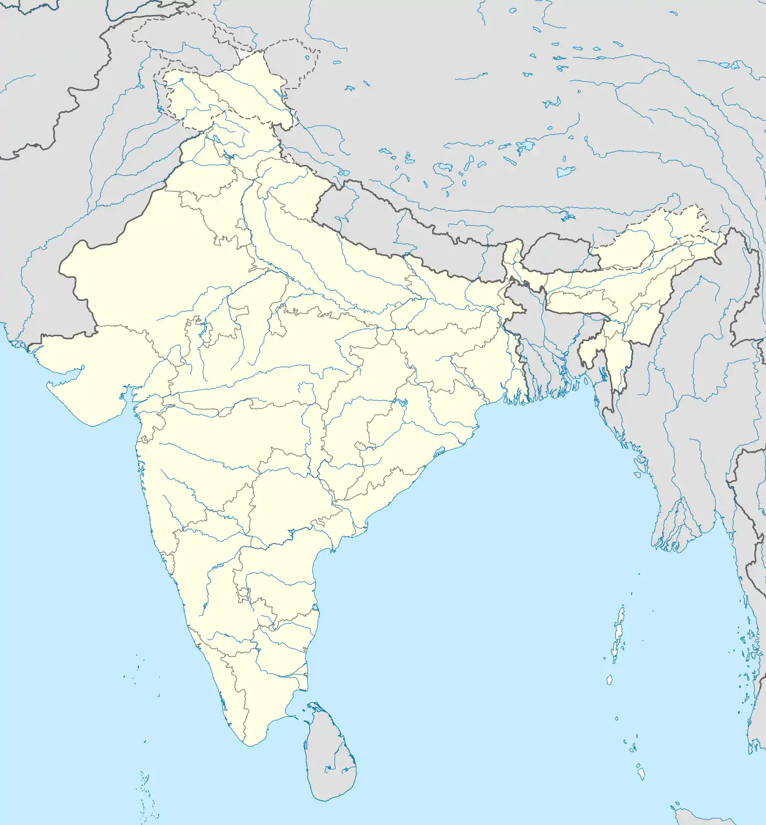 Banjar Banjar (India) | |
| Coordinates: 31.63°N 77.35°E | |
| Country | |
| State | Himachal Pradesh |
| District | Kullu |
| Chief Minister | Jai Ram Thakur |
| Government | |
| • Type | Bharatiya Janata Party |
| Elevation | 1,356 m (4,449 ft) |
| Population (2011) | |
| • Total | 1,414 |
| Official | |
| • Official | Hindi and English |
| Time zone | UTC+5:30 (IST) |
| PIN | 175123 |
| Area code(s) | 01903 |
| Vehicle registration | HP-49 |
Geography
Banjar is located at 31.63°N 77.35°E.[1] It is situated at a height of 1356 meters (4515.48 feet) from sea level. The place lies on the alternate route to Kullu from Shimla. The main route is via Bilaspur and Mandi. The alternate route goes from Theog, Aani, Jalori Pass, Banjar and joins the main route at Aut. The Banjar Valley is in the middle Himalayan range and going towards the east, the peaks progressively get taller, finally giving way to the great Himalayan range, where peaks have heights of 4500 meters and above. Banjar is one of the tehsil of the Kullu district. C-24 is the name given to Banjar Constituency. Banjar constituency has 3 Zila Parishad ward names as Khadagad, Plahach, and Raila. The city is growing with rapid speed in the tourism industry. The valley is also a gateway to The Great Himalayan National Park from its north-eastern side. The town consists of a lot of pocket-friendly and less crowded tourist places and serves as a summer destination. The Main source of earning in this area is through agriculture and horticulture. Now tourism and hospitality industry is attracting the locals.
Tirthan and Jibhi valley are the two main attractions in Banjar. Tirthan valley is also known for the Trout fish Valley ,and its divine beauty. People of Banjar celebrate many festivals like Magh-Sakranti (in January), Faguli (in March), Shairi (in September) and Diwali. People wear woolen clothes. There are many holy places.
Demographics
As of 2001 India census,[2] Banjar had a population of 1262. Males constitute 55% of the population and females 45%. Banjar has an average literacy rate of 84%, higher than the national average of 59.5%; with 89% of the males and 78% of females literate. 8% of the population is under 6 years of age, of which 52% are male and 48% are female.
Administrative Setup[3] of Banjar Sub Division
| 1 | Year of creation of Sub Division | 1963 |
| 2 | Total Area (Hectares) | 10076 |
| 3 | Total Assembly Constituency | 24-Banjar |
| 4 | Administrative Units | |
| 4.1 | Tehsils | 1 |
| 4.2 | Sub-Tehsils | 1 |
| 4.3 | Blocks | 1 |
| 4.4 | Towns | 1 |
| 4.5 | Total Villages | 45 |
| 4.6 | Total Police Stations/Posts | 2 |
| 5 | Families | |
| 5.1 | Total Families | 10,940 |
| 5.2 | Rural Families | 10,597 |
| 5.3 | Urban Families | 343 |
| 6 | Literacy | |
| 6.1 | Total | 70.88 |
| 6.2 | Male | 83.28 |
| 6.3 | Female | 57.99 |
| 7 | Panchyati Raj | |
| 7.1 | Total Panchayats | 41 |
| 7.2 | Backward Panchayats | 7 |
| 7.3 | Zila Parishad Members | 2 |
| 7.4 | Panchayat Samiti Members | 15 |
| 7.5 | Gram Panchayat Members | 198 |
| 7.6 | Total Panchayat Secretaries | 12 |
| 7.7 | Total Panchayat Sahyaks | 22 |
| 7.8 | Total Technical Assistants | 10 |
| 8 | Agriculture | |
| 8.1 | Total Agricultural Land (Hect.) | 10,858 |
| 8.2 | Net Shown Area (Hect.) | 6,935 |
| 8.3 | Anganwaris | 45 |
| 8.4 | Primary Schools | 153 |
| 8.5 | Middle Schools | 20 |
| 8.6 | High Schools | 14 |
| 8.7 | Senior Secondary Schools | 3 |
| 8.8 | Colleges | 1 |
| 9 | Health | |
| 9.1 | P.H.C. | 3 |
| 9.2 | Sub-Centres | 18 |
| 9.3 | Hospitals | 1 |
| 9.4 | Ayurvadic Health Centres | 12 |
| 10 | Banks | |
| 10.1 | Co-operative Banks | 3 |
| 10.2 | Commercial Banks | 4 |
| 10.3 | Land Dev. Banks | 1 |
| 11 | No. of Micro Watershed Schemes | 6 |
| 11.1 | Area Covered (Hect.) | 3,701 |
Nearest Airport
Though Bhuntar is technically the closest airport, flights tend to be erratic due to the weather. Your best bet is to take the Himachal Tourism (HTPDC) bus to Manali. The state-run bus service is reliable and comfortable compared to private operators, and quite safe for travelers.
An alternate and more relaxed route is via Shimla. Descend down the breathtaking Jalori pass to enter the valleys via charming villages like Shoja and drive through beautiful cedar forests. You can also take a train (or flight) to Chandigarh and take a taxi to the valleys. Alternatively, take the toy train from Kalka to Shimla and drive down from there.
References
- Falling Rain Genomics, Inc - Banjar
- "Census of India 2001: Data from the 2001 Census, including cities, villages and towns (Provisional)". Census Commission of India. Archived from the original on 16 June 2004. Retrieved 1 November 2008.
- "Administrative Setup Banjar Sub-Division".