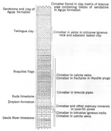
Buda Limestone
The Buda Limestone is a geological formation in the High Plains and Trans-Pecos regions of West Texas[1] and in southern New Mexico,[2] whose strata date back to the Late Cretaceous. Pterosaur remains are among the fossils that have been recovered from the formation.[3]
| Buda Limestone Stratigraphic range: Late Cretaceous (Cenomanian) | |
|---|---|
| Type | Geological formation |
| Unit of | Washita Group |
| Underlies | Eagle Ford Group, Woodbine Formation, Boquillas Formation |
| Overlies | Del Rio Formation and Grayson Formation |
| Thickness | 100 feet (30 m) |
| Lithology | |
| Primary | Limestone |
| Location | |
| Coordinates | 30.0849°N 97.8507°W |
| Region | North America |
| Country | United States |
| Type section | |
| Named for | Buda, Texas |
| Named by | T.W. Vaughan |
| Year defined | 1900 |
 Buda Limestone (the United States)  Buda Limestone (Texas) | |

Description

The Buda Limestone is a dense white to yellow sparry limestone with numerous calcite veins that weathers to yellowish or pinkish due to its iron content. In far western Texas, the formation overlies the Del Rio Formation and is in turn overlain by the Eagle Ford Group. The total thickness is about 100 feet (30 m).[1][4] In trans-Pecos Texas, the formation rests on the Grayson Formation and is overlain by the Boquillas Formation.[5]
In the Big Bend National Park area, the formation is divided into three informal members. The lowest is 25 feet (7.6 m) of hard microgranular grayish-white limestone that breaks with a conchoidal fracture. The middle member is about 30 feet (9.1 m) of an argillaceous or marly nodular grayish-white limestone. The upper member is up to 60 feet (18 m) of limestone similar to the lower member.[6]
Fossils
Foraminifera are poorly preserved, but may include Globigerina.[1] Gastropods, a few Gryphaea oysters,[2] and the bivalve Alectryonia carinata[1] has also been found in the formation. Abundant bivalve fossils are found in the formation east of Big Bend National Park.[6]
Exposures in Hays County, Texas have yielded fossil remains of Pterodactyloidea, Ornithocheiroidea and Ornithocheiridae.[3]
History of investigation
The formation was originally named the Shoal Creek Limestone, but this name was preempted, and the formation was renamed the Buda Limestone by T.W. Vaughan in 1900.[1] By 1935, the formation had been included in the Washita Group.[7]
References
- Vaughan, T.W. (1900). "Reconnaissance in the Rio Grande coal fields of Texas, including a report on igneous rocks from the San Carlos coal field by C.E. Lord" (PDF). U.S. Geological Survey Bulletin. 164. Retrieved 11 September 2020.
- Lovejoy, E.M.P. (1976). "Geology of Cerro de Cristo Rey uplift, Chihuahua and New Mexico" (PDF). New Mexico Bureau of Mines and Mineral Resources Memoir. 31. Retrieved 3 August 2020.
- Barrett, P.M., Butler, R.J., Edwards, N.P., & Milner, A.R. Pterosaur distribution in time and space: an atlas. p61-107. in Flugsaurier: Pterosaur papers in honour of Peter Wellnhofer. 2008. Hone, D.W.E., and Buffetaut, E. (eds). Zitteliana B, 28. 264pp.
- Saribudak, Mustafa (September 2016). "Geophysical mapping of Mount Bonnell fault of Balcones fault zone and its implications on Trinity-Edwards Aquifer interconnection, central Texas, USA". The Leading Edge. Society of Exploration Geophysicists. 35 (9): 752–758. doi:10.1190/tle35090752.1. Retrieved 12 September 2016.
- Goldich, Samuel S.; Elms, Morris A. (1949). "Stratigraphy and Petrology of the Buck Hill Quadrangle, Texas". Geological Society of America Bulletin. 60 (7): 1133. Bibcode:1949GSAB...60.1133G. doi:10.1130/0016-7606(1949)60[1133:SAPOTB]2.0.CO;2.
- Barnes, V.E. (1977). Geologic atlas of Texas. University of Texas-Austin, Bureau of Economic Geology.
- Wilmarth, M.G. (1938). "Lexicon of geologic names of the United States (including Alaska)". U.S. Geological Survey Bulletin. 896.