California Historical Landmarks in Imperial County
List table of the properties and districts — listed on the California Historical Landmarks — within Imperial County, Southern California.
- Note: Click the "Map of all coordinates" link to the right to view a Google map of all properties and districts with latitude and longitude coordinates in the table below.
Listings
| Image | [1] | Landmark name | Location | City or town | Summary |
|---|---|---|---|---|---|
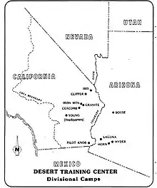 Camp Pilot Knob |
985 | Camp Pilot Knob | Sidewinder Rd. 32°45′03″N 114°45′17″W |
Felicity | Part of the Desert Training Center, California-Arizona Maneuver Area, Established by Major General George S. Patton, Jr. (#985) |
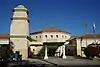 Camp Salvation |
808 | Camp Salvation | Rockwood Plaza, 6th St E. & Heber Ave. 32°40′12″N 115°29′36″W |
Calexico | Site is now City Hall of Calexico |
 Charley's World of Lost Art |
939.4 | Charley's World of Lost Art | 32°43′51″N 114°43′37″W |
Andrade | Part of the Twentieth Century Folk Art Environments (#939) |
 Fort Yuma |
806 | Fort Yuma | 350 Picacho Rd. 32°43′54″N 114°36′56″W |
Winterhaven | |
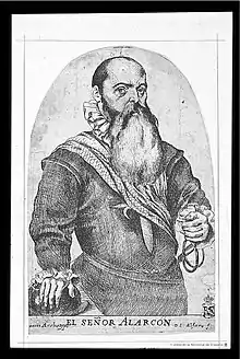 Hernando de Alarcón Expedition |
568 | Hernando de Alarcón Expedition | Algondes Rd. 32°44′15″N 114°43′00″W |
Winterhaven | |
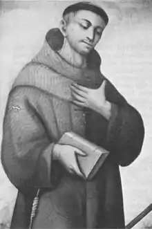 Mission Puerto de Purísima Concepción |
350 | Mission Puerto de Purísima Concepción | Fort Yuma 32°43′50″N 114°36′56″W |
Winterhaven | Site of former Mission |
 Mountain Springs Station |
194 | Mountain Springs Station | I-8 32°39′33″N 116°05′59″W |
Jacumba | |
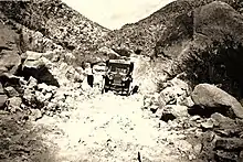
 Picacho Mines |
193 | Picacho Mines | Picacho Rd. 32°58′19″N 114°38′07″W |
Winterhaven | |
 Plank Road |
845 | Plank Road | Grays Well Road 32°42′37″N 114°55′22″W |
Winterhaven | |
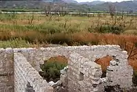
 Fort Romualdo Pacheco |
944 | Fort Romualdo Pacheco | West bank of New River 32°50′50″N 115°40′58″W |
Imperial | Site of former Fort, now present day Imperial Valley College Museum |
Site of Mission San Pedro y San Pablo de Bicuñer |
921 | Site of Mission San Pedro y San Pablo de Bicuñer | County Rd. 524 32°48′59″N 114°30′54″W |
Bard | Site of former Mission |
 Tecolote Rancho Site |
1034 | Tecolote Rancho Site | East Country Hwy & Barbara Worth Rd. 32°48′00″N 115°25′18″W |
Holtville | Harold Bell Wright home |
.jpg.webp) Tumco Mines |
182 | Tumco Mines | Gold Rack Ranch Rd. 32°52′55″N 114°51′44″W |
Ogilby | |
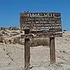 Yuha Well |
1008 | Yuha Well | Eastbound Sunbeam Roadside Rest Area, I-8 32°46′25″N 115°40′13″W |
Seeley |
References
- "California Historical Landmarks By County". Ohp.parks.ca.gov. Retrieved 2019-04-03.
See also
| Wikimedia Commons has media related to California Historical Landmarks in Imperial County, California. |
This article is issued from Wikipedia. The text is licensed under Creative Commons - Attribution - Sharealike. Additional terms may apply for the media files.