Cambois
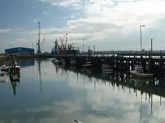
Cambois (/ˈkæməs/ KAM-əs) is a village in south-east Northumberland, England.[1][2] It is situated on the north side of the estuary of the River Blyth between Blyth and Ashington on the North Sea coast.
| Cambois | |
|---|---|
 Cambois Fishing Fleet | |
 Cambois Location within Northumberland | |
| OS grid reference | NZ305835 |
| Unitary authority | |
| Ceremonial county | |
| Region | |
| Country | England |
| Sovereign state | United Kingdom |
| Post town | BLYTH |
| Postcode district | NE24 |
| Dialling code | 01670 |
| Police | Northumbria |
| Fire | Northumberland |
| Ambulance | North East |
| UK Parliament | |
Etymology
According to earlier scholarship, the etymology of the name is probably Gaelic cambas 'bay, creek'.[3] However, the name could equally be from the Cumbric cognate of cambas, *camas 'bend in a river, bay', which would fit with Cambois's location at the confluence of Sleek Burn and the River Blyth. In either case, the spelling seems to have been influenced by French bois 'wood'.[4]
History

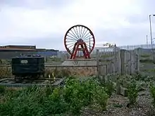
Cambois was a township in Bedlingtonshire which, until 1844, was part of County Durham. It was a coal mining village from 1862 to week ending 20 April 1968 when Cambois Colliery closed.
Cambois is now closely related to the area known as North Blyth. The main commercial activity was the importation of alumina for the manufacture of aluminium at Lynemouth, but that smelter has now closed. Alumina is still imported and moved by rail to the smelter at Lochaber, near Fort William on the west coast of Scotland.
In 1883, the Coal Company gave a list of the property it owned, or leased:
| North Blyth Staithes | 7 houses |
| Mr Moore, colliery Manager | 1 house |
| Mood & Scott | 2 houses |
| Stable Cottage | 1 house |
| Schoolmaster's House (at Boca Chica) | 1 house |
| Sea View | 12 houses |
| Quality Row | 18 houses |
| Sinker's Row | 20 houses |
| Chapel Row | 20 houses |
| Mawburn Terrace | 30 houses |
| Gee's Houses | 30 houses |
| Watergate | 29 houses |
| Cowgate | 26 houses |
| Bridge Street | 40 houses |
| Boca Chica | 46 houses |
| Boat House Terrace | 46 houses |
| Mr Freeman | 5 houses |
| New Cottages | 18 houses |
| Store Row | |
| Institute Row | 3 houses |
References
- Ordnance Survey: Landranger map sheet 81 Alnwick & Morpeth (Rothbury & Amble) (Map). Ordnance Survey. 2014. ISBN 9780319242094.
- "Ordnance Survey: 1:50,000 Scale Gazetteer" (csv (download)). www.ordnancesurvey.co.uk. Ordnance Survey. 1 January 2016. Retrieved 30 January 2016.
- Bethany Fox, 'The P-Celtic Place-Names of North-East England and South-East Scotland', The Heroic Age, 10 (2007), http://www.heroicage.org/issues/10/fox.html (appendix at http://www.heroicage.org/issues/10/fox-appendix.html); "Archived copy" (PDF). Archived from the original (PDF) on 15 February 2010. Retrieved 30 November 2009.CS1 maint: archived copy as title (link)
- Bethany Fox, 'The P-Celtic Place-Names of North-East England and South-East Scotland', The Heroic Age, 10 (2007), http://www.heroicage.org/issues/10/fox.html (appendix at http://www.heroicage.org/issues/10/fox-appendix.html).