Clarges Street
Clarges Street is a street in the City of Westminster, London. The street runs from Clarges Mews in the north to Piccadilly in the south. It is crossed by Curzon Street.
.jpg.webp)
Clarges Street from Piccadilly
History
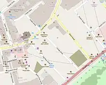
The immediate vicinity of Clarges Street
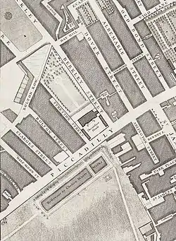
Clarges Street on John Rocque's 1746 map of London
Clarges Street was built in the early 18th century and is probably named after Sir Thomas Clarges.[1]
Notable inhabitants
Notable inhabitants of Clarges Street have included Lady Hamilton, Edmund Kean, Thomas Babington Macaulay,[1] and racing driver D'Arcy Baker.[2]
Buildings
Clarges Street is mostly made up of Georgian town houses and modern office buildings.[1] The headquarters of The Kennel Club is at numbers 1–5.[3]
References
- "Clarges Street, W1." in Christopher Hibbert; Ben Weinreb; John Keay; Julia Keay (2010). The London Encyclopaedia. London: Pan Macmillan. p. 192. ISBN 978-0-230-73878-2.
- https://www.familysearch.org/ark:/61903/3:1:3QS7-89N8-QNZG?i=87&cc=2228170
- Head Office. The Kennel Club Charitable Trust. Retrieved 30 July 2015.
External links
![]() Media related to Clarges Street at Wikimedia Commons
Media related to Clarges Street at Wikimedia Commons
Desolation Island by Patrick O'Brian, Harper Collins 2003 ed., @ p.102.
This article is issued from Wikipedia. The text is licensed under Creative Commons - Attribution - Sharealike. Additional terms may apply for the media files.