Cras-sur-Reyssouze
Cras-sur-Reyssouze is a former commune in the Ain department in eastern France. On 1 January 2019, it was merged into the new commune of Bresse Vallons.[2]
Cras-sur-Reyssouze | |
|---|---|
Part of Bresse Vallons | |
 | |
Location of Cras-sur-Reyssouze 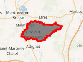
| |
 Cras-sur-Reyssouze  Cras-sur-Reyssouze | |
| Coordinates: 46°18′33″N 5°09′59″E | |
| Country | France |
| Region | Auvergne-Rhône-Alpes |
| Department | Ain |
| Arrondissement | Bourg-en-Bresse |
| Canton | Attignat |
| Commune | Bresse Vallons |
| Area 1 | 13.83 km2 (5.34 sq mi) |
| Population (2017)[1] | 1,471 |
| • Density | 110/km2 (280/sq mi) |
| Time zone | UTC+01:00 (CET) |
| • Summer (DST) | UTC+02:00 (CEST) |
| Postal code | 01340 |
| Elevation | 195–229 m (640–751 ft) |
| 1 French Land Register data, which excludes lakes, ponds, glaciers > 1 km2 (0.386 sq mi or 247 acres) and river estuaries. | |
Population
| Year | Pop. | ±% |
|---|---|---|
| 1793 | 1,370 | — |
| 1800 | 1,270 | −7.3% |
| 1806 | 1,313 | +3.4% |
| 1821 | 1,229 | −6.4% |
| 1831 | 1,251 | +1.8% |
| 1836 | 1,200 | −4.1% |
| 1841 | 1,230 | +2.5% |
| 1846 | 1,213 | −1.4% |
| 1851 | 1,217 | +0.3% |
| 1856 | 1,215 | −0.2% |
| 1861 | 1,189 | −2.1% |
| 1866 | 1,165 | −2.0% |
| 1872 | 1,190 | +2.1% |
| 1876 | 1,156 | −2.9% |
| 1881 | 1,137 | −1.6% |
| 1886 | 1,150 | +1.1% |
| 1891 | 1,155 | +0.4% |
| 1896 | 1,114 | −3.5% |
| 1901 | 1,080 | −3.1% |
| 1906 | 1,043 | −3.4% |
| 1911 | 996 | −4.5% |
| 1921 | 936 | −6.0% |
| 1926 | 922 | −1.5% |
| 1931 | 888 | −3.7% |
| 1936 | 835 | −6.0% |
| 1946 | 760 | −9.0% |
| 1954 | 702 | −7.6% |
| 1962 | 719 | +2.4% |
| 1968 | 679 | −5.6% |
| 1975 | 693 | +2.1% |
| 1982 | 807 | +16.5% |
| 1990 | 846 | +4.8% |
| 1999 | 907 | +7.2% |
| 2008 | 1,155 | +27.3% |
| 2015 | 1,431 | +23.9% |
See also
References
| Wikimedia Commons has media related to Cras-sur-Reyssouze. |
| Authority control |
|
|---|
This article is issued from Wikipedia. The text is licensed under Creative Commons - Attribution - Sharealike. Additional terms may apply for the media files.