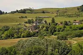
Dionay
Dionay is a former commune in the Isère department in southeastern France. On 31 December 2015, it was merged into the new commune of Saint-Antoine-l'Abbaye.[2]
Dionay | |
|---|---|
Part of Saint-Antoine-l'Abbaye | |
 | |
Location of Dionay 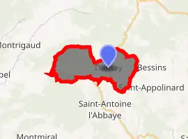
| |
 Dionay  Dionay | |
| Coordinates: 45°12′14″N 5°13′14″E | |
| Country | France |
| Region | Auvergne-Rhône-Alpes |
| Department | Isère |
| Arrondissement | Grenoble |
| Canton | Le Sud Grésivaudan |
| Commune | Saint-Antoine-l'Abbaye |
| Area 1 | 14.01 km2 (5.41 sq mi) |
| Population (2017)[1] | 114 |
| • Density | 8.1/km2 (21/sq mi) |
| Time zone | UTC+01:00 (CET) |
| • Summer (DST) | UTC+02:00 (CEST) |
| Postal code | 38160 |
| Elevation | 392–625 m (1,286–2,051 ft) (avg. 520 m or 1,710 ft) |
| 1 French Land Register data, which excludes lakes, ponds, glaciers > 1 km2 (0.386 sq mi or 247 acres) and river estuaries. | |
Population
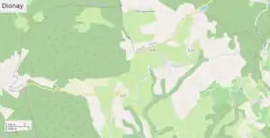
OpenStreetMap of Dionay, 2021
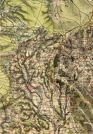
Dionay, old military map, 1866
| Year | Pop. | ±% |
|---|---|---|
| 1793 | 424 | — |
| 1806 | 444 | +4.7% |
| 1821 | 495 | +11.5% |
| 1831 | 450 | −9.1% |
| 1841 | 492 | +9.3% |
| 1846 | 477 | −3.0% |
| 1851 | 519 | +8.8% |
| 1861 | 483 | −6.9% |
| 1872 | 409 | −15.3% |
| 1881 | 360 | −12.0% |
| 1891 | 369 | +2.5% |
| 1901 | 468 | +26.8% |
| 1911 | 322 | −31.2% |
| 1921 | 239 | −25.8% |
| 1931 | 235 | −1.7% |
| 1946 | 221 | −6.0% |
| 1954 | 193 | −12.7% |
| 1962 | 180 | −6.7% |
| 1968 | 147 | −18.3% |
| 1975 | 128 | −12.9% |
| 1982 | 124 | −3.1% |
| 1990 | 103 | −16.9% |
| 1999 | 107 | +3.9% |
| 2009 | 125 | +16.8% |
| 2011 | 120 | −4.0% |
See also
This article is issued from Wikipedia. The text is licensed under Creative Commons - Attribution - Sharealike. Additional terms may apply for the media files.