Down Thomas
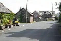
Down Thomas is a village in Devon, England.[1] The village is situated about 4 miles south of Plymouth. It is on the Wembury peninsula and is surrounded by farmland. The village is a part of the South Hams local government district.
| Down Thomas | |
|---|---|
 Converted Farm Buildings in Down Thomas | |
 Down Thomas Location within Devon | |
| Civil parish | |
| District | |
| Ceremonial county | |
| Region | |
| Country | England |
| Sovereign state | United Kingdom |
| Post town | Plymouth |
| Postcode district | PL9 |
| UK Parliament | |
The Village has a pub, post office, bike shop and a local village store.
References
- Ordnance Survey: Landranger map sheet 201 Plymouth & Launceston (Tavistock & Looe) (Map). Ordnance Survey. ISBN 978-0-319-23287-3.
External links
![]() Media related to Down Thomas at Wikimedia Commons
Media related to Down Thomas at Wikimedia Commons
This article is issued from Wikipedia. The text is licensed under Creative Commons - Attribution - Sharealike. Additional terms may apply for the media files.