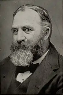
Edwin E. Howell
Edwin Eugene Howell (March 12, 1845 – April 16, 1911) was an American geologist and cartographer, who produced some of the most detailed raised-relief maps of his time, for which he was regarded by geologist G. K. Gilbert as "a pioneer—if not the pioneer—in the United States."[1] His maps were known internationally, and he produced the first commercial relief map of the Grand Canyon.

Howell was born in Genesee County, New York, and studied at the University of Rochester under the geologist Henry A. Ward. He was geologist of the United States Geological Survey in surveys west of the Rocky Mountains in 1872-73, and was with the government survey of the Rocky Mountain region under John Wesley Powell in 1874. In 1870 he made a relief map of the island of San Domingo, and in 1875 produced his famous relief map of the Grand Canyon. In his later years he devoted his time to the manufacture of geological models and maps first in the Rochester Museum and then in an establishment at Washington, D.C. which he called The Microcosm. He wrote on meteorites, and was a founder of the Geological Society of America. He died in Washington in 1911, aged 66.[2][3]
References
- Gilbert, G. K. (1911). "Edwin E. Howell". Science. 33 (854): 720–721. doi:10.1126/science.33.854.720. PMID 17748605.
- Curtis, G. C. (1911). "Howell's Relief Maps and the Naturalistic Land Model". Science. 34 (863): 45–47. doi:10.1126/science.34.863.45. JSTOR 1638721. PMID 17775300.
- McCalmont, Melanie Schleeter (2015). A Wilderness of Rocks: The Impact of Relief Models on Data Science. FriesenPress. pp. 19–28. ISBN 978-1-4602-7196-4.
 This article incorporates text from a publication now in the public domain: Hugh Chisholm (1913). The Britannica Year-book 1913: A Survey of the World's Progress Since the Completion in 1910 of the Encyclopaedia Britannica. Encyclopaedia britannica Company, limited. p. 757.
External links
 Media related to Edwin Eugene Howell at Wikimedia Commons
- Works by or about Edwin E. Howell at Internet Archive