Flötjan Lighthouse
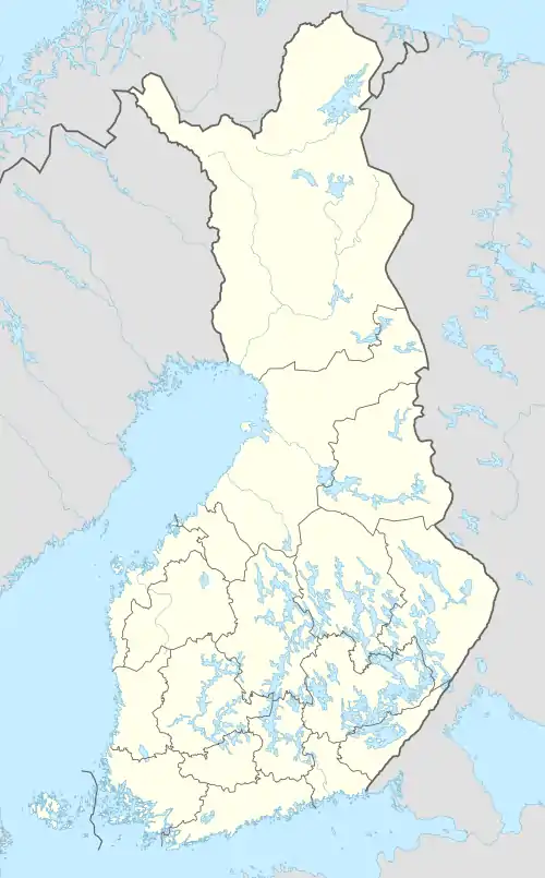
Flötjan is a small rocky islet in Finland. It is located in the Åland Sea to the southwest of Lågskär. Depths near Flötjan measure approximately 180 metres (590 ft).[3]
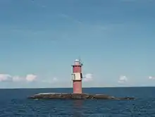 Flötjan Lighthouse in 2009 | |
 Finland | |

| |
| Location | Offshore 18 kilometres (11 mi) southwest of Mariehamn |
|---|---|
| Coordinates | 59°48′30.3″N 19°46′55.6″E |
| Year first constructed | 1908 (first) |
| Year first lit | 1953 (current) |
| Automated | 1959 |
| Foundation | rock and concrete base |
| Construction | concrete tower |
| Tower shape | cylindrical tower with ouble balcony and lantern |
| Markings / pattern | red tower with a white horizontal band, white lantern |
| Tower height | 22 metres (72 ft) |
| Focal height | 26 metres (85 ft) |
| Light source | solar power |
| Range | 10 nautical miles (19 km; 12 mi)[1] |
| Characteristic | Fl (2) W 20s. |
| Racon | T |
| Admiralty number | C4482 |
| NGA number | 16100 |
| ARLHS number | ALA-005[2] |
Lighthouse
The original light was badly damaged during World War II. A concrete lighthouse tower was built in 1953 and automated in 1959. The light range is 28 kilometres (17 mi). The Stockholm-Mariehamn-Tallinn ferry passes just to the west of the island.
References
- List of Lights, Pub. 116: Baltic Sea with Kattegat, Belts and Sound and Gulf of Bothnia (PDF). List of Lights. United States National Geospatial-Intelligence Agency. 2015.
- Åland Islands The Lighthouse Directory. University of North Carolina at Chapel Hill. Retrieved 4 April 2017
- Tiedeseura, Suomen (1907). Finlandische hydrographisch-biologische untersuchungen (in German) (Public domain ed.). Helsingin uusi kirjapaino-osakeyhtiö. pp. 4–.
This article is issued from Wikipedia. The text is licensed under Creative Commons - Attribution - Sharealike. Additional terms may apply for the media files.