Galena Bay
Galena Bay is an unincorporated locality, on the bay of the same name, at the head of Upper Arrow Lake in the West Kootenay region of southeastern British Columbia.
- Not the Galena Bay on Kootenay Lake at Riondel Galena Bay
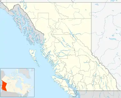
 Galena BayLocation of Galena Bay in British Columbia
Coordinates: 50°40′00″N 117°51′00″W Country .svg.png.webp) Canada
CanadaProvince  British Columbia
Area code(s) 250, 778
The bay was formerly called Thumb Bay, because it had the appearance of a giant thumb on early maps, but was renamed Galena Bay by 1890. Significant galena mining occurred in this area. In 1897, a townsite called Rosenheim was cleared, and a hotel built, for a planned railway linking with Camborne and Trout Lake, but the project evaporated within a year. Galena Bay remained the name of the neighbourhood.[1]
In 1957, the locality became the eastern terminal for the Arrowhead–Galena Bay ferry. Since 1968, the western terminal has been Shelter Bay. This ferry link forms part of British Columbia Highway 23 from Nakusp to Revelstoke. Galena Bay is also the terminus of British Columbia Highway 31, which runs northeast, then southeast via Trout Lake and Lardeau and then south down the west side of the north arm of Kootenay Lake to Balfour, near Nelson.