Harswell
Harswell is a village in the East Riding of Yorkshire, England. It is approximately 3.5 miles (5.6 km) west of Market Weighton town centre, 5 miles (8 km) south of Pocklington town centre, and 1 mile (1.6 km) west of the A614 road.
| Harswell | |
|---|---|
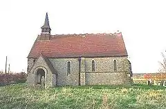
 St Peter's church | |
 Harswell Location within the East Riding of Yorkshire | |
| OS grid reference | SE826409 |
| • London | 165 mi (266 km) S |
| Civil parish | |
| Unitary authority | |
| Ceremonial county | |
| Region | |
| Country | England |
| Sovereign state | United Kingdom |
| Post town | YORK |
| Postcode district | YO42 |
| Dialling code | 01430 |
| Police | Humberside |
| Fire | Humberside |
| Ambulance | Yorkshire |
| UK Parliament | |
It forms part of the civil parish of Everingham.
In 1823 Harswell was a village and civil parish in the Wapentake of Harthill. Population at the time was 78, with occupations that included five farmers, and a carrier who operated between the village and Market Weighton once a week.[1]
The village church is dedicated to St Peter. There has been a church in Harswell from the late 12th century and the building that was present in 1823 was described by Baines as "a small ancient structure". It was rebuilt in 1870-1871 and parish records, dating back to 1653, are held by the Borthwick Institute in York.[1][2]
Harswell was served by Everingham railway station on the Selby to Driffield Line between 1853 and 1954.[3] The station house is now a Grade II listed building.[4]
References
- Baines, Edward, ed. (1823). History, Directory & Gazeteer, of the County of York: Vol. II. – East and North Ridings. p. 213. Retrieved 3 February 2018.
- "fonds PR/HAR - Parish records of Harswell". University of York: Borthwick Institute for Archives. Retrieved 3 February 2018.
- Butt, R. V. J. (1995). The Directory of Railway Stations: details every public and private passenger station, halt, platform and stopping place, past and present (1st ed.). Sparkford: Patrick Stephens Ltd. ISBN 978-1-85260-508-7. OCLC 60251199.
- Historic England. "Station House (1031358)". National Heritage List for England. Retrieved 19 April 2020.
- Gazetteer – A–Z of Towns Villages and Hamlets. East Riding of Yorkshire Council. 2006. p. 6.