Hawaii Route 93
Route 93 is a major east–west highway on the island of Oahu which begins as Interstate H-1 terminates in Kapolei and ends at Kaena Point on the extreme northwest end of Oahu, just past Makaha. It is part of the Farrington Highway.
| ||||
|---|---|---|---|---|
| Farrington Highway | ||||
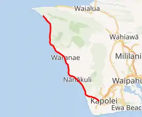
Route 93 highlighted in red | ||||
| Route information | ||||
| Maintained by HDOT | ||||
| Length | 19.524 mi[1] (31.421 km) | |||
| Major junctions | ||||
| West end | End of road in Kaʻena Point State Park | |||
| East end | ||||
| Highway system | ||||
Routes in Hawaii
| ||||

Route description
As H1 ends near Kapolei and Ko Olina, it continues as a four lane, and then two lane highway up into the Waianae and Makaha area, the "Leeward Coast", of west Oahu.
References
- Hawaii Department of Transportation (October 2016). "State DOT Road Inventory" (ESRI Shapefile). Retrieved July 31, 2019.
This article is issued from Wikipedia. The text is licensed under Creative Commons - Attribution - Sharealike. Additional terms may apply for the media files.