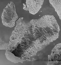
Ikuchi-jima
Ikuchi-jima (生口島, Ikuchijima) is an island in the Seto Inland Sea, belonging to Hiroshima Prefecture in Japan. Ikuchi-jima is administered as part of Onomichi city. The bridges connecting Ikuchi-jima to the mainland (Honshu island) via Innoshima and to Shikoku via Ōmishima Island. The island's highest peak is Mount Kanno 472.3 m (1,550 ft).
| Native name: 生口島 Ikuchijima | |
|---|---|
 aerial photo of Ikuchi-jima in 1947 | |
 Ikuchi-jima Location in Japan  Ikuchi-jima Ikuchi-jima (Hiroshima Prefecture) | |
| Geography | |
| Location | Seto Inland Sea |
| Coordinates | 34°17′15.2″N 133°6′28.6″E |
| Archipelago | Geiyo Islands |
| Area | 31.21 km2 (12.05 sq mi) |
| Length | 8.8 km (5.47 mi) |
| Width | 4.9 km (3.04 mi) |
| Coastline | 24 km (14.9 mi) |
| Highest elevation | 472.3 m (1549.5 ft) |
| Highest point | mount Kanno |
| Administration | |
Japan | |
| Prefecture | Hiroshima Prefecture |
| City | Onomichi |
| Demographics | |
| Population | 11000[1] (2006) |
| Pop. density | 352/km2 (912/sq mi) |
| Ethnic groups | Japanese |
History
- April 1, 1889, Ikuchi-juma was formally demarcated into Nishiikuchi-gun, Kitaikuchi-gun, Myōga-gun and Minamiikuchi-gun
- April 1, 1937, Nishiikuchi-gun merged into Setoda.
- April 1, 1944, Kitaikuchi-gun and Myōga-gun merged into Setoda.
- April 1, 1955, Minamiikuchi-gun merged into Setoda.
- July 27, 1970, Bridge connection to Takane Island opened.
- December 8, 1991, Bridge connection to Innoshima and Ōmishima.
- January 10, 2006, Setoda, along with the city of Innoshima, was merged into the expanded city of Onomichi
Attractions
- Outdoor island-wide monument park
- Hiking and cycling routes
- Sunset-view beach hotels
- Lemon orchards -Ikuchijima is known as "Lemon Island" in Japan.
See also
- This article incorporates material from Japanese Wikipedia page 生口島, accessed 11 June 2018
| Wikimedia Commons has media related to Ikuchijima. |
References
This article is issued from Wikipedia. The text is licensed under Creative Commons - Attribution - Sharealike. Additional terms may apply for the media files.