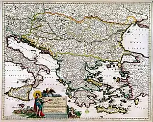
Justus Danckerts
Justus Danckerts I (11 November 1635 in Amsterdam – 16 July 1701 in Amsterdam) was a Dutch engraver and print publisher who along with other members of the Danckerts family created one of the leading Dutch geographical map and atlas publishing houses.

Biography
Justus Danckerts was the son of Cornelis Danckerts I (1603-1656), who established the Danckerts cartographic family business in Amsterdam.[1] After producing in the early 1680s over 20 folio-sized atlas maps, he published in 1686–1887 the first Danckerts atlas.[2] In 1690, another 26-sheet geographical atlas was published; between 1698 and 1700, a 60-sheet atlas was completed. Its map sheets and plates were used by various publishers until the middle of the 18th century.[3]
Family
His sons, Theodorus Danckerts I (1663-1727) and Cornelis Danckerts II (1664-1717) were prominent engravers and print makers, skillful in map plate engraving and etching.[4]
Plates
- William III., Prince of Orange; afterwards King of England.
- Casimir, King of Poland.
- Seven plates of the Gates of Amsterdam.
Works
- Nova totus terrarum orbis tabula ex officina Iusti Danckerts, Amsterdam. 1680.
- Accuratissima Regnorum Sueciae, Daniae et Norvegiae Tabula. Danckerts, Amsterdam ca. 1700. digital
- Accuratissima Totius Regni Hispaniae Tabula. Danckerts, Amsterdam ca. 1700. digital
- Novissima et accuratissima XVII provinciarum Germaniæ inferioris tabula. Danckerts, Amsterdam ca. 1700. digital
- Novissima Regnorum Portugalliae et Algarbia Descriptio. Danckerts, Amsterdam ca. 1700. digital
References
- Johannes Keuning. Cornelis Danckerts and his “Nieuw Aerdsch Pleyn”, Imago Mundi: The International Journal for the History of Cartography, 1955, Volume 12, Issue 1.
- Danku, Gyuri and Sumegny, Zoltán. The Danckerts Atlas: The production and chronology of its maps, Imago Mundi: The International Journal for the History of Cartography, 2007, volume 59, pp. 43–77.
- Danku, Gyuri and Sumegny, Zoltán. An outline of the Danckerts Atlas history, Map Department, National Széchényi Library, Budapest, Hungary
- Tooley, Ronald Vere. Tooley's Dictionary of mapmakers. New York: Meridian Pub. Co., 1979.
 This article incorporates text from a publication now in the public domain: Bryan, Michael (1886). "Danckerts, Justus". In Graves, Robert Edmund (ed.). Bryan's Dictionary of Painters and Engravers (A–K). I (3rd ed.). London: George Bell & Sons.
| Wikimedia Commons has media related to Justus Danckerts. |