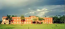
Kailashahar
Kailashahar is a municipal council city, the headquarters of the Unakoti district in the Indian state of Tripura.
Kailashahar | |
|---|---|
Town | |
 Kailashahar  Kailashahar | |
| Coordinates: 24.33°N 92.02°E | |
| Country | |
| State | Tripura |
| District | Unakoti |
| Population (2015) | |
| • Total | 23,418 |
| Languages | |
| • Official | Bengali, Kokborok, Meitei, English, |
| Time zone | UTC+5:30 (IST) |
| Telephone code | 03824 |
| Vehicle registration | TR |
| Website | www.kailashaharinfo.in |

It is located along the Bangladesh border.
History
Kailashahar was the ancient capital of the Tripuri kingdom. Its history is associated with Unakoti, noted for its 7th - 9th century AD stone and rock cut images. A Shiva disciple who started the Tripurabda (Tripuri Calendar), prayed for Lord Shiva in Chhambulnagar village on the banks of the Mau river. It is speculated that Chhambulnagar, which is mentioned in Rajmala, was situated near Unakoti Hill. The Prince prayed for Mahadeva in Unakoti. Kailashahar may be the legendary Chhambulnagar. Some believers thought that Har (Shiva) resides in Kailash. Therefore, the place was known as Kailash Har which was later on transformed to Kailashahar. Tripura king Adi-Dharmapha ruled there in the 7th century. He performed a yagna with pomp and gaiety..[1]
Demographics
As of 2001 India census,[2] Kailasahar had a population of 23,418. Males constitute 51% of the population and females 49%. Kailasahar has an average literacy rate of 82%, higher than the national average of 59.5%: male literacy is 84%, and female literacy is 79%. In Kailasahar, 10% of the population is under 6.
Transport
Kailashahar is connected to the rest of India mainly by road. The town has an airport. The nearest rail connection is in Kumarghat.
Culture
Kailasahar is a prosperous area. It is mainly populated by Bengalis,Tripuri,Meitei Manipuri,Darlong,Muslims and Bishnupriya Manipuris.
Festivals
The Durga Puja festival comes between September - October. The bright festival of Kali Puja is also celebrated.
Religion
Hinduism is the dominant religion and the city hosts many temples, notably Lakshmi Narayan and 14 Deities Temple or Choudoo Devotar Mandir, Rangauti. Islam many followers and a mosque operates near the main bazaar. Buddhism has many followers. Christianity is a growing religion with the majority of the Christians coming from the native Tripuri people. Most of the Christians are Baptists.
Climate
| Climate data for Kailashahar Airport (1981–2010, extremes 1968–present) | |||||||||||||
|---|---|---|---|---|---|---|---|---|---|---|---|---|---|
| Month | Jan | Feb | Mar | Apr | May | Jun | Jul | Aug | Sep | Oct | Nov | Dec | Year |
| Record high °C (°F) | 31.4 (88.5) |
34.1 (93.4) |
38.6 (101.5) |
42.2 (108.0) |
42.0 (107.6) |
38.3 (100.9) |
37.8 (100.0) |
37.5 (99.5) |
36.6 (97.9) |
35.5 (95.9) |
36.8 (98.2) |
31.7 (89.1) |
42.2 (108.0) |
| Average high °C (°F) | 25.5 (77.9) |
27.9 (82.2) |
31.5 (88.7) |
32.5 (90.5) |
32.0 (89.6) |
32.2 (90.0) |
32.0 (89.6) |
32.5 (90.5) |
32.0 (89.6) |
31.5 (88.7) |
29.5 (85.1) |
26.6 (79.9) |
30.5 (86.9) |
| Average low °C (°F) | 11.0 (51.8) |
13.3 (55.9) |
17.9 (64.2) |
21.3 (70.3) |
23.2 (73.8) |
24.9 (76.8) |
25.1 (77.2) |
25.2 (77.4) |
24.6 (76.3) |
22.6 (72.7) |
17.6 (63.7) |
12.7 (54.9) |
20.0 (68.0) |
| Record low °C (°F) | 2.4 (36.3) |
3.9 (39.0) |
7.2 (45.0) |
12.1 (53.8) |
17.5 (63.5) |
19.3 (66.7) |
19.7 (67.5) |
20.8 (69.4) |
20.0 (68.0) |
15.4 (59.7) |
8.8 (47.8) |
6.3 (43.3) |
2.4 (36.3) |
| Average rainfall mm (inches) | 8.3 (0.33) |
41.9 (1.65) |
109.3 (4.30) |
277.5 (10.93) |
455.9 (17.95) |
465.9 (18.34) |
380.2 (14.97) |
357.1 (14.06) |
306.9 (12.08) |
166.7 (6.56) |
29.7 (1.17) |
16.8 (0.66) |
2,616.2 (103.00) |
| Average rainy days | 1.0 | 2.3 | 5.0 | 10.8 | 15.0 | 17.1 | 18.7 | 18.4 | 15.0 | 7.2 | 1.4 | 0.8 | 112.8 |
| Average relative humidity (%) (at 17:30 IST) | 69 | 59 | 57 | 69 | 75 | 83 | 84 | 83 | 85 | 83 | 80 | 76 | 75 |
| Source: India Meteorological Department[3][4][5] | |||||||||||||
Education

General degree College
- Ramkrishna Mahabhidyalay ( Associated with Tripura University)
Polytechnic College
- Industrial Trade institute (I.T.I)
Schools
- Goldharpur R.S.H.S. School
- Kailashahar Government Girls Higher Secondary School
- Kendriya Vidyalaya Kailashahar
- Radha Kishore Institution
- RamKrishna Shiksha Pratishthan
- Netaji Vidyapith English Medium (H.S) School
- Vidyanagar HS School
- Tilabazar H.S School
Nursery
- Children's Garden
- Children's Blossom
- Angel Kidz, Gobindapur, Kailashaha.
- Netaji Shiksha Niketan
Governance
Kailashahar assembly constituency is part of Tripura East (Lok Sabha constituency).[6]
References
- UNAKOTI SCULPTURES : A BEWITCHING TOURISTS’ ATTRACTION
- "Census of India 2001: Data from the 2001 Census, including cities, villages and towns (Provisional)". Census Commission of India. Archived from the original on 16 June 2004. Retrieved 1 November 2008.
- "Station: Kailashahar (A) Climatological Table 1981–2010" (PDF). Climatological Normals 1981–2010. India Meteorological Department. January 2015. pp. 373–374. Archived from the original (PDF) on 5 February 2020. Retrieved 6 February 2020.
- "Extremes of Temperature & Rainfall for Indian Stations (Up to 2012)" (PDF). India Meteorological Department. December 2016. p. M209. Archived from the original (PDF) on 5 February 2020. Retrieved 6 February 2020.
- "Kailashahar Climatological Table 1981–2010". India Meteorological Department. Retrieved 6 February 2020.
- "Assembly Constituencies - Corresponding Districts and Parliamentary Constituencies" (PDF). Tripura. Election Commission of India. Archived from the original (PDF) on 8 November 2005. Retrieved 8 October 2008.