La Chaussée-d'Ivry
La Chaussée-d'Ivry is a commune in the Eure-et-Loir department in northern France.
La Chaussée-d'Ivry | |
|---|---|
_%C3%89glise_Sainte-Blaise_Eure-et-Loir_France.jpg.webp) The church in La Chaussée-d'Ivry | |
.svg.png.webp) Coat of arms | |
Location of La Chaussée-d'Ivry 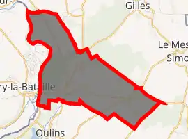
| |
 La Chaussée-d'Ivry  La Chaussée-d'Ivry | |
| Coordinates: 48°52′59″N 1°28′48″E | |
| Country | France |
| Region | Centre-Val de Loire |
| Department | Eure-et-Loir |
| Arrondissement | Dreux |
| Canton | Anet |
| Intercommunality | Val d'Eure et Vesgre |
| Government | |
| • Mayor (2008–2014) | Michel Dimpault |
| Area 1 | 8.39 km2 (3.24 sq mi) |
| Population (2017-01-01)[1] | 1,156 |
| • Density | 140/km2 (360/sq mi) |
| Time zone | UTC+01:00 (CET) |
| • Summer (DST) | UTC+02:00 (CEST) |
| INSEE/Postal code | 28096 /28260 |
| Elevation | 52–168 m (171–551 ft) |
| 1 French Land Register data, which excludes lakes, ponds, glaciers > 1 km2 (0.386 sq mi or 247 acres) and river estuaries. | |
Population
| Year | Pop. | ±% |
|---|---|---|
| 1962 | 470 | — |
| 1968 | 541 | +15.1% |
| 1975 | 649 | +20.0% |
| 1982 | 879 | +35.4% |
| 1990 | 965 | +9.8% |
| 1999 | 924 | −4.2% |
| 2008 | 1,011 | +9.4% |
References
- "Populations légales 2017". INSEE. Retrieved 6 January 2020.
| Wikimedia Commons has media related to La Chaussée-d'Ivry. |
| Authority control |
|---|
This article is issued from Wikipedia. The text is licensed under Creative Commons - Attribution - Sharealike. Additional terms may apply for the media files.