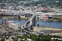
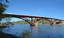
List of crossings of the Willamette River
This is a list of bridges and other crossings of the Willamette River in the U.S. state of Oregon from the Columbia River upstream to the confluence of the Middle Fork Willamette River and Coast Fork Willamette River. This confluence, at 44.023318°N 123.023897°W, is considered the source of the Willamette River.
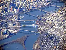
Aerial view of crossings in downtown Portland
Portland
Northern Willamette Valley
| Image | Crossing | Carries | Location | River mile | Year built | Coordinates |
|---|---|---|---|---|---|---|
 |
Lake Oswego Railroad Bridge | Portland and Western Railroad | Lake Oswego/Milwaukie | 20.0 | 1910 | 45.42500°N 122.65472°W |
| Abernethy Bridge | Oregon City | 25.0 | 1970 | 45.36444°N 122.60417°W | ||
_-_2.jpg.webp) |
Oregon City Bridge | Oregon City | 26.0 | 1922 | 45.35889°N 122.60972°W | |
| 2 sets of aerial electric cable crossings | West Linn/Canby | 30.0 | 45.31774°N 122.66585°W | |||
| aerial electric power for the Canby Ferry | Canby | 34.37 | 45.30009°N 122.69192°W | |||
 |
Canby Ferry | SW Mountain Rd (on the north), N Locust St (on the south) | Canby | 34.4 | 1914 | 45.30011°N 122.69273°W |
| aerial electric cable crossing | Molalla River State Park | 35.98 | 45.30214°N 122.72207°W | |||
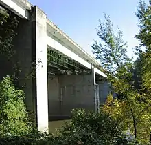 |
Boone Bridge | Wilsonville | 38.5 | 1954 | 45.29194°N 122.76944°W | |
 |
Wilsonville railroad bridge | Portland & Western Railroad | Wilsonville | 38.5 | 1975 | 45.29306°N 122.77639°W |
 |
Oregon Route 219 bridge | Newberg | 48.3 | 1958 | 45.26778°N 122.94333°W | |
 |
Champoeg Road bridge | Pipeline | Newberg | 50.0 | 45.28377°N 122.96222°W |
Middle Willamette Valley
| Image | Crossing | Carries | Location | River mile | Year built | Coordinates |
|---|---|---|---|---|---|---|
 |
Wheatland Ferry | Wheatland Road | Wheatland | 72.0 | 1844 | 45.09028°N 123.04500°W |
 |
Union Street Railroad Bridge | (formerly) Black Rock Rail Line, (currently) pedestrians, bicycles, emergency vehicles | Salem | 84.1 | 1913 | 44.94722°N 123.04167°W |
 |
Marion Street Bridge | Salem | 84.4 | 1952 | 44.94583°N 123.04250°W | |
 |
Center Street Bridge | Salem | 84.5 | 1918 | 44.94500°N 123.04333°W | |
| Independence Street Bridge | River Road South, sidewalks | Independence | 97.1 | 1950 | 44.84556°N 123.17972°W | |
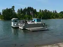 |
Buena Vista Ferry | Buena Vista Road | Buena Vista | 106.0 | 1851 | 44.77000°N 123.14583°W |
_bridge_-_Albany%252C_Oregon.jpg.webp) |
Toledo District Willamette Bridge | Portland and Western Railroad/Toledo District | Albany | 119.7 | 44.64085°N 123.09677°W | |
| Lyon Street Bridge | Albany | 120.0 | 1971 | 44.63917°N 123.10587°W | ||
 |
Ellsworth Street Bridge | Albany | 120.1 | 1925 | 44.63924°N 123.10666°W | |
 |
Harrison Street Bridge | Corvallis | 131.5 | 1964 | 44.5661°N 123.25622°W | |
 |
Van Buren Street Bridge | Corvallis | 131.5 | 1913 | 44.56541°N 123.25652°W | |
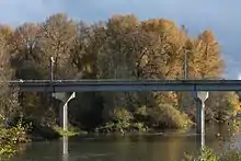 |
Corvallis Bypass Bridge | Corvallis | 132.95 | 1992 | 44.55814°N 123.25987°W |
Southern Willamette Valley
| Image | Crossing | Carries | Location | River mile | Year built | Coordinates |
|---|---|---|---|---|---|---|
| OR 99E bridge | Harrisburg | 161.2 | 1925 | 44.26708°N 123.17483°W | ||
| rail bridge; former drawbridge (vertical-lift type) | Portland and Western Railroad | Junction City | 162.7 | 44.24864°N 123.17538°W | ||
| rail bridge; former drawbridge (swing-span type) | Union Pacific Railroad Amtrak |
Junction City | 162.8 | 44.24815°N 123.17451°W | ||
| Beltline Highway (westbound), sidewalk | Eugene | 178.2 | 1961 | 44.09525°N 123.10651°W | ||
| Beltline Highway (eastbound) | Eugene | 178.2 | 1966 | 44.09519°N 123.10666°W | ||
 |
Owosso Bicycle Bridge | Eugene | 178.7 | 44.09185°N 123.11609°W | ||
 |
Greenway Bicycle Bridge | Eugene | 180.6 | 1978 | 44.06750°N 123.11175°W | |
| Washington-Jefferson Street Bridge | Eugene | 181.2 | 1960 | 44.06391°N 123.10076°W | ||
.jpg.webp) |
Ferry Street Bridge | Coburg Road Ruth Bascom Bike Path |
Eugene | 182.2 | 1950 | 44.05794°N 123.08391°W |
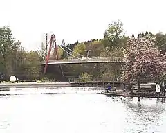 |
Peter DeFazio Bicycle Bridge | Eugene | 182.35 | 2000 | 44.05691°N 123.08352°W | |
 |
Dave and Lynn Frohnmayer Pedestrian and Bicycle Bridge[1] | Eugene | 182.7 | 1970 | 44.05160°N 123.07127°W | |
| Knickerbocker Bicycle Bridge | Eugene | 183.8 | 1978 | 44.04529°N 123.05214°W | ||
 |
Whilamut Passage Bridge (west span) | Eugene | 183.91 | 2011 | 44.04540°N 123.05010°W | |
 |
Whilamut Passage Bridge (east span) | Eugene | 183.92 | 2013[2] | 44.04550°N 123.04958°W | |
| Springfield Bridge (north span) | Springfield | 185.25 | 1950 | 44.04544°N 123.02743°W | ||
| Springfield Bridge (south span) | Springfield | 185.3 | 44.04511°N 123.02718°W | |||
 |
Southern Pacific Rail bridge | Union Pacific Railroad Amtrak |
Springfield | 185.4 | 1891 |
Former crossings
| Image | Crossing | Carried | Location | River mile | Year built | Coordinates |
|---|---|---|---|---|---|---|
| Madison Street Bridge[n 1] | Madison Street | Portland | 13.1 | 1891, 1900[n 1] | 45.51333°N 122.67083°W | |
 | Boones Ferry | Boones Ferry Road | Wilsonville | 38.9 | 1847 | 45.29312°N 122.775038°W |
See also
Notes
References
- Edward Russo (September 15, 2009). "Popular river crossing renamed". The Register-Guard. Eugene, Oregon. p. B1.
- "Whilamut Passage Bridge Opens". KEZI.com. August 8, 2013. Archived from the original on September 30, 2013. Retrieved November 30, 2014.
- "Hawthorne Bridge: Spanning Willamette River on Hawthorne Boulevard, Portland, Multnomah County, Oregon" (PDF). Historic American Engineering Record, National Park Service, United States Department of the Interior. p. 2. Retrieved August 18, 2016.
- "Old Span Wrecked; Madison Bridge in Six Weeks Will Be Only Memory". The Morning Oregonian. August 2, 1909. p. 14. Retrieved August 18, 2016.
External links
This article is issued from Wikipedia. The text is licensed under Creative Commons - Attribution - Sharealike. Additional terms may apply for the media files.


.jpg.webp)


