List of hills in the Peak District
This is a list of the hills of the Peak District of England. Most lie within the Peak District National Park, but others lie outside its borders. The list is sorted by absolute height, then by relative height. Marilyns are marked in boldface. The top three are considered mountains as they are above 2,000 feet high.
| Peak | Absolute height (m) |
Relative height (m) |
Grid reference |
|---|---|---|---|
| Kinder Scout | 636 | 496.6 | SK084875 |
| Bleaklow | 633 | 128 | SK094960 |
| Higher Shelf Stones | 621 | 15 | SK089948 |
| Grindslow Knoll | 601 | 15 | SK110868 |
| Black Hill | 582 | 165 | SE078046 |
| Brown Knoll | 569 | 36 | SK083851 |
| Shining Tor | 559 | 236 | SJ994737 |
| Axe Edge Moor | 551 | 84 | SK035706 |
| Lord's Seat | 550 | 62 | SK111834 |
| Margery Hill | 546 | 19 | SK189956 |
| Featherbed Moss | 545 | 10 | SE046011 |
| Featherbed Top | 544 | c. 32 | SK090920 |
| Mill Hill | 544 | 32 | SK061904 |
| Black Chew Head | 542 | 35 | SE056019 |
| Back Tor | 538 | 67 | SK197909 |
| Britland Edge Hill | 523 | c. 20 | SE106027 |
| Cats Tor | 518 | c.35 | SJ995759 |
| Lost Lad | 518 | c. 10 | SK193912 |
| Mam Tor | 517 | 62 | SK127836 |
| Oliver Hill | 513 | 45 | SK027675 |
| Black Edge | 507 | 99 | SK062770 |
| Shutlingsloe | 506 | 134 | SJ976695 |
| The Roaches | 505 | c. 120 | SK001638 |
| Burbage Edge | 500 | 25 | SK029732 |
| West Nab | 500 | c. 50 | SK266940 |
| Dead Edge End | 499 | c. 25 | SE124017 |
| South Head | 494 | c.44 | SK060845 |
| Merryton Low | 489 | c. 54 | SK041610 |
| Slitherstone Hill | 477 | c.70 | SK123819 |
| Lose Hill | 476 | 76 | SK153854 |
| Snailsden Pike End | 475 | c. 20 | SE132034 |
| Bradwell Moor | 471 | c. 50 | SK132801 |
| Eldon Hill | 470 | c. 20 | SK115811 |
| Win Hill | 462 | c. 144 | SK186850 |
| High Neb | 458 | c. 103 | SK227853 |
| nr Ann Roach Farm | 454 | 27 | SK021655 |
| Foxlow Edge | 452 | 35 | SK004756 |
| Stanedge Pole | 438 | c. 24 | SK247844 |
| Sough Top (Taddington Moor) | 438 | c. 20 | SK133709 |
| Corbar Hill | 437 | c. 20 | SK051743 |
| Higger Tor | 434 | c. 15 | SK257819 |
| Grin Low | 430 | c.45 | SK054718 |
| Eyam Moor – Sir William Hill | 429 | 122 | SK215778 |
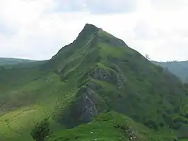
| Chrome Hill | c. 425 | c. 45 | SK070673 |
| High Wheeldon | 422 | c. 25 | SK100660 |
| Snels Low | 419 | c. 25 | SK113818 |
| Shatton Edge (Abney Moor) | 417 | 48 | SK195807 |
| Durham Edge (Abney Moor) | 416 | c. 40 | SK180794 |
| Black Hill (Whaley Bridge) | 410 | c. 105 | SJ989821 |
| Gautries Hill | 410 | c. 85 | SK099810 |
| Hen Cloud | 410 | 60 | SK008615 |
| Burton Bole End | c. 410 | c. 50 | SK193809 |
| Pike Low | 405 | 11 | SK180898 |
| Croker Hill | 402 | 98 | SJ933677 |
| Revidge | 400 | 40 | SK077599 |
| Gradbach Hill | 399 | 43 | SK000653 |
| Brittain's Plantation | 398 | c. 50 | SK278930 |
| Aleck Low | 398 | 53 | SK173595 |
| Pilsbury Lodge | 395 | c. 40 | SK121639 |
| Totley Moor | 395 | c. 17 | SK285788 |
| Longstone Moor | 391 | c. 110 | SK189733 |
| Emlin | 389 | c. 10 | SK240934 |
| Houndkirk Hill | 389 | c. 10 | SK284818 |
| Wolfscote Hill | 388 | c. 100 | SK136583 |
| Gun | 385 | 168 | SJ970615 |
| Rock Hall | 383 | 16 | SK227772 |
| Crook Hill | 382 | c. 84 | SK183872 |
| Hawks Low | 382 | c. 35 | SK170570 |
| Pikenaze Hill | 382 | 15 | SE105004 |
| Tegg's Nose | 380 | c. 30 | SJ947725 |
| Waggon Low | 380 | c. 16 | SK116647 |
| Harborough Rocks | 379 | 65 | SK243553 |
| Minninglow Hill | 372 | c. 58 | SK209573 |
| Wetton Hill | 372 | c. 55 | SK104563 |
| Beeley Moor | 371 | 84 | SK293686 |
| Eccles Pike | 370 | c. 132 | SK035812 |
| Wardlow Hay Cop | 370 | c. 47 | SK179740 |
| Slipper Low | 368 | c. 30 | SK227569 |
| Blakelow Hill | 367 | 69 | SK255594 |
| Big Moor | 367 | 19 | SK260764 |
| Hartcliff Hill | 364 | 83 | SE221018 |
| Parkhouse Hill | c. 360 | c. 35 | SK079669 |
| The Height | 359 | c. 30 | SK250973 |
| Middleton Moor | 358 | 60 | SK268556 |
| Bole Hill | 356 | c. 50 | SK184676 |
| High Field | 354 | c. 50 | SK162724 |
| Abney Low | 347 | c. 45 | SK202794 |
| The Cloud | 343 | 170 | SJ904636 |
| Heights of Abraham | 338 | c. 56 | SK285587 |
| Gibraltar Rocks | 335 | c. 25 | SK249909 |
| Blake Low | 330 | c. 28 | SK220602 |
| Low Moor | 330 | c. 10 | SK183642 |
| Bunster Hill | 329 | 24 | SK141516 |
| Fin Cop | 327 | c. 90 | SK175709 |
| Stanton Moor | 323 | c. 108 | SK245629 |
| Bolehill | 323 | c. 105 | SK294554 |
| Wire Stone | 318 | c. 10 | SK321634 |
| Alport Height | 314 | c. 67 | SK305515 |
| Bole Hill | 312 | c. 15 | SK290856 |
| Ughill Height | 311 | c. 15 | SK263907 |
| Allman Well Hill | 310 | c. 25 | SK281968 |
| Nelson's Monument | 310 | c. 23 | SK278731 |
| Lees Moor | 304 | c. 142 | SK249674 |
| Hare Edge Hill | 304 | c. 16 | SK303727 |
| Thorpe Cloud | 287 | 79 | SK151510 |
| Rainster Rocks | 287 | c. 10 | SK220547 |
| Calver Peak | 285 | 20 | SK229742 |
| High Low | 281 | 30 | SK221802 |
| Haven Hill | 276 | c. 15 | SK212519 |
| Harthill Moor | 272 | c. 100 | SK210627 |
| Wibben Hill | 249 | c. 10 | SK184523 |
This article is issued from Wikipedia. The text is licensed under Creative Commons - Attribution - Sharealike. Additional terms may apply for the media files.


