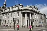
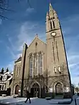
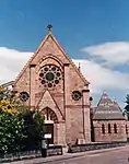
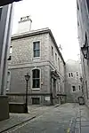
List of listed buildings in Aberdeen/7
List
| Name | Location | Date Listed | Grid Ref. [note 1] | Geo-coordinates | Notes | LB Number [note 2] | Image |
|---|---|---|---|---|---|---|---|
| Seaton Park, Park Wall To Tillydrone Road | 57°10′13″N 2°06′31″W | Category B | 20063 |  | |||
| Westburn Road And Argyll Place, Victoria Park, Fountain | 57°09′07″N 2°07′20″W | Category A | 20065 | .jpg.webp) | |||
| King George Vi Bridge Over River Dee, At Great Southern Road | 57°07′42″N 2°06′29″W | Category B | 20070 |  | |||
| Girdleness Lighthouse, Greyhope Road, Including Fog Signal At South Side At Nj 9724 0530 | 57°08′20″N 2°02′55″W | Category A | 20078 | .jpg.webp) | |||
| Crown Terrace Baptist Church, Crown Terrace | 57°08′39″N 2°06′08″W | Category B | 19939 |  | |||
| Kings College Chapel, College Bounds | 57°09′51″N 2°06′06″W | Category A | 19943 |  | |||
| St Clements Street, East St Clement's Church And Churchyard Including Boundary Wall | 57°08′49″N 2°04′58″W | Category B | 19954 | _Church%252C_Aberdeen.jpg.webp) | |||
| St. Machar's Cathedral, Gate Lodges, Chanonry | 57°10′09″N 2°06′11″W | Category B | 19959 |  | |||
| Lecture Hall Of Geography Department, High Street, Old Aberdeen | 57°09′59″N 2°06′09″W | Category B | 19965 |  | |||
| 13-15 (Odd Numbers) Fonthill Terrace, Including Railings | 57°08′09″N 2°06′31″W | Category C(S) | 46478 |  | |||
| Holburn Street At South Anderson Drive, Privies And Pantries (Former Tram Shelter And Public Lavatory) | 57°07′27″N 2°07′18″W | Category C(S) | 46480 |  | |||
| Duthie Park, Bandstand | 57°07′50″N 2°06′14″W | Category B | 46777 |  | |||
| Duthie Park, Gordon Highlanders Obelisk Memorial | 57°07′53″N 2°06′25″W | Category C(S) | 46783 |  | |||
| North Esplanade West At Old Ford Road And Mouth Of Ferryhill Burn, March Stone A (Alpha) | 57°08′19″N 2°05′41″W | Category C(S) | 46796 |  | |||
| 27 Polmuir Road, Including Boundary Wall | 57°08′04″N 2°06′11″W | Category C(S) | 46797 |  | |||
| 88 Cornhill Road, Gannochy, Including Boundary Walls | 57°09′23″N 2°07′47″W | Category C(S) | 46984 |  | |||
| 14 King's Gate, King's Lodge, Including Gatepiers, And Boundary Walls | 57°08′53″N 2°07′57″W | Category C(S) | 46993 |  | |||
| 42 And 42A Belgrave Terrace, Including Boundary Walls | 57°08′52″N 2°07′09″W | Category C(S) | 47456 |  | |||
| 46 Belgrave Terrace, Apardion House, Including Gatepiers, Boundary Walls And Railings | 57°08′51″N 2°07′10″W | Category C(S) | 47458 |  | |||
| 1-5 (Odd Numbers) Desswood Place And 3 And 7 Whitehall Road, Including Boundary Wall | 57°08′44″N 2°07′24″W | Category C(S) | 47466 |  | |||
| 10 And 12 Westfield Terrace, Including Gates And Boundary Walls | 57°08′50″N 2°07′19″W | Category C(S) | 47501 |  | |||
| 66 Forest Road, Including Gatepiers And Boundary Walls | 57°08′46″N 2°08′12″W | Category C(S) | 47926 |  | |||
| 367 Great Western Road, Including Boundary Walls | 57°08′03″N 2°07′43″W | Category C(S) | 48516 |  | |||
| Bridge Place, Former Palace Theatre | 57°08′40″N 2°06′06″W | Category C(S) | 48579 |  | |||
| Don Cottage, Tillydrone, Aberdeen | 57°10′34″N 2°06′51″W | Category B | 49191 |  | |||
| Footdee, No 3 North Square | 57°08′38″N 2°04′20″W | Category C(S) | 50938 |  | |||
| Footdee, No 15 South Square | 57°08′35″N 2°04′13″W | Category C(S) | 50942 |  | |||
| Millburn Street And Crown Street, Hydro-Electric Board Offices And Warehousing | 57°08′21″N 2°06′00″W | Category C(S) | 45664 |  | |||
| 2 Rubislaw Den South At Forest Road, Including, Gatepiers And Boundary Walls | 57°08′35″N 2°08′03″W | Category B | 20795 |  | |||
| 32 Rubislaw Den South, Including Gatepiers And Boundary Walls | 57°08′34″N 2°08′20″W | Category B | 20807 |  | |||
| 34 Rubislaw Den South, Including Gatepiers And Boundary Walls | 57°08′34″N 2°08′21″W | Category B | 20808 |  | |||
| Eday Road Woodend Hospital Staff Home | 57°08′54″N 2°10′29″W | Category B | 20828 |  | |||
| 22 Forest Road, Including Gatepiers And Boundary Walls | 57°08′37″N 2°08′05″W | Category B | 20701 |  | |||
| 1 Queen's Road, St Joseph's Roman Catholic Primary School | 57°08′33″N 2°07′41″W | Category B | 20708 |  | |||
| 5 Queen's Road, St Joseph's Roman Catholic Primary School | 57°08′33″N 2°07′41″W | Category C(S) | 20710 |  | |||
| 17 Queen's Road, Albyn School For Girls, Including Gatepiers And Boundary Walls | 57°08′31″N 2°07′52″W | Category C(S) | 20716 |  | |||
| 78 Queen's Road, Including Gatepiers And Boundary Walls | 57°08′28″N 2°08′19″W | Category C(S) | 20747 |  | |||
| 102 Queen's Road, Serena | 57°08′24″N 2°08′36″W | Category B | 20755 |  | |||
| 110 Queen's Road | 57°08′23″N 2°08′40″W | Category C(S) | 20757 |  | |||
| 18 Rubislaw Den North, Including Gatepiers And Boundary Walls | 57°08′42″N 2°08′15″W | Category C(S) | 20772 |  | |||
| 26 Rubislaw Den North, Including Gatepiers And Boundary Walls | 57°08′41″N 2°08′19″W | Category C(S) | 20776 |  | |||
| 60 Rubislaw Den North, Including Gatepiers And Boundary Walls | 57°08′40″N 2°08′29″W | Category B | 20780 |  | |||
| 92 Queen's Road, Hamewith, Including Gatepiers And Boundary Walls | 57°08′26″N 2°08′28″W | Category B | 20638 |  | |||
| St Luke's (Gordon Highlanders Museum) Viewfield Road | 57°08′15″N 2°08′46″W | Category B | 20640 |  | |||
| Queen Street And West North Street, Queen Street Church (Church Of Scotland) | 57°08′59″N 2°05′41″W | Category B | 20644 |  | |||
| Union Street, 393-399 (Odd Nos) | 57°08′37″N 2°06′31″W | Category B | 20543 |  | |||
| Union Street, 423, 425 | 57°08′36″N 2°06′35″W | Category C(S) | 20546 |  | |||
| 46-50 (Even Nos) Union Street, Union Chambers | 57°08′50″N 2°05′48″W | Category C(S) | 20550 |  | |||
| 60 And 62 Union Street, Clydesdale Bank | 57°08′50″N 2°05′51″W | Category B | 20552 |  | |||
| Union Street, 150 And 1 Diamond Street | 57°08′44″N 2°06′11″W | Category B | 20559 |  | |||
| 208-210 Union Street | 57°08′41″N 2°06′21″W | Category B | 20565 |  | |||
| 218 Union Street | 57°08′41″N 2°06′22″W | Category C(S) | 20567 |  | |||
| Union Street, 226 And 228 | 57°08′41″N 2°06′24″W | Category C(S) | 20570 |  | |||
| 44 And 46 Upperkirkgate | 57°08′55″N 2°05′56″W | Category C(S) | 20583 |  | |||
| 48-58 (Even Nos) Upperkirkgate | 57°08′55″N 2°05′56″W | Category C(S) | 20584 |  | |||
| 13 Victoria Street, Including Boundary Wall | 57°08′37″N 2°06′48″W | Category C(S) | 20588 |  | |||
| North Silver Street 15 | 57°08′48″N 2°06′22″W | Category B | 20486 |  | |||
| North Silver Street, 19 | 57°08′49″N 2°06′23″W | Category C(S) | 20488 |  | |||
| North Silver Street 6, 8 | 57°08′48″N 2°06′20″W | Category B | 20491 |  | |||
| North Silver Street, 21 | 57°08′50″N 2°06′22″W | Category B | 20497 |  | |||
| Old Aberdeen, High Street, 10, 12 Thom's Place | 57°09′57″N 2°06′11″W | Category B | 20513 |  | |||
| 47 And 49 Union Street | 57°08′49″N 2°05′46″W | Category C(S) | 20517 |  | |||
| Union Street, 173, 173A | 57°08′43″N 2°06′09″W | Category B | 20529 |  | |||
| 54 King's Gate, Atholl Hotel, Including Gatepiers And Boundary Walls | 57°08′50″N 2°08′11″W | Category B | 20413 |  | |||
| Mackie Place, Gatepiers | 57°08′49″N 2°06′43″W | Category C(S) | 20420 |  | |||
| 22-26 (Even Nos) Marischal Street | 57°08′50″N 2°05′35″W | Category B | 20435 |  | |||
| 44 Marischal Street | 57°08′49″N 2°05′33″W | Category B | 20439 |  | |||
| 60 And 62 Marischal Street | 57°08′47″N 2°05′31″W | Category B | 20443 |  | |||
| 57 Queen's Road, Hamilton School, Including Gatepiers And Boundary Walls | 57°08′27″N 2°08′10″W | Category B | 20457 |  | |||
| Angusfield House Queen's Road, 226 | 57°08′28″N 2°09′21″W | Category C(S) | 20460 |  | |||
| 49 And 51 Regent Quay | 57°08′48″N 2°05′24″W | Category B | 20466 |  | |||
| Golden Square, 16 | 57°08′46″N 2°06′21″W | Category B | 20327 |  | |||
| High Street, 1. (West Side) College Place, Old Aberdeen | 57°09′52″N 2°06′08″W | Category B | 20344 |  | |||
| High Street, 43, (West Side) Old Aberdeen | 57°09′56″N 2°06′08″W | Category B | 20356 |  | |||
| High Street, 81 (West Side) Old Aberdeen | 57°09′58″N 2°06′11″W | Category A | 20360 | .jpg.webp) | |||
| High Street, 97 (West Side) Old Aberdeen, St Machar Bar | 57°10′00″N 2°06′09″W | Category B | 20363 |  | |||
| High Street, 68 (East Side) Old Aberdeen | 57°09′57″N 2°06′07″W | Category B | 20369 |  | |||
| High Street, 104 (East Side) Greenlaw Court Old Aberdeen | 57°10′01″N 2°06′08″W | Category B | 20376 |  | |||
| Don Street, 74 (East Side) Old Aberdeen | 57°10′07″N 2°05′57″W | Category B | 20293 |  | |||
| Don Street (S.E. Side) Brig House | 57°10′39″N 2°06′00″W | Category B | 20307 |  | |||
| College Bounds, 53 (West Side) Old Aberdeen | 57°09′51″N 2°06′11″W | Category B | 20221 |  | |||
| Constitution Street, Beach Court Care Home, (Former St Peter's R.C. Infant School) Including Boundary Wall And Gate Piers | 57°09′05″N 2°05′17″W | Category C(S) | 20238 |  | |||
| Crown Street, 85, Masonic Temple | 57°08′36″N 2°06′07″W | Category B | 20243 |  | |||
| Crown Street, 145 | 57°08′29″N 2°06′03″W | Category B | 20246 |  | |||
| Don Street, 19 (West Side) Old Aberdeen | 57°10′03″N 2°06′07″W | Category B | 20274 |  | |||
| 3 Carden Terrace, Including Boundary Walls | 57°08′41″N 2°07′06″W | Category C(S) | 20159 |  | |||
| 4 Carden Terrace, Including Boundary Walls | 57°08′40″N 2°07′07″W | Category C(S) | 20160 |  | |||
| 5 Castle Street (Former Clydesdale Bank) | 57°08′53″N 2°05′38″W | Category A | 20162 |  | |||
| Chanonry, 2 (East Side) Old Aberdeen | 57°10′03″N 2°06′08″W | Category B | 20178 |  | |||
| 14A Chanonry, Old Aberdeen | 57°10′09″N 2°06′07″W | Category B | 20195 |  | |||
| Chanonry, 15 Castleton House, Old Aberdeen | 57°10′09″N 2°06′06″W | Category B | 20196 |  | |||
| College Bounds, 3 (West Side) Old Aberdeen | 57°09′42″N 2°06′06″W | Category B | 20207 |  | |||
| College Bounds, 21 (West Side) Old Aberdeen | 57°09′45″N 2°06′07″W | Category B | 20212 |  | |||
| College Bounds, 23 (West Side) Old Aberdeen | 57°09′45″N 2°06′07″W | Category B | 20213 |  | |||
| 28 Albyn Place, Conservative Club, Including Gatepiers And Boundary Walls | 57°08′34″N 2°07′15″W | Category B | 20121 |  | |||
| 1 And 3 Belmont Street And 7 Denburn Road | 57°08′46″N 2°06′04″W | Category B | 20127 |  | |||
| Robert Gordon's Institute Of Technology, School Of Navigation, 352 King Street | 57°09′20″N 2°05′38″W | Category B | 20090 |  | |||
| Bon Accord Street, Ferryhill House Hotel (Formerly Ferryhill House), Including Gatepiers And Boundary Walls | 57°08′17″N 2°06′16″W | Category B | 20100 |  | |||
| 14, 15 And 16 Regent Quay, Harbour Offices | 57°08′47″N 2°05′36″W | Category B | 19986 |  | |||
| Head Post Office, Crown Street And Dee Street | 57°08′39″N 2°06′12″W | Category B | 19987 |  | |||
| Princewall House 50 Huntly Street | 57°08′45″N 2°06′28″W | Category B | 19994 |  | |||
| 25-30 (Inclusive Nos) Castle Street, 3 Castle Street, 6-14 (Even Nos) Justice Street And 1-5 (Inclusive Nos) Castle Hill, Salvation Army Citadel | 57°08′54″N 2°05′30″W | Category B | 19996 |  | |||
| Edward Vii, Statue, Junction Of Union Street And Union Terrace | 57°08′45″N 2°06′08″W | Category B | 20004 |  | |||
| Wallace, William, Union Terrace And Rosemount Viaduct | 57°08′52″N 2°06′17″W | Category B | 20012 |  | |||
| March Stone No. 46 On The Farm Of Westerton Of Auchmill On The West Side Of The Road About 50 Yards South-East Of The Farm | 57°10′16″N 2°10′07″W | Category B | 20026 |  | |||
| March Stone No. 48 On North Side Of Marchburn Drive At Its Junction With Oldtown Place | 57°10′09″N 2°09′30″W | Category B | 20028 |  | |||
| March Stone No. 55, At Back Entrance To Central Park On North Side Of Back Hilton Road | 57°09′39″N 2°07′06″W | Category B | 20035 |  | |||
| March Stone No. 63, Golf Road At Rear Entrance To Pittodrie Football Ground | 57°09′33″N 2°05′10″W | Category B | 20043 |  | |||
| March Stone <> On South Bank Of River Don At The Outlet Of The Powis Burn, Just Off The Esplanade | 57°10′26″N 2°05′03″W | Category B | 20046 |  | |||
| March Stone Cr In Alford Lane Forming Quoin On Rear Gable Of Holburn Central Church | 57°08′32″N 2°06′45″W | Category B | 20047 |  | |||
| Langstane, Within Wall Of 10 Langstane Place | 57°08′41″N 2°06′17″W | Category B | 20051 |  | |||
| Bridge Street Viaduct Over Windmill Brae | 57°08′42″N 2°06′06″W | Category B | 20074 |  | |||
| Belmont Street, Former St Nicholas Congregational Church | 57°08′49″N 2°06′06″W | Category A | 19937 | .jpg.webp) | |||
| Great Western Road At Ashley Park Drive, Holburn West Church (Church Of Scotland) | 57°08′12″N 2°07′22″W | Category B | 19942 |  | |||
| 33 King Street, Aberdeen Arts Centre | 57°08′58″N 2°05′39″W | Category A | 19946 | .jpg.webp) | |||
| Rosemount Church (C. Of S.), Rosemount Terrace, Caroline Place And Westburn Road | 57°09′11″N 2°06′44″W | Category C(S) | 19949 |  | |||
| Holburn Street, Ruthrieston South Church (Church Of Scotland) And Hall, Including Gates, Gatepiers And Boundary Walls | 57°07′44″N 2°07′01″W | Category B | 19950 |  | |||
| Ruthrieston West Church (C. Of S.), Broomhill Road | 57°07′42″N 2°07′39″W | Category B | 19951 |  | |||
| St. Fittick's Church (Old, Ruin) And Churchyard St. Fittick's Road | 57°08′08″N 2°03′48″W | Category B | 19955 |  | |||
| Carden Place At Albert Terrace, St Mary's Church (Episcopal), Including Gatepiers And Boundary Walls | 57°08′40″N 2°07′10″W | Category A | 19964 |  | |||
| Concert Hall, Advocates' Hall | 57°08′54″N 2°05′42″W | Category A | 19977 |  | |||
| 22 Union Terrace | 57°08′49″N 2°06′17″W | Category B | 19980 |  | |||
| Viewfield Road, Kepplestone Mansion | 57°08′17″N 2°08′44″W | Category C(S) | 46173 |  | |||
| Fonthill Road At Hardgate, Ferryhill Library | 57°08′14″N 2°06′48″W | Category B | 46474 |  | |||
| 1-5 (Odd Numbers) Fonthill Road, Cowdray Club, Fonthill Lodge Nursing Home, Including Boundary Walls And Railings | 57°08′12″N 2°06′21″W | Category C(S) | 46789 |  | |||
| South College Street And Palmerston Road, Railway Viaduct, The Arches | 57°08′19″N 2°05′50″W | Category C(S) | 46801 |  | |||
| Gregness Gardens At Girdleness Road, Edward Viii Pillar Box | 57°07′50″N 2°05′00″W | Category B | 47266 |  | |||
| 10 Crathie Gardens West, "Ruthven House", Including Gatepiers And Boundary Wall | 57°07′46″N 2°06′56″W | Category C(S) | 47406 |  | |||
| 25-31 (Odd Numbers) Belgrave Terrace, Including Boundary Walls | 57°08′51″N 2°07′06″W | Category C(S) | 47454 |  | |||
| Desswood Place At Prince Arthur Street, Edward Viii Pillar Box | 57°08′45″N 2°07′25″W | Category B | 47478 |  | |||
| 496-502 (Even Numbers) Union Street | 57°08′35″N 2°06′43″W | Category C(S) | 47497 |  | |||
| Queen's Cross, Queen's Road, St Swithin Street And Queen's Lane South, Gates, Gatepiers And Boundary Walls To St Joseph's Roman Catholic Primary School, | 57°08′34″N 2°07′38″W | Category B | 47931 |  | |||
| 327 Great Western Road And 2 Salisbury Terrace, Including Gatepiers And Boundary Walls | 57°08′06″N 2°07′34″W | Category C(S) | 48515 |  | |||
| 30 Salisbury Terrace, Including Boundary Walls | 57°08′03″N 2°07′28″W | Category C(S) | 48519 |  | |||
| 16 Ashley Gardens, Ashley House, Including Boundary Walls | 57°08′19″N 2°07′30″W | Category C(S) | 48521 |  | |||
| Brick Terrace Within Bon-Accord Crescent Gardens | 57°08′31″N 2°06′26″W | Category B | 49361 |  | |||
| 57 Thomson Street, 'Monte Rosa Cottage', Including Boundary Walls | 57°09′05″N 2°07′15″W | Category B | 49509 |  | |||
| Footdee, No 1 North Square | 57°08′38″N 2°04′21″W | Category C(S) | 50936 |  | |||
| King Street, Former School To South Of St Andrews Cathedral | 57°08′56″N 2°05′34″W | Category C(S) | 50948 |  | |||
| 8 And 10 Trinity Street | 57°08′43″N 2°05′54″W | Category C(S) | 50956 |  |
Key
The scheme for classifying buildings in Scotland is:
- Category A: "buildings of national or international importance, either architectural or historic; or fine, little-altered examples of some particular period, style or building type."[1]
- Category B: "buildings of regional or more than local importance; or major examples of some particular period, style or building type, which may have been altered."[1]
- Category C: "buildings of local importance; lesser examples of any period, style, or building type, as originally constructed or moderately altered; and simple traditional buildings which group well with other listed buildings."[1]
In March 2016 there were 47,288 listed buildings in Scotland. Of these, 8% were Category A, and 50% were Category B, with the remaining 42% being Category C.[2]
See also
Notes
- Sometimes known as OSGB36, the grid reference (where provided) is based on the British national grid reference system used by the Ordnance Survey.
• "Guide to National Grid". Ordnance Survey. Retrieved 12 December 2007.
• "Get-a-map". Ordnance Survey. Retrieved 17 December 2007. - Historic Environment Scotland assign a unique alphanumeric identifier to each designated site in Scotland, for listed buildings this always begins with "LB", for example "LB12345".
References
- All entries, addresses and coordinates are based on data from Historic Scotland. This data falls under the Open Government Licence
- "What is Listing?". Historic Environment Scotland. Retrieved 29 May 2018.
- Scotland's Historic Environment Audit 2016 (PDF). Historic Environment Scotland and the Built Environment Forum Scotland. pp. 15–16. Retrieved 29 May 2018.
This article is issued from Wikipedia. The text is licensed under Creative Commons - Attribution - Sharealike. Additional terms may apply for the media files.