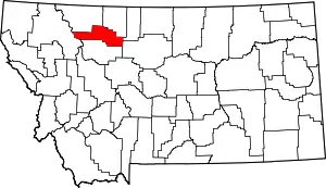
List of mountains in Pondera County, Montana
There are at least 28 named mountains in Pondera County, Montana.
- Black Buttes, 48°09′46″N 112°17′13″W, el. 4,167 feet (1,270 m)[1]
- Bruin Peaks, 48°11′56″N 113°09′05″W, el. 7,703 feet (2,348 m)[2]
- Bullshoe Mountain, 48°13′31″N 113°13′32″W, el. 8,008 feet (2,441 m)[3]
- Conrad Butte, 48°17′59″N 111°41′25″W, el. 3,668 feet (1,118 m)[4]
- Curly Bear Mountain, 48°11′49″N 113°04′50″W, el. 7,903 feet (2,409 m)[5]
- Elbow Mountain, 48°10′37″N 113°06′54″W, el. 7,139 feet (2,176 m)[6]
- Elkcalf Mountain, 48°17′05″N 113°17′52″W, el. 7,569 feet (2,307 m)[7]
- Family Peak, 48°08′55″N 113°01′25″W, el. 8,094 feet (2,467 m)[8]
- Feather Woman Mountain, 48°13′40″N 112°57′35″W, el. 7,592 feet (2,314 m)[9]
- Flag Butte, 48°26′08″N 112°29′57″W, el. 4,176 feet (1,273 m)[10]
- Flattop Mountain, 48°17′43″N 113°19′48″W, el. 6,614 feet (2,016 m)[11]
- Goat Mountain, 48°13′08″N 113°08′30″W, el. 8,182 feet (2,494 m)[12]
- Half Dome Crag, 48°16′15″N 113°04′46″W, el. 8,045 feet (2,452 m)[13]
- Heart Butte, 48°14′31″N 112°55′17″W, el. 6,821 feet (2,079 m)[14]
- Kiyo Crag, 48°17′37″N 113°06′29″W, el. 7,743 feet (2,360 m)[15]
- Little Plume Peak, 48°16′32″N 113°00′35″W, el. 6,985 feet (2,129 m)[16]
- Lookout Butte, 48°28′32″N 112°16′35″W, el. 3,734 feet (1,138 m)[17]
- Morningstar Mountain, 48°11′25″N 113°01′50″W, el. 8,376 feet (2,553 m)[18]
- Mount Poia, 48°10′57″N 112°59′56″W, el. 8,271 feet (2,521 m)[19]
- Mount Richmond, 48°08′26″N 112°56′09″W, el. 8,166 feet (2,489 m)[20]
- Running Crane Mountain, 48°14′51″N 113°14′13″W, el. 7,746 feet (2,361 m)[21]
- Running Owl Mountain, 48°13′28″N 113°11′42″W, el. 7,828 feet (2,386 m)[22]
- Sam George Hill, 48°10′47″N 112°02′20″W, el. 3,947 feet (1,203 m)[23]
- Scarface Mountain, 48°10′48″N 113°01′12″W, el. 8,277 feet (2,523 m)[24]
- Scoffin Butte, 48°08′43″N 112°41′46″W, el. 5,128 feet (1,563 m)[25]
- Split Mountain, 48°08′26″N 112°48′51″W, el. 6,171 feet (1,881 m)[26]
- Spotted Eagle Mountain, 48°11′16″N 113°04′21″W, el. 8,038 feet (2,450 m)[27]
- Telephone Hill, 48°19′52″N 112°02′22″W, el. 4,019 feet (1,225 m)[28]
Notes
- "Black Buttes". Geographic Names Information System. United States Geological Survey.
- "Bruin Peaks". Geographic Names Information System. United States Geological Survey.
- "Bullshoe Mountain". Geographic Names Information System. United States Geological Survey.
- "Conrad Butte". Geographic Names Information System. United States Geological Survey.
- "Curly Bear Mountain". Geographic Names Information System. United States Geological Survey.
- "Elbow Mountain". Geographic Names Information System. United States Geological Survey.
- "Elkcalf Mountain". Geographic Names Information System. United States Geological Survey.
- "Family Peak". Geographic Names Information System. United States Geological Survey.
- "Feather Woman Mountain". Geographic Names Information System. United States Geological Survey.
- "Flag Butte". Geographic Names Information System. United States Geological Survey.
- "Flattop Mountain". Geographic Names Information System. United States Geological Survey.
- "Goat Mountain". Geographic Names Information System. United States Geological Survey.
- "Half Dome Crag". Geographic Names Information System. United States Geological Survey.
- "Heart Butte". Geographic Names Information System. United States Geological Survey.
- "Kiyo Crag". Geographic Names Information System. United States Geological Survey.
- "Little Plume Peak". Geographic Names Information System. United States Geological Survey.
- "Lookout Butte". Geographic Names Information System. United States Geological Survey.
- "Morningstar Mountain". Geographic Names Information System. United States Geological Survey.
- "Mount Poia". Geographic Names Information System. United States Geological Survey.
- "Mount Richmond". Geographic Names Information System. United States Geological Survey.
- "Running Crane Mountain". Geographic Names Information System. United States Geological Survey.
- "Running Owl Mountain". Geographic Names Information System. United States Geological Survey.
- "Sam George Hill". Geographic Names Information System. United States Geological Survey.
- "Scarface Mountain". Geographic Names Information System. United States Geological Survey.
- "Scoffin Butte". Geographic Names Information System. United States Geological Survey.
- "Split Mountain". Geographic Names Information System. United States Geological Survey.
- "Spotted Eagle Mountain". Geographic Names Information System. United States Geological Survey.
- "Telephone Hill". Geographic Names Information System. United States Geological Survey.
This article is issued from Wikipedia. The text is licensed under Creative Commons - Attribution - Sharealike. Additional terms may apply for the media files.
