List of provincial parks of Southwestern Ontario
This is a list of provincial parks in Southwestern Ontario. These provincial parks are maintained by Ontario Parks. For a list of other provincial parks in Ontario, see the List of provincial parks in Ontario.
Bruce County
| Name | Established | Commons category | Picture | Coordinates |
|---|---|---|---|---|
| Black Creek Provincial Park | 1989 | 44.973333333333°N 81.363611111111°W | ||
| Cabot Head Provincial Nature Reserve | 1985 | 45.209722222222°N 81.448611111111°W | ||
| Hope Bay Forest Provincial Nature Reserve | 1985 | 44.92306°N 81.15572°W | ||
| Inverhuron Provincial Park | 1967 | Inverhuron Provincial Park | 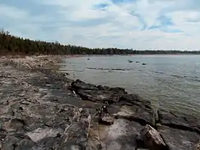 |
44.2997°N 81.5881°W |
| Ira Lake Provincial Nature Reserve | 1989 | 45.039995°N 81.364884°W | ||
| Johnston Harbour-Pine Tree Point Provincial Nature Reserve | 1989 | 45.107537°N 81.514344°W | ||
| Lion's Head Provincial Park | 1985 | 44.997°N 81.201°W | ||
| Little Cove Provincial Nature Reserve | 1985 | 45.247222222222°N 81.612222222222°W | ||
| MacGregor Point Provincial Park | 1975 | MacGregor Point Provincial Park | 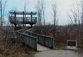 |
44.4086°N 81.4458°W |
| Sauble Falls Provincial Park | 1971 | 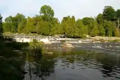 |
44.6756°N 81.2567°W | |
| Smokey Head/White Bluff Provincial Nature Reserve | 1985 | 45.000555555556°N 81.220277777778°W |
Chatham-Kent
| Name | Established | Commons category | Picture | Coordinates |
|---|---|---|---|---|
| Clear Creek Forest Provincial Park | 2014 | 42.472314°N 81.723261°W | ||
| Rondeau Provincial Park | 1894 | Rondeau Provincial Park | .JPG.webp) |
42.2833°N 81.8667°W |
| Wheatley Provincial Park | 1971 | Wheatley Provincial Park | 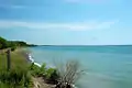 |
42.09°N 82.4472°W |
Elgin County
| Name | Established | Coordinates |
|---|---|---|
| John E. Pearce Provincial Park | 1957 | 42.608055555556°N 81.446666666667°W |
| Port Bruce Provincial Park | 1974 | 42.655°N 81.013333333333°W |
| Port Burwell Provincial Park (formerly Iroquois Beach Provincial Park 1971-1986) | 1971 | 42.648055555556°N 80.816111111111°W |
Essex County
| Name | Established | Coordinates |
|---|---|---|
| East Sister Island Provincial Nature Reserve | 41.81317°N 82.85576°W | |
| Fish Point Provincial Nature Reserve | 1985 | 41.7376°N 82.67139°W |
| Lighthouse Point Provincial Nature Reserve | 1985 | 41.8255°N 82.63928°W |
| Ojibway Prairie Provincial Nature Reserve | 1977 | 42.2655556°N 83.0766666°W |
Grey County
| Name | Established | Picture | Coordinates |
|---|---|---|---|
| Bayview Escarpment Provincial Nature Reserve | 1985 | 44.636666666667°N 80.710833333333°W | |
| Craigleith Provincial Park | 1967 | 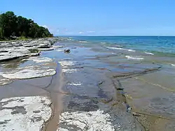 |
44.5367°N 80.3486°W |
| Duncan Escarpment Provincial Nature Reserve | 1985 | 44.416944444444°N 80.466111111111°W | |
| Pretty River Valley Provincial Park | 1985 | 44.426666666667°N 80.290277777778°W |
Haldimand County
| Name | Established | Commons category | Picture | Coordinates |
|---|---|---|---|---|
| James N. Allan Provincial Park | 1989 | 42.84948°N 79.663466°W | ||
| Rock Point Provincial Park | 1957 | Rock Point Provincial Park | 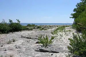 |
42.8482°N 79.5525°W |
| Selkirk Provincial Park | 1967 | 42.813888888889°N 79.958888888889°W |
Huron County
| Name | Established | Coordinates |
|---|---|---|
| Morris Tract Provincial Nature Reserve | 1997 | 43.726944444444°N 81.643333333333°W |
| Point Farms Provincial Park | 1970 | 43.805°N 81.717222222222°W |
Lambton County
| Name | Established | Commons category | Picture | Coordinates |
|---|---|---|---|---|
| The Pinery Provincial Park | 1957 | Pinery Provincial Park | 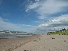 |
43.26°N 81.8278°W |
Middlesex County
| Name | Established | Coordinates |
|---|---|---|
| Komoka Provincial Park | 1989 | 42.95°N 81.3975°W |
Norfolk County
| Name | Established | Commons category | Picture | Coordinates |
|---|---|---|---|---|
| Long Point Provincial Park | 1921 | Long Point Provincial Park | 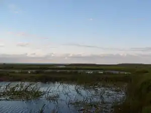 |
42.58°N 80.385°W |
| Turkey Point Provincial Park | 1959 |  |
42.7047°N 80.3333°W |
Oxford County
| Name | Established | Coordinates |
|---|---|---|
| Trillium Woods Provincial Park | 1969 | 43.06377°N 80.77787°W |
This article is issued from Wikipedia. The text is licensed under Creative Commons - Attribution - Sharealike. Additional terms may apply for the media files.