Low and Burbank's Grant, New Hampshire
Low and Burbank's Grant is a township located in Coös County, New Hampshire, United States. The grant lies entirely within the White Mountain National Forest. As of the 2010 census, the grant had a population of zero.[1]
Low and Burbank's Grant, New Hampshire | |
|---|---|
 East elevation of Mount Madison, seen from New Hampshire Route 16 | |
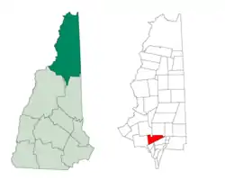
 Location in Coös County, New Hampshire | |
| Coordinates: 44°19′33″N 71°21′46″W | |
| Country | United States |
| State | New Hampshire |
| County | Coös |
| Area | |
| • Total | 26.1 sq mi (67.6 km2) |
| • Land | 26.1 sq mi (67.6 km2) |
| • Water | 0 sq mi (0 km2) 0% |
| Elevation | 5,584 ft (1,702 m) |
| Population (2010) | |
| • Total | 0 |
| Time zone | UTC-5 (Eastern) |
| • Summer (DST) | UTC-4 (Eastern) |
| Area code(s) | 603 |
In New Hampshire, locations, grants, townships (which are different from towns), and purchases are unincorporated portions of a county which are not part of any town and have limited self-government (if any, as many are uninhabited).
History
The purchase is named for Clovis Lowe of Jefferson and Barker Burbank of Shelburne who purchased land from the state in 1832.[2]
Geography
According to the United States Census Bureau, the grant has a total area of 26.1 square miles (67.6 km2), all of it land.[3]
Features of Low and Burbank's Grant include Mt. Sam Adams—at 5,584 feet (1,702 m) above sea level, the highest point in the grant—and Mt. Madison, elevation 5,367 feet (1,636 m). Both peaks are part of the Presidential Range of the White Mountains. The northern slopes of the range comprise one of the most densely tracked areas in the White Mountain National Forest. The Randolph Mountain Club and the Appalachian Mountain Club maintain seasonal huts and cabins on the north slopes of these two mountains, at or above 4,000 feet (1,200 m).
Demographics
| Historical population | |||
|---|---|---|---|
| Census | Pop. | %± | |
| 1960 | 0 | — | |
| 1970 | 0 | — | |
| 1980 | 1 | — | |
| 1990 | 0 | −100.0% | |
| 2000 | 0 | — | |
| 2010 | 0 | — | |
| 2015 (est.) | 0 | [4] | |
| U.S. Decennial Census[5] | |||
As of the 2010 census,[6] there were no people living in the grant.
References
- United States Census Bureau, American FactFinder, 2010 Census figures. Retrieved March 23, 2011.
- Julyan, Robert Hixson; Julyan, Mary (1993), Place Names of the White Mountains (Revised ed.), University Press of New England, p. 94, ISBN 978-0-87451-638-8
- "Geographic Identifiers: 2010 Demographic Profile Data (G001) - Low and Burbanks grant, New Hampshire". United States Census Bureau. Retrieved November 9, 2011.
- "Annual Estimates of the Resident Population for Incorporated Places: April 1, 2010 to July 1, 2015". Archived from the original on June 2, 2016. Retrieved July 2, 2016.
- "Census of Population and Housing". Census.gov. Retrieved June 4, 2016.
- "U.S. Census website". United States Census Bureau. Retrieved 2008-01-31.
