Mai Khola
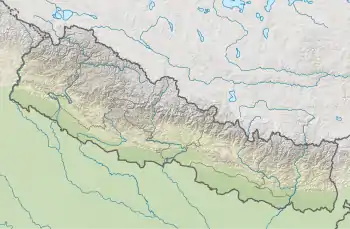
The Mai Khola is a river in eastern Nepal, the headwater of the Kankai River. Its water is used for irrigation and also powers several hydroelectric plants.
| Mai Khola | |
|---|---|
 | |
| Physical characteristics | |
| Mouth | Kankai Mai |
• coordinates | 26.8289°N 87.7800°E |
Location
The Mai Khola is the main tributary of the Kankai River. It is a perennial river that originates in springs in the Mahabharat Range about 3,300 metres (10,800 ft) above sea level. It flows from north to south. Major tributaries include the Jog Mai Khola and Puwa Khola. At its confluence with the Deb Mai Khola, it takes the name of Kankai Mai River, and when it enters the Jhapa District it becomes the Kankai River. The catchment area of the Mai Khola upstream from the Kankai Mai River at Chepte is 1,150 square kilometres (440 sq mi), and lies entirely within the Ilam District.[1]
Mai AWP
The Mai Area Water Partnership (AWP) was established after a June 2002 workshop. It is a network of local water-related institutions with the Namsaling Community Development Centre (NCDC), a non-governmental organization, as the host institution. The purpose was to ensure sustainable irrigation development in the Mai River basin, the only basin in Ilam.[2] For the purpose of a pilot project study the Mai River basin was divided into 14 sub-basins, or blocks.[2] The study found that two of these blocks were water-stressed and another two had only just enough water flows for present demand.[3] One of the challenges of the AWP was to encourage the members to work together as a network, rather than use it as a forum to air grievances. However, it was hoped that the AWP would provide a model for similar partnerships in other parts of Nepal.[4]
Hydroelectricity
As of January 2020 seven hydropower projects on the Mai Khola were operational and another three were under development. If the 6.2 MW Puwa Khola Hydropower Station is included, the active and under construction plants total 86.97 MW output.[5] The projects were:[5][6]
| Output | Project | Status | Commissioned | Developer |
|---|---|---|---|---|
| 4.5 MW | Mai Khola Small Hydropower Station | Active | 2008-01-28 | Himal Dolakha Hydropower |
| 22 MW | Mai Hydropower Station | Active | 2015-01-28 | Sanima Mai Hydropower |
| 7 MW | Mai Cascade Hydropower Plant | Active | 2016-04-01 | Sanima Mai Hydropower |
| 12 MW | Upper Mai Hydropower Station | Active | 2016-06-23 | Mai Valley Hydropower |
| 6.1 MW | Upper Mai-C Hydropower Station | Active | 2017-07-24 | Mai Valley Hydropower |
| 8 MW | Mai Cascade Hydropower Plant | Active | 2018-04-09 | Himal Dolakha Hydropower |
| 7.8 MW | Super Mai Hydropower Station | Active | 2018-10-28 | Super Mai Hydro Power |
| 9.6 MW | Super Mai-A Hydropower Station | Active | Super Mai Hydro Power | |
| 3.8 MW | Super Mai Khola Cascade Hydropower Station | Active | Super Mai Hydro Power | |
| 9.51 MW | Mai Beni hydropower project | Construction | Urja Developers |
The intake to the 6.2 MW Puwa Khola Hydropower Station is on the Puwa River about 500 metres (1,600 ft) above the Geya Danda Irrigation System. About 250 liters per second (3,300 imp gal/min) of water is diverted to the power station.[7] The diverted water flows along a 3.2 kilometres (2.0 mi) headrace tunnel and then a 990 metres (3,250 ft) penstock pipe to the power station, which discharges it into the left bank of the Mai Khola.[8] This leaves very little irrigation water in the dry season.[7]
Notes
- Hirakaji Ghale 2005, p. 3.
- Hirakaji Ghale 2005, p. 7.
- Hirakaji Ghale 2005, p. 8.
- Hirakaji Ghale 2005, p. 11.
- Kokila Dhakal 2020.
- Mai Khola – NWRP.
- Sewanta Kattel 2006, p. 4.
- Hirakaji Ghale 2005, pp. 3-4.
Sources
- Hirakaji Ghale (September 2005), Independent Evaluation of Mai River Area Water Partnership (AWP) (PDF), Min Bhawan, Kathmandu: Consolidated Management Services Nepal (CMS), retrieved 2020-12-02
- Kokila Dhakal (27 January 2020), "Mai Khola To Have 10 Hydro Projects", The Rising Nepal, retrieved 2020-12-03
- "Mai Khola", NWRP: Nepal Water Resource Profile, retrieved 2020-12-03
- Sewanta Kattel (December 2006), "Dispute Management in Farmer's Managed Irrigation System: A Case Study of Geya Danda Irrigation System of Eastern Nepal", Dhaulagiri Journal of Sociology and Anthropology, 1, doi:10.3126/dsaj.v1i0.277, retrieved 2020-12-02