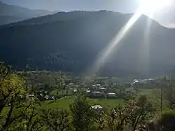
Mandal, Uttarakhand
Mandal[3] is a village in the Garhwal Himalayas of Uttarakhand, India.
Mandal | |
|---|---|
Village | |
 Mandal Village | |
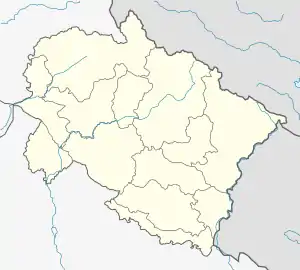
 Mandal Location in Uttarakhand, India | |
| Coordinates: 30.455°N 79.275°E | |
| Country | |
| State | Uttarakhand |
| District | Chamoli |
| Government | |
| • Type | Gram Panchayat |
| Area | |
| • Total | 1.2 km2 (0.5 sq mi) |
| Elevation | 1,500−1,700 m (−4,100 ft) |
| Population (2011)[1] | |
| • Total | 452 |
| Languages | |
| • Official | Hindi, Garhwali |
| Time zone | UTC+5:30 (IST) |
| PIN | 246401[2] |
| Vehicle registration | UK-11 |
| Website | uk |
About Mandal[4]
According to Census 2011 information the location code or village code of Mandal village is 040908. Mandal village is located in Chamoli Tehsil of Chamoli district in Uttarakhand, India. It is situated 23 km away from sub-district headquarter Chamoli and 13 km away from district headquarter Gopeshwar. Mandal village is also a gram panchayat.
Demography[5]
The total geographical area of village is 119.42 hectares. Mandal has a total population of 452 peoples. There are about 108 houses in village. As per 2019 stats, Mandal villages comes under Badrinath assembly & Garhwal parliamentary constituency. Gopeshwar is nearest town to Mandal which is approximately 13 km away.
Nearby villages
- Pangar Basa
- Ansuya
- Rudra Nath
- Siroli
- Khala
- Koteshwar
References
- "2011 Census Data". Mandal - Village 2011 Official Census Data.
- "PIN Code". Postal Index Number Code.
- "Mandal Village information". soki.in.
- "mandal travel". indian express.
- "2011 Census Data". Mandal - Village 2011 Official Census Data.
External links
- https://www.euttaranchal.com/tourism/how-to-reach-mandal-village.php
- https://indianexpress.com/article/lifestyle/destination-of-the-week/uttarakhand-travelogue-rudraprayag-mandal-chopta/lite/&ved=2ahUKEwi_hZq7kL3sAhUSA3IKHfGpCGkQFjAGegQIBhAB&usg=AOvVaw0dyylDyVldyWeGEyW1rfUd&cf=1&cshid=1602990905583
This article is issued from Wikipedia. The text is licensed under Creative Commons - Attribution - Sharealike. Additional terms may apply for the media files.