Mount Emmons (Alaska)
Mount Emmons[3] is a post-caldera stratovolcano within the Emmons Lake caldera on the Alaska Peninsula within the Lake and Peninsula Borough, Alaska, United States.
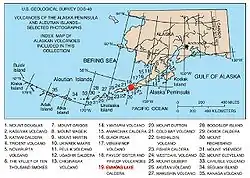
Map showing volcanoes of Alaska. The mark is set at the location of Emmons Lake.
| Mount Emmons | |
|---|---|
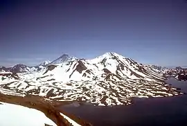 View, looking northeast, of Mount Emmons in 1987 | |
| Highest point | |
| Elevation | 4,711 ft (1,436 m) [1] |
| Listing | List of volcanoes in the United States |
| Coordinates | 55°20′27″N 162°04′21″W [2] |
| Geography | |
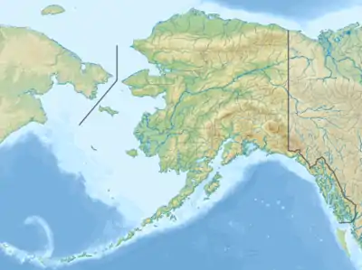 Mount Emmons Location of Mount Emmons within Alaska | |
| Location | Alaska Peninsula, Lake and Peninsula Borough, Alaska United States |
| Parent range | Aleutian Range |
| Topo map | USGS Cold Bay B-1 |
| Geology | |
| Mountain type | Caldera |
| Volcanic arc/belt | Aleutian Arc |
| Last eruption | Unknown |
Description
The summit is one of three cones constructed within the 7-by-11-mile (11 km × 18 km) caldera, which also contains an elongated crater lake on its southwest side.[1]
The most recent of several caldera-forming eruptions at Emmons Lake occurred more than 10,000 years ago. No historical eruptions have occurred at Emmons Lake.[4]
The peak is located within the Alaska Peninsula National Wildlife Refuge.[5]
Mount Emmons is a local name published on a USGS map in 1943.[3]
References
- "Emmons Lake". Global Volcanism Program. Smithsonian Institution. Retrieved 26 Jan 2005.
- "Emmons Lake Volcanic Center". Alaska Volcano Observatory. Retrieved 1 Jun 2009.
- U.S. Geological Survey Geographic Names Information System: Mount Emmons
- "Volcanoes of the Alaska Peninsula and Aleutian Islands". Digital Data Series DDS-40. United States Geological Survey. 2002. Retrieved 1 Jun 2009.
- MyTopo Maps - Mount Emmons, Aleutians East, Alaska, United States (Map). Trimble Navigation, Ltd. Retrieved 4 Feb 2018.
This article is issued from Wikipedia. The text is licensed under Creative Commons - Attribution - Sharealike. Additional terms may apply for the media files.