Mount Grosvenor (Alaska Range)
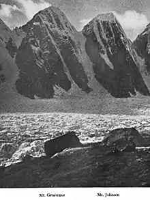
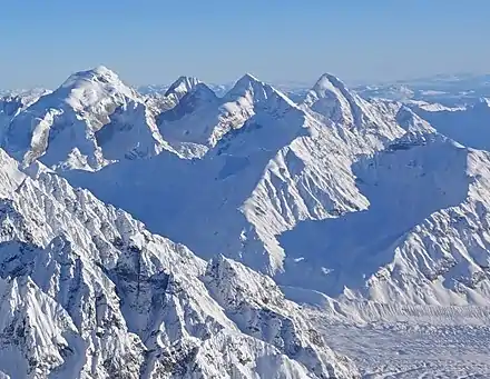
Mount Grosvenor is an 8,400+ ft (2,560+ m) mountain summit located in the Alaska Range, in Denali National Park and Preserve, in Alaska, United States. It is situated on the west side of the Ruth Gorge, 0.87 mi (1 km) northwest of Mount Church and 0.54 mi (1 km) south of Mt. Johnson. Its nearest higher peak is Mount Wake, 1.32 miles (2.12 km) to the northwest. Despite its relatively low elevation, it is notable for its east face with over 4,000 feet of vertical sheer granite. The mountain was named by famed explorer Dr. Frederick Cook who claimed the first ascent of Mount McKinley in 1906, but was later disproved.[2][3] This peak's unofficial name honors Gilbert Hovey Grosvenor (1875–1966), President of the National Geographic Society, father of photojournalism, and the first full-time editor of National Geographic magazine. The first ascent of the peak was made in 1979 by Gary Bocarde, Charlie Head, John Lee, and Jon Thomas.[4]
| Mount Grosvenor | |
|---|---|
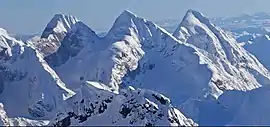
 Aerial view from northwest. Mt. Grosvenor centered, flanked by Johnson (left), Church (right) | |
| Highest point | |
| Elevation | 8,400+ ft (2,560+ m) [1] |
| Prominence | 925 ft (282 m) [1] |
| Parent peak | Mount Wake |
| Coordinates | 62°53′13″N 150°42′23″W [1] |
| Geography | |
 Mount Grosvenor Location of Mt. Grosvenor in Alaska | |
| Location | Denali National Park and Preserve Matanuska-Susitna Borough Alaska, United States |
| Parent range | Alaska Range |
| Topo map | USGS Talkeetna D-2 |
| Geology | |
| Type of rock | Granite |
| Climbing | |
| First ascent | 1979 |
Climate
Based on the Köppen climate classification, Mount Grosvenor is located in a subarctic climate zone with long, cold, snowy winters, and cool summers.[5] Temperatures can drop below −20 °C with wind chill factors below −30 °C. The months May through June offer the most favorable weather for climbing or viewing.

See also
- Mountain peaks of Alaska
References
- "Mount Grosvenor". Peakbagger.com. Retrieved 2020-04-23.
- Americanalpineclub.org Four Ascents in the Great Gorge of the Ruth Glacier
- C. E. Rusk, On the Trail of Dr. Cook, The Pacific Monthly, 1911, page 59.
- Appalachia, Summer/Fall 2005, Volumes 56-58, page 111
- Peel, M. C.; Finlayson, B. L.; McMahon, T. A. (2007). "Updated world map of the Köppen−Geiger climate classification". Hydrol. Earth Syst. Sci. 11: 1633–1644. ISSN 1027-5606.
External links
- Mts. Grosvenor and Johnson: Flickr photo
- National Weather Service Forecast
- Mountain Forecast
