National Register of Historic Places listings in Lander County, Nevada
Contents: List of Registered Historic Places in Lander County, Nevada, USA:
The locations of National Register properties and districts (at least for all showing latitude and longitude coordinates below), may be seen in an online map by clicking on "Map of all coordinates".[1]
- This National Park Service list is complete through NPS recent listings posted January 29, 2021.[2]
Current listings
| [3] | Name on the Register | Image | Date listed[4] | Location | City or town | Description |
|---|---|---|---|---|---|---|
| 1 | Austin Cemetery | 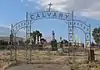 Austin Cemetery |
August 14, 2003 (#03000753) |
Northern and southern sides of U.S. Route 50 near its junction with State Route 305 39°30′04″N 117°05′04″W |
Austin | |
| 2 | Austin City Hall | 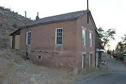 Austin City Hall |
August 14, 2003 (#03000754) |
90 South St. 39°29′33″N 117°04′15″W |
Austin | |
| 3 | Austin Historic District | 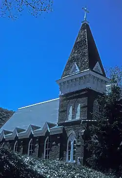 Austin Historic District |
November 23, 1971 (#71000489) |
In Pony Canyon at the junction of State Route 8A and U.S. Route 50 39°29′37″N 117°04′15″W |
Austin | |
| 4 | Austin Masonic and Odd Fellows Hall | 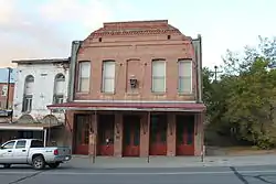 Austin Masonic and Odd Fellows Hall |
August 14, 2003 (#03000756) |
105 Main St. 39°29′34″N 117°04′10″W |
Austin | |
| 5 | Austin Methodist Church | 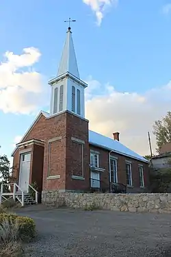 Austin Methodist Church |
August 14, 2003 (#03000751) |
135 Court St. 39°29′32″N 117°04′06″W |
Austin | |
| 6 | Gridley Store | 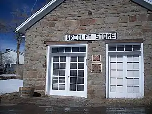 Gridley Store |
August 14, 2003 (#03000752) |
247 Water St. 39°29′22″N 117°03′47″W |
Austin | Store operated by Reuel Colt Gridley |
| 7 | Lander County Courthouse | 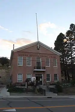 Lander County Courthouse |
August 14, 2003 (#03000750) |
122 Main St. 39°29′31″N 117°04′11″W |
Austin | |
| 8 | Lander County High School | Lander County High School |
July 20, 2000 (#00000821) |
130 6th St. 39°29′37″N 117°04′08″W |
Austin | |
| 9 | Nevada Central Turntable | _center_1.JPG.webp) Nevada Central Turntable |
August 14, 2003 (#03000759) |
Off Austin Roping Arena Rd. on the southern side of U.S. Route 50 39°29′50″N 117°05′02″W |
Austin | |
| 10 | St. Augustine's Catholic Church | 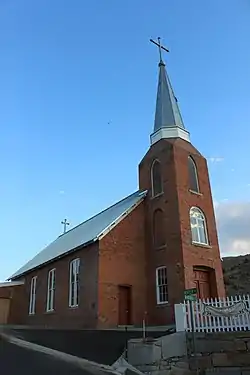 St. Augustine's Catholic Church |
August 14, 2003 (#03000758) |
113 Virginia St. 39°29′35″N 117°04′11″W |
Austin | |
| 11 | St. George's Episcopal Church | 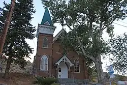 St. George's Episcopal Church |
August 14, 2003 (#03000755) |
156 Main St. 39°29′28″N 117°04′07″W |
Austin | |
| 12 | Stokes Castle | 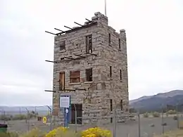 Stokes Castle |
August 14, 2003 (#03000757) |
Along U.S. Route 50 west of Austin 39°29′37″N 117°04′45″W |
Austin | |
| 13 | Toquima Cave | 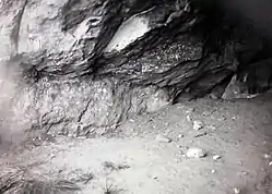 Toquima Cave |
April 4, 2002 (#02000298) |
Humboldt-Toiyabe National Forest 39°11′13″N 116°47′12″W |
Austin |
See also
| Wikimedia Commons has media related to National Register of Historic Places in Lander County, Nevada. |
References
- The latitude and longitude information provided in this table was derived originally from the National Register Information System, which has been found to be fairly accurate for about 99% of listings. Some locations in this table may have been corrected to current GPS standards.
- "National Register of Historic Places: Weekly List Actions". National Park Service, United States Department of the Interior. Retrieved on January 29, 2021.
- Numbers represent an alphabetical ordering by significant words. Various colorings, defined here, differentiate National Historic Landmarks and historic districts from other NRHP buildings, structures, sites or objects.
- The eight-digit number below each date is the number assigned to each location in the National Register Information System database, which can be viewed by clicking the number.
This article is issued from Wikipedia. The text is licensed under Creative Commons - Attribution - Sharealike. Additional terms may apply for the media files.