Okubo, Narashino
Okubo (大久保, Ōkubo) is a district of Narashino City, Chiba Prefecture, Japan, consisting of 1-chōme to 4-chōme. The name “Okubo” is also used to refer to the area around Keisei Ōkubo Station.
Okubo
大久保 | |
|---|---|
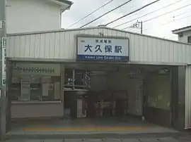
 Keisei Ōkubo Station, in Moto-Okubo, Narashino | |
 Okubo Okubo | |
| Coordinates: 35.6879°N 140.0493°E | |
| Country | |
| Prefecture | |
| City | |
| Area | |
| • Total | 0.667 km2 (0.258 sq mi) |
| Population (September 2018)[2] | |
| • Total | 9,298 |
| • Density | 14,000/km2 (36,000/sq mi) |
| Time zone | UTC+9 (Japan Standard Time) |
| Postal code | 275-0011[3] |
| Area code(s) | 047[4] |
| Vehicle registration | Narashino |
Etymology
The name Okubo came from a sunken place (Kubo) of a tributary of the Hamada River or Okubo clan, a hatamoto of the neighborhood in the Edo period.[5]
Demographics
The population as of September 2018 is shown below.[1][2]
| Chōme | Population | Density (/km2) |
|---|---|---|
| 1-chōme | 3,095 | 13,520 |
| 2-chōme | 2,794 | 15,880 |
| 3-chōme | 1,888 | 17,160 |
| 4-chōme | 1,521 | 10,010 |
| Total | 9,298 | 13,940 |
Transportation
Rail service
Bus service
- Narashino City Happy Bus - Keisei Ōkubo Station Route
- Okubo 1-chōme - Keisei Ōkubo Station North Entrance
Commerce
Commercial area locates to the north of Keisei Ōkubo Station.
- Okubo Shopping District
- Maruetsu Okubo-ekimae
Education
- Narashino City Okubo-Higashi Elementary School
References
- 平成29年版 習志野市統計書 習志野市ホームページ (in Japanese). Japan. Retrieved 22 February 2019.
- 町丁目別・年齢別住民基本台帳人口 習志野市ホームページ (in Japanese). Japan. Retrieved 22 February 2019.
- 郵便番号. 日本郵便. Retrieved 22 February 2019.
- 市外局番の一覧. 総務省. Retrieved 22 February 2019.
- 名前の由来 習志野市ホームページ [Origin of place names - Narashino City] (in Japanese). Japan: Narashino City. Retrieved 22 February 2019.
External links
This article is issued from Wikipedia. The text is licensed under Creative Commons - Attribution - Sharealike. Additional terms may apply for the media files.