Pago (Papua New Guinea)
The volcano Pago is located East of Kimbe, West New Britain Province, Papua New Guinea. Pago is a young post-caldera cone within the Witori Caldera. The Buru Caldera cuts the SW flank of the Witori volcano. Biggest eruptions were at 4000±200 BC, VEI 6, 10 cubic kilometres (2.5 mi.3); 1370±100 BC, VEI6, 30 km3 (7 mi.3); and 710±75 AD, VEI 6, 20 km3 (5 mi.3) of tephra.[1]
| Pago | |
|---|---|
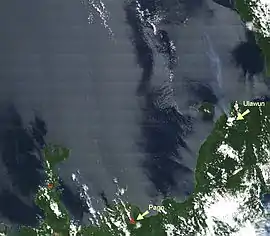 Pago on the left | |
| Highest point | |
| Elevation | 742 m (2,434 ft) |
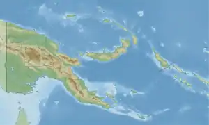
| Coordinates | 5°35′0″S 150°31′0″E |
| Geography | |
| Geology | |
| Age of rock | 350 years ago |
| Volcanic arc/belt | Bismarck volcanic arc |
| Last eruption | May to July 2012 |
This article is issued from Wikipedia. The text is licensed under Creative Commons - Attribution - Sharealike. Additional terms may apply for the media files.