Pedro Reinel
Pedro Reinel (c. 1462 – c. 1542) was a Portuguese cartographer, author of one of the oldest signed Portuguese nautical charts (c. 1485). That is a portolan type of chart, covering western Europe and part of Africa, and already reflecting the explorations made by Diogo Cão in 1482–1485. With his son Jorge Reinel (c. 1502 – c. 1572), and the cartographer Lopo Homem, he participated in the construction of the well-known Miller Atlas (1519). His Atlantic Chart of c. 1504 is the earliest known nautical chart with a scale of latitudes, and the first to depict a wind rose with a clearly drawn fleur-de-lys. He has a Portuguese postage stamp in his honour.[1]
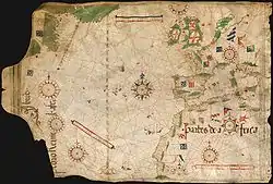
 Pedro Reinel, (c.1485). Archives départementales de la Gironde, Bordeaux
 Reinel compass rose
 Pedro Reinel, North Atlantic (1535)
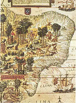 "Terra Brasilis", Miller Atlas, 1519, French National Library in Paris
Pedro Reinel (c. 1504). Bayerische Staatsbibliothek, Munich.
References
| Authority control |
|---|
This article is issued from Wikipedia. The text is licensed under Creative Commons - Attribution - Sharealike. Additional terms may apply for the media files.