Point of Rocks (Kansas)
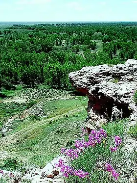
Point of Rocks is a cliff in Morton County, Kansas[1] which was one of three landmarks by the same name on the Santa Fe Trail. This one was on the Cimarron Cutoff. It is now part of Cimarron National Grassland.

The bluff overlooks the north side of the Cimarron River and lies approximately seven miles north of Elkhart west of K-27.[2] Point of Rocks has been an important landmark for travelers to this region of Kansas. It signifies the closeness of springs and thus water. Many springs are known to exist in the region of the Cimarron River near Point of Rocks. Because of this, Point of Rocks was an important landmark for travelers heading west on the Cimarron Cutoff and for modern day ranchers. Point of Rocks is the third Highest Point in the state of Kansas with the elevation at its summit being 3,540 feet (1,080 m).[1]
References
- U.S. Geological Survey Geographic Names Information System: Point of Rocks (Kansas)
- Elkhart North, KS, 7.5 Minute Topographic Quadrangle, USGS, 1973