Puerto Rico Highway 567
Puerto Rico Highway 567 (PR-567) is a north–south rural road located between the municipalities of Orocovis and Morovis, Puerto Rico.[3] It extends from its junction with PR-157 on the Barros–Damián Arriba line in Orocovis,[4] passing through Vaga, Pasto and San Lorenzo barrios until its end at its intersection with PR-145 and PR-6622 in the Torrecillas–Morovis Norte line in Morovis.[5][6]
| ||||
|---|---|---|---|---|
| Route information | ||||
| Maintained by Puerto Rico DTPW | ||||
| Length | 16.3 km[1] (10.1 mi) | |||
| Existed | 1953[2]–present | |||
| Major junctions | ||||
| South end | ||||
| North end | ||||
| Location | ||||
| Municipalities | Orocovis, Morovis | |||
| Highway system | ||||
| ||||

Major intersections
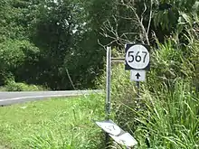
PR-567 in Morovis
| Municipality | Location | km[1] | mi | Destinations | Notes |
|---|---|---|---|---|---|
| Orocovis | Barros–Damián Arriba line | 0.0 | 0.0 | Southern terminus of PR-567 | |
| Morovis | Pasto–Vaga line | 4.6 | 2.9 | ||
| Torrecillas–Morovis Norte line | 16.3 | 10.1 | Northern terminus of PR-567 | ||
| 1.000 mi = 1.609 km; 1.000 km = 0.621 mi | |||||
Related route
| |
|---|---|
| Location | Morovis |
| Length | 2.8 km[7] (1.7 mi) |
Puerto Rico Highway 5567 (PR-5567) is a spur route located in Morovis. It extends from PR-567 on the Pasto–Vaga line to Vaga barrio.[8]
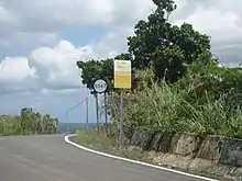
PR-5567 heading to Vaga barrio in Morovis
The entire route is located in Morovis.
| Location | km[7] | mi | Destinations | Notes | |
|---|---|---|---|---|---|
| Pasto–Vaga line | 0.0 | 0.0 | Southern terminus of PR-5567 | ||
| Vaga | 2.8 | 1.7 | Barrio Vaga – Morovis | Northern terminus of PR-5567 | |
| 1.000 mi = 1.609 km; 1.000 km = 0.621 mi | |||||
See also
References
- Google (29 February 2020). "PR-567" (Map). Google Maps. Google. Retrieved 29 February 2020.
- "Morovis, Memoria Núm. 65" (PDF). Puerto Rico Planning Board (in Spanish). 1955. Retrieved 22 February 2020.
- Puerto Rico (fold out) (Map). National Geographic Adventure Map (Book 3107). 7 May 2011. ISBN 978-1566955188.
- "PR-567, Orocovis, Puerto Rico". geoview.info. Retrieved 22 February 2020.
- "Tránsito Promedio Diario (AADT)". Transit Data (Datos de Transito) (in Spanish). DTOP PR. p. 116.
- "PR-567, Morovis, Puerto Rico". geoview.info. Retrieved 22 February 2020.
- Google (22 March 2020). "PR-5567" (Map). Google Maps. Google. Retrieved 22 March 2020.
- "PR-5567, Morovis, Puerto Rico". geoview.info. Retrieved 22 March 2020.
External links
| Wikimedia Commons has media related to |
This article is issued from Wikipedia. The text is licensed under Creative Commons - Attribution - Sharealike. Additional terms may apply for the media files.