Puerto Rico Highway 6685
Puerto Rico Highway 6685 (PR-6685) is a rural highway in Puerto Rico that runs south to north, connecting the towns of Ciales and Manatí on Puerto Rico's north coast.[2] It runs slightly parallel to Puerto Rico Highway 149 until it ends at Puerto Rico Highway 2 in Manatí.[3] It has a junction with PR-149 in Ciales and with Puerto Rico Highway 642 in Río Arriba Saliente, in Manatí.[4]
| ||||
|---|---|---|---|---|
| Route information | ||||
| Maintained by Puerto Rico DTPW | ||||
| Length | 11.9 km[1] (7.4 mi) | |||
| Major junctions | ||||
| South end | ||||
| ||||
| North end | ||||
| Location | ||||
| Municipalities | Ciales, Manatí | |||
| Highway system | ||||
| ||||


Major intersections
| Municipality | Location | km[1] | mi | Destinations | Notes |
|---|---|---|---|---|---|
| Ciales | Hato Viejo–Cordillera line | 11.9 | 7.4 | Southern terminus of PR-6685 | |
| Hato Viejo | 10.1 | 6.3 | |||
| 9.8– 9.7 | 6.1– 6.0 | Puente Mata de Plátano over the Río Grande de Manatí[5] | |||
| 8.8 | 5.5 | ||||
| Manatí | Río Arriba Saliente | 6.6 | 4.1 | ||
| 4.4 | 2.7 | ||||
| Manatí barrio-pueblo | 0.0 | 0.0 | Northern terminus of PR-6685 | ||
| 1.000 mi = 1.609 km; 1.000 km = 0.621 mi | |||||
Gallery
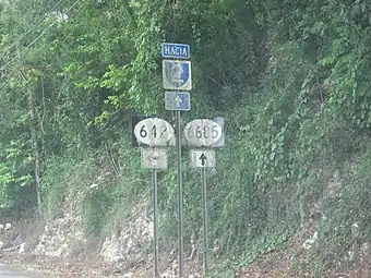 On PR-6685 heading north to PR-2
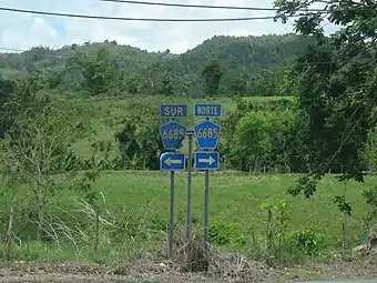 Signs for PR-6685 south and north
References
- Google (28 February 2020). "PR-6685" (Map). Google Maps. Google. Retrieved 28 February 2020.
- "PR-6685, Ciales, Puerto Rico". geoview.info. Retrieved 28 February 2020.
- "PR-6685, Manatí, Puerto Rico". geoview.info. Retrieved 28 February 2020.
- National Geographic Maps (2011). Puerto Rico (Map). 1:125,000. Adventure Map. Evergreen, CO: National Geographic Maps. ISBN 978-1566955188. OCLC 756511572.
- Luis F. Pumarada O’Neill (1991). "Los Puentes Históricos de Puerto Rico" (PDF) (in Spanish). p. 99-100. Retrieved 10 March 2020.
This article is issued from Wikipedia. The text is licensed under Creative Commons - Attribution - Sharealike. Additional terms may apply for the media files.