Q'illu Apachita
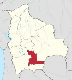
Q'illu Apachita (Aymara and Quechua q'illu yellow, apachita the place of transit of an important pass in the principal routes of the Andes; name for a stone cairn in the Andes, a little pile of rocks built along the trail in the high mountains,[2][3] also spelled Khellu Apacheta) is a mountain in the Bolivian Andes which reaches a height of approximately 4,440 m (14,570 ft). It is located in the Chuquisaca Department, Nor Cinti Province, San Lucas Municipality. It lies northeast of Llaqta Pampa.[1][4]
| Q'illu Apachita | |
|---|---|
 Q'illu Apachita Location within Bolivia | |
| Highest point | |
| Elevation | 4,440 m (14,570 ft) [1] |
| Coordinates | 20°07′15″S 64°47′35″W |
| Geography | |
| Location | Bolivia, Chuquisaca Department |
| Parent range | Andes |
References
- Bolivian IGM map 1:50,000 Comunidad Canchas Blancas 6633-IV
- Radio San Gabriel, "Instituto Radiofonico de Promoción Aymara" (IRPA) 1993, Republicado por Instituto de las Lenguas y Literaturas Andinas-Amazónicas (ILLLA-A) 2011, Transcripción del Vocabulario de la Lengua Aymara, P. Ludovico Bertonio 1612 (Spanish-Aymara-Aymara-Spanish dictionary)
- Teofilo Laime Ajacopa, Diccionario Bilingüe Iskay simipi yuyayk'ancha, La Paz, 2007 (Quechua-Spanish dictionary)
- "San Lucas". INE, Bolivia. Archived from the original on May 6, 2016. Retrieved April 25, 2016.
This article is issued from Wikipedia. The text is licensed under Creative Commons - Attribution - Sharealike. Additional terms may apply for the media files.
