Qillwiri
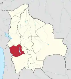
Qillwiri (Aymara qillwa, qiwña, qiwlla Andean gull,[1][2] -(i)ri a suffix, also spelled Khellhuiri) is a mountain in the Andes on the border of Bolivia and Chile. On the Chilean side it is located in the Arica y Parinacota Region. It is situated in the Cordillera Occidental between the mountains Pukintika in the north-west and Lliscaya in the south-east, east of the Suriri salt flat. On the Bolivian side the mountain lies in the Oruro Department, Sabaya Province, Sabaya Municipality.[3][4]
| Qillwiri | |
|---|---|
 Qillwiri Location in Bolivia | |
| Highest point | |
| Coordinates | 18°50′35″S 68°55′32″W |
| Geography | |
| Location | Bolivia, Oruro Department, Sabaya Province Chile, Arica y Parinacota Region |
| Parent range | Andes, Cordillera Occidental |
See also
References
- "Diccionario Bilingüe, Castellano - Aymara, 2002". Félix Layme Pairumani. Archived from the original on September 23, 2015. Retrieved December 12, 2014. (see: Gaviota)
- Programas de Educación Intercultural Bilingüe, Sector Lengua Indígena Aymara, Ministerio de Educación, Chile 2011
- BIGM map 1:50,000 Cerro Capitan Hoja 5837-III
- "Sabaya". Archived from the original on August 13, 2014. Retrieved September 12, 2014.
This article is issued from Wikipedia. The text is licensed under Creative Commons - Attribution - Sharealike. Additional terms may apply for the media files.
