Sainte-Cécile, Indre
Sainte-Cécile is a former commune in the Indre department in central France. On 1 January 2016, it was merged into the new commune of Val-Fouzon.[2]
Sainte-Cécile | |
|---|---|
Part of Val-Fouzon | |
Location of Sainte-Cécile 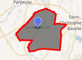
| |
 Sainte-Cécile  Sainte-Cécile | |
| Coordinates: 47°11′18″N 1°40′14″E | |
| Country | France |
| Region | Centre-Val de Loire |
| Department | Indre |
| Arrondissement | Issoudun |
| Canton | Valençay |
| Commune | Val-Fouzon |
| Area 1 | 9.5 km2 (3.7 sq mi) |
| Population (2017)[1] | 91 |
| • Density | 9.6/km2 (25/sq mi) |
| Time zone | UTC+01:00 (CET) |
| • Summer (DST) | UTC+02:00 (CEST) |
| Postal code | 36210 |
| Elevation | 88–121 m (289–397 ft) (avg. 125 m or 410 ft) |
| 1 French Land Register data, which excludes lakes, ponds, glaciers > 1 km2 (0.386 sq mi or 247 acres) and river estuaries. | |
Population
| Year | Pop. | ±% |
|---|---|---|
| 1793 | 230 | — |
| 1800 | 238 | +3.5% |
| 1806 | 242 | +1.7% |
| 1821 | 299 | +23.6% |
| 1831 | 323 | +8.0% |
| 1836 | 353 | +9.3% |
| 1841 | 347 | −1.7% |
| 1846 | 326 | −6.1% |
| 1851 | 318 | −2.5% |
| 1856 | 325 | +2.2% |
| 1861 | 328 | +0.9% |
| 1866 | 357 | +8.8% |
| 1872 | 352 | −1.4% |
| 1876 | 353 | +0.3% |
| 1881 | 332 | −5.9% |
| 1886 | 339 | +2.1% |
| 1891 | 338 | −0.3% |
| 1896 | 313 | −7.4% |
| 1901 | 330 | +5.4% |
| 1906 | 288 | −12.7% |
| 1911 | 280 | −2.8% |
| 1921 | 277 | −1.1% |
| 1926 | 245 | −11.6% |
| 1931 | 232 | −5.3% |
| 1936 | 223 | −3.9% |
| 1946 | 206 | −7.6% |
| 1954 | 202 | −1.9% |
| 1962 | 163 | −19.3% |
| 1968 | 139 | −14.7% |
| 1975 | 118 | −15.1% |
| 1982 | 110 | −6.8% |
| 1990 | 90 | −18.2% |
| 1999 | 99 | +10.0% |
| 2006 | 106 | +7.1% |
| 2009 | 103 | −2.8% |
See also
This article is issued from Wikipedia. The text is licensed under Creative Commons - Attribution - Sharealike. Additional terms may apply for the media files.