Sant'Angelo dei Lombardi
Sant'Angelo dei Lombardi is a town and comune in the province of Avellino in the Campania region of southern Italy.
Sant'Angelo dei Lombardi | |
|---|---|
| Comune di Sant'Angelo dei Lombardi | |
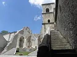
 View of the Goleto Abbey. | |
 Coat of arms | |
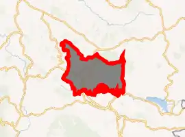
Location of Sant'Angelo dei Lombardi 
| |
 Sant'Angelo dei Lombardi Location of Sant'Angelo dei Lombardi in Italy  Sant'Angelo dei Lombardi Sant'Angelo dei Lombardi (Campania) | |
| Coordinates: 40°56′N 15°11′E | |
| Country | Italy |
| Region | Campania |
| Province | Avellino (AV) |
| Frazioni | See list |
| Government | |
| • Mayor | Marco Marandino |
| Area | |
| • Total | 55.11 km2 (21.28 sq mi) |
| Elevation | 875 m (2,871 ft) |
| Population (13 December 2017)[2] | |
| • Total | 4,207 |
| • Density | 76/km2 (200/sq mi) |
| Demonym(s) | Santangiolesi |
| Time zone | UTC+1 (CET) |
| • Summer (DST) | UTC+2 (CEST) |
| Postal code | 83054 |
| Dialing code | 0827 |
| ISTAT code | 064092 |
| Patron saint | Michael the Archangel |
| Saint day | 29 September |
| Website | Official website |
Geography
Just on a hilltop near the Fredano river, the town is home to a cathedral and a Lombard castle. The town is bordered by Guardia Lombardi, Lioni, Morra De Sanctis, Nusco, Rocca San Felice, Torella dei Lombardi and Villamaina.
Nearby is the Benedictine Abbey of San Guglielmo al Goleto.[3]
History
The name "Sant'Angelo" derives from the town's patron saint Michael the Archangel. Lombardi is derived from the migrant workers of Lombardy who settled there around 1000 AD.[4] The cathedral was originally built in the 11th century and was rebuilt in the 16th century. Also near the Piazza of Andrea is the castle of the Lombards, built around the first half of the 10th century. Initially, it was a jail/prison/fort and was later modified to serve as a castle. There is a small pathway that was constructed under the castle and from there it leads to the main town square where there was an underground prison. In the late 1800s many people from the town immigrated to Brazil and The United States of America.
Earthquake and reconstruction
The town was virtually destroyed by the magnitude 6.9 Irpina earthquake of 23 November 1980.[5]
References
- "Superficie di Comuni Province e Regioni italiane al 9 ottobre 2011". Istat. Retrieved 16 March 2019.
- "Popolazione Residente al 1° Gennaio 2018". Istat. Retrieved 16 March 2019.
- "La storia dell'Abbazia del Goleto". Official web site. Abbazia dei Goleto. Retrieved 8 December 2011.
- Ricerche di storia dell'arte, Issues 34-36, 1988, p. 39
- Download - Catalogo Parametrico dei Terremoti Italiani (in Italian), archived from the original on 2009-05-06, retrieved 2009-04-07,
2413 DI 1980 11 23 18 34 52 Irpinia-Basilicata CFTI 1319 100 100 40.850 15.280 A 6.89 0.04 6.89 0.04 6.89 0.04 927 G 553 1587 2413
| Wikimedia Commons has media related to Sant'Angelo dei Lombardi. |
