Sant'Elpidio a Mare
Sant'Elpidio a Mare is a town and comune in the province of Fermo, in the Marche region of Italy.
Sant'Elpidio a Mare | |
|---|---|
| Comune di Sant'Elpidio a Mare | |
 View of the town | |
 Coat of arms | |
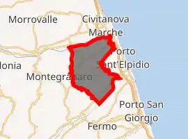
Location of Sant'Elpidio a Mare 
| |
 Sant'Elpidio a Mare Location of Sant'Elpidio a Mare in Italy  Sant'Elpidio a Mare Sant'Elpidio a Mare (Marche) | |
| Coordinates: 43°14′N 13°41′E | |
| Country | Italy |
| Region | Marche |
| Province | Fermo (FM) |
| Frazioni | Casette d'Ete, Cascinare, Bivio Cascinare, Castellano, Luce, Cretarola |
| Government | |
| • Mayor | Alessio Terrenzi |
| Area | |
| • Total | 50.52 km2 (19.51 sq mi) |
| Elevation | 257 m (843 ft) |
| Population (31 December 2016)[2] | |
| • Total | 17,073 |
| • Density | 340/km2 (880/sq mi) |
| Demonym(s) | Elpidiensi |
| Time zone | UTC+1 (CET) |
| • Summer (DST) | UTC+2 (CEST) |
| Postal code | 63811 |
| Dialing code | 0734 |
| Patron saint | Saint Elpidius |
| Saint day | September 2 |
| Website | Official website |
Geography
Sant'Elpidio a Mare is located on a ridge of Marche Apennine, elevation 251 metres (823 ft) above sea level, between the lower river valleys of the river Tenna and Ete Morto, 9 kilometres (6 mi) from the Adriatic Sea.
Toponym
The historical name of locality is documented by an 11th century parchment as "Sancto Elpidio Majore" to distinguish it from other places in Sant'Elpidio Morico Brand Fermana. The abbreviation of "majore" was later changed to "mare" ("sea" in Italian).
History
The town occupies the site of the ancient Roman city of Cluana, destroyed by the Visigoths in the early 5th century. In 887 here a large Benedictine Abbey was founded in 887; the medieval borough rose around it as Castello di Sant'Elpidio, starting from the 11th century.
Main sights
- Imperial Abbey of Santa Croce al Chienti. This is a Benedictine convent founded, according to tradition, in 887 on a pre-existing religious building. The heyday of the abbey was between the 10th and the 12th century in which it was enlarged and renovated in Romanesque style.
- Church of Madonna dei Lumi
- Church of Sant'Elpidio Abate
- Sanctuary of Madonna degli Angeli
- Church of Sant'Agostino (14th century)
- Remains of 3 kilometres (1.9 mi) of the 13th and 14th century walls; only three of the seven original gates are visible today
- Torre Gerosolimitana ("Tower of the Knights of Jerusalem"), built by the Knights Hospitaller in the 16th century
- Town Hall (14th century)
See also
References
- "Superficie di Comuni Province e Regioni italiane al 9 ottobre 2011". Istat. Retrieved 16 March 2019.
- Population data from ISTAT