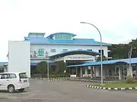
Serasa
Serasa is a settlement, industrial area and the main passenger gateway by sea into Brunei. It is located in the northeasternmost part of Brunei-Muara District, adjacent to the port town of Muara, some 20 kilometres (12 mi) from the capital Bandar Seri Begawan.[1] Serasa is officially a village, the third-level subdivision of Brunei, hence the official Malay name Kampung Serasa (sometimes Kampong Serasa; literally 'Serasa Village'); it is a subdivision under the mukim or subdistrict of the same name. Serasa is home to Serasa Ferry Terminal, the main gateway for passengers and vehicles by sea, and provides connectivity mainly to Labuan, the island federal territory of Malaysia.[2][3] The postcode for Serasa is BT1728.[4][5]
Serasa | |
|---|---|
 Location in Brunei | |
| Coordinates: 5°01′07″N 115°03′28″E | |
| Country | Brunei |
| District | Brunei-Muara |
| Mukim | Serasa |
| Postcode | BT1728 |
Schools
Places of interest
- Serasa Beach
Image gallery
 Serasa Passenger Ferry Terminal
 A ferry at Serasa Ferry Terminal
 Passport exit stamp from the Serasa Ferry Terminal
 Serasa Beach
References
- "PKL JAYA SDN BHD - Ferry Terminal Page". www.pkljaya.com. Retrieved 2018-03-19.
- "Ports Department - Berth and Terminals". www.mincom.gov.bn. Retrieved 2018-03-19.
- "New Serasa Ferry Terminal To Open In October". World Maritime News. 2006-06-23. Retrieved 2018-03-19.
- "Brunei Postal Services - postcodes". post.gov.bn. Retrieved 2018-03-19.
- "Kampong Serasa, Serasa, Brunei Muara: BT1728 | Brunei Postcode". brn.postcodebase.com. Retrieved 2018-03-19.
- "Festive cheer at Serasa Primary School | Borneo Bulletin Online". borneobulletin.com.bn. Retrieved 2018-03-19.
- "Two religious teachers receive special awards | The BT Archive". www.btarchive.org. Retrieved 2018-03-19.
This article is issued from Wikipedia. The text is licensed under Creative Commons - Attribution - Sharealike. Additional terms may apply for the media files.