Sint-Maria-Oudenhove
Sint-Maria-Oudenhove is a village in the Denderstreek and in the Flemish Ardennes, the hilly southern part of the province of East Flanders, Belgium.
Sint-Maria-Oudenhove | |
|---|---|
Village | |
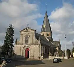
 Church of Sint-Maria-Oudenhove (2009) | |
 Sint-Maria-Oudenhove Location in Belgium | |
| Coordinates: 50.833°N 3.796°E | |
| Country | |
| Region | Flemish Region |
| Province | East Flanders |
| Municipality | Zottegem Brakel |
| Area | |
| • Total | 8.91 km2 (3.44 sq mi) |
| Population (2000)[1] | |
| • Total | 2,971 |
| • Density | 330/km2 (860/sq mi) |
| Time zone | CET |
It was formerly an independent municipality. In 1977 the main part of the settlement became part of the municipality of Zottegem, with a smaller section joining the municipality of Brakel.[1]
History
From the middle of the 12th century, Sint-Maria-Oudenhove was part of the Land of Aalst in loan by the Lords of Zotegem. In 1675, it became a barony.[1]

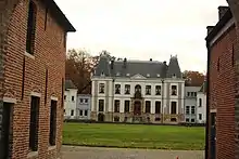
The Castle of Lilare is located near the River Zwalm. The original castle was plundered and set on fire by the troops of Louis XIV during the War of Devolution in 1667.[2] The castle was rebuilt in the late 17th century. In 1933, the castle was bought by the sisters of Saint Francis of Opbrakel and turned into a girl boarding school. The castle is still in use as a school.[3]
During the 20th century, Sint-Maria-Oudenhove became mainly a commuter's community.[1] In 1977, most of the municipality merged into Zottegem with a small area awarded to Brakel.[1]
References
- "Sint-Maria-Oudenhove". Agentschap Onroerend Erfgoed (in Dutch). Retrieved 21 October 2020.
- "Het kasteel van Lilare in Sint-Maria-Oudenhove". Koenraad de Wolf (in Dutch). Retrieved 21 October 2020.
- "Kasteeldomein Norman". Agentschap Onroerend Erfgoed (in Dutch). Retrieved 21 October 2020.
External links
 Media related to Sint-Maria-Oudenhove at Wikimedia Commons