Survey vessel
A survey vessel is any type of ship or boat that is used for mapping. It is a type of research vessel.

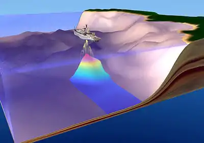
An illustration depicting underwater mapping capability of USNU Bowditch (T-AGS 62)
Role
The task of survey vessels is to map the bottom, benthic zone, full water column, and surface for the purpose of:
- hydrography
- general oceanography
- marine habitats
- salvage
- dredging
- marine archaeology
Survey equipment
Typically, modern survey vessels are equipped with one or more of the following equipment:
- GPS positioning and logging
- single beam sonar
- multibeam sonar
- Side-scan sonar
- towed magnetometer
- subsurface profiler
- grab sampler
- bottom coring device
- DCHP
- CTD
- Inertial Measurement Unit
This article is issued from Wikipedia. The text is licensed under Creative Commons - Attribution - Sharealike. Additional terms may apply for the media files.