Transport corridor
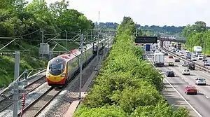
A transport corridor is a generally linear area that is defined by one or more modes of transportation like highways, railroads or public transit which share a common course. Development often occurs around transportation corridors because they carry so many people, creating linear agglomerations like the Las Vegas Strip or the linear form of many neighborhood retail areas.

A 2019 review and meta-analysis of research into transport corridors found that they improved economic welfare, but had adverse environmental impacts.[1]
Examples
- TEN-T Core Network Corridors - planned infrastructure network in the European Union
- Transportation Corridor Agencies - administrative body for toll roads in Orange County, California.
- Pan-European corridors - planned intercity rail network in Central and Eastern Europe
- Western Railway Corridor - proposed rail network in western Ireland
- Southeast High Speed Rail Corridor - proposed high-speed rail network in the Mid-Atlantic and Southeastern United States
- Northeast Corridor - Amtrak high-speed rail network in the Northeast megalopolis of the United States
- Panama Canal - artificial waterway linking the Atlantic Ocean and the Pacific Ocean
SE Asia
- North-South Economic Corridor
- East-West Economic Corridor
- Southern Economic Corridor
See also
References
- Roberts, Mark; Melecky, Martin; Bougna, Théophile; Xu, Yan (Sarah) (2019). "Transport corridors and their wider economic benefits: A quantitative review of the literature". Journal of Regional Science. 0 (2): 207–248. doi:10.1111/jors.12467. hdl:10084/138956. ISSN 1467-9787.
This article is issued from Wikipedia. The text is licensed under Creative Commons - Attribution - Sharealike. Additional terms may apply for the media files.