Tropical cyclone effects in Europe
The effects of tropical cyclones in Europe and their extratropical remnants include strong winds, heavy rainfall, and in rare instances, tornadoes or snowfall. There are only two modern cyclones officially regarded as directly impacting mainland Europe while still fully tropical or subtropical: Hurricane Vince in 2005, which struck southwestern Spain as a tropical depression; and Subtropical Storm Alpha in 2020, which made landfall in northern Portugal at peak intensity. Hurricane Debbie in 1961 may have still been tropical when it made landfall in northwestern Ireland, but this is disputed.[nb 1] In 1842, it is believed that a hurricane struck Europe.
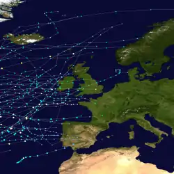
Atlantic hurricanes generally do not form east of the 30th meridian west, and those that do typically continue to the west. Storms can move around the Bermuda high and turn to the northeast and affect Europe. There have been several extratropical cyclones that struck Europe and were colloquially called hurricanes, and some of these European windstorms had hurricane-force winds of over 119 km/h (74 mph). Those storms are not included in this list.[1]
Climatology and predictions
Beginning in the 1860s, advanced meteorological observation stations, as well as ship reports, allowed Atlantic hurricanes to be tracked for extended durations, including to the European mainland in some cases. Most storms that affected Europe have done so from August to October, which is the climatological peak of the Atlantic hurricane season. In a survey of such European tropical cyclones from 1961 to 2010, Dr. Kieran Hickey observed that the storms generally formed west of Africa and recurved to the northeast, or formed off the east coast of the United States and proceeded eastward. Due to their positions far to the west of the rest of Europe, Ireland and the United Kingdom experience the most effects, although countries as far east as Estonia[2] and Russia[3] have experienced tropical cyclone impacts.
Tropical-like systems, referred to as "medicanes,"[4] are occasionally observed over the Mediterranean Sea. Several of these storms have developed eye-like features and hurricane-force winds; however, their nature is contrary to that of a tropical cyclone. The majority of these storm originate from deep, cold-core lows which they do not fully disassociate from. Additionally, unlike tropical systems, sea surface temperatures above 26 °C (79 °F) are not required for their development.[5]
In a paper published in April 2013, the Royal Netherlands Meteorological Institute predicted that by the year 2100, global warming would greatly increase the threat of hurricane-force winds to western Europe from former tropical cyclones and hybrid storms, the latter similar to Hurricane Sandy in 2012.[6] One model predicted an increase from 2 to 13 in the number of cyclones with hurricane-force winds in the waters offshore western Europe. The study suggested that conditions favorable for tropical cyclones would expand 1,100 km (680 mi) to the east. A separate study based out of University of Castile-La Mancha predicted that hurricanes would develop in the Mediterranean Sea in Septembers by the year 2100, which would threaten countries in southern Europe.[7]
Storms
Pre-1900
- August 1680 – A reconstructed path of a hurricane proposed by researchers from contemporary records, which is thought to have undergone extratropical transition over the North Atlantic before affecting Wales and southern England.[8]
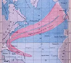
- November 18–19, 1724 – One of the most destructive storms ever experienced in Portugal since the early 17th century,[9] caused damage to the east coast of Madeira and central and northern Portugal. (There is some conjecture whether this storm was a tropical system such as Hurricane Vince in 2005 which impacted Europe).[10]
- October 29, 1842 – Research presented to the American Meteorological Society suggested that the equivalent of a Category 2 hurricane on the Saffir–Simpson scale (SSHWS) was located over the extreme eastern Atlantic Ocean in late October 1842. While passing near Madeira, the storm produced a minimum pressure of 965 mbar (28.5 inHg), causing heavy damage there. Moving to the northeast, the cyclone struck southwestern Spain on October 29, with winds estimated at over 95 km/h (59 mph), which was strong enough to uproot trees and damage houses. Researchers estimated that the storm was becoming extratropical at or shortly after landfall; if tropical, the cyclone would be the only tropical storm to make landfall in continental Europe. The storm was considered an analogue to Hurricane Vince in 2005.[11]
- September 1848 – A hurricane travelled from the Caribbean to the east coast of the United States, eventually dissipating near the United Kingdom. It resulted in one of the earliest completed track maps for an Atlantic hurricane.[12]
- September 1, 1883 – An extratropical storm, which previously passed near Bermuda as a major hurricane, crossed over the British Isles, producing hurricane-force winds and rough seas in London.[13]
- September 6, 1884 – After moving across Newfoundland as a tropical storm, a system struck Ireland with gusty winds as an Extratropical Cyclone.[14]
- September 6, 1887 – The remnants of Hurricane Ten produced strong winds along the northern Irish coastline.[15]
- November 6, 1887 – The 1887 Halloween Tropical Storm that struck Florida became extratropical, moved across the Atlantic Ocean, and eventually brushed southern Ireland before striking France.[16]
1900-1980s
- October 2, 1906 – After tracking across the Azores, a former tropical storm dissipated near Wales, bringing rainfall and strong winds to the United Kingdom.[17]
- September 7, 1917 – The remnants of Hurricane Three were noted just south of Iceland; impacts, if any, are unknown.[18]
- September 26, 1922 – The remnants of Hurricane Two brought gale-force winds to parts of Wales.[19]
- August 26–27, 1927 – The powerful remnants of the 1927 Nova Scotia hurricane moved over Iceland with a central pressure of 963 mbar (28.4 inHg). Hurricane-force winds were measured over the North Atlantic, though winds in Iceland only reached 65 km/h (40 mph).[20]
- September 13–17, 1932 – The extratropical remnants of the 1932 Bahamas hurricane later tracked across Iceland, Jan Mayen Island, northern Scandinavia, and into the far northwestern Soviet Union.[21][22] Maximum Sustained winds in Finland reached 83 km/h (52 mph) while Iceland experienced winds up to 74 km/h (46 mph).[23]
- September 28, 1944 – The remnants of Hurricane Nine merged with another extratropical system over Iceland; impacts, if any, are unknown.[24]
- October 16, 1944 – The remnants of Hurricane Twelve moved over the Iberian Peninsula; Maximum sustained winds reached 74 km/h (46 mph) in Seville, Spain.[25]
- September 17, 1950 – Former Hurricane Dog dissipated near Ireland, after having crossed much of the Atlantic Ocean.[26]
- September 17, 1953 – The remnants of Hurricane Dolly dissipated along the coast of Portugal.[26]
- September 24–25, 1957 – The extratropical remnants of Hurricane Carrie brought strong winds, waves, and severe flooding to the British Isles, resulting in three fatalities.[27][28]
- October 4, 1958 – The remnants of Hurricane Helene dissipated along the coast of Great Britain.[26]
- September 17, 1961 – Hurricane Debbie struck Ireland, although official records are unclear whether it was tropical or not at landfall.[26][29] Regardless of its status, Debbie produced among the lowest pressures in Europe from a post-tropical cyclone, with a pressure of 950 mbar (28 inHg) reported between Ireland and Scotland. At Malin Head in northwestern Ireland, a gust of 183 km/h (114 mph) was reported, which was the highest gust in a survey of post-tropical cyclones from 1960 to 2009. Sustained winds reached 126 km/h (78 mph) at the same location. The high winds caused heavy damage across Ireland, estimated at over $40 million (1961 USD). There were also 12 deaths in the country. High winds also affected Northern Ireland, killing six people.[30][31] Debbie's remnants later impacted the Soviet Union.
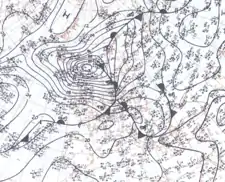
- September 6, 1966 – Hurricane Faith was officially declared extratropical to the north of Scotland,[26] having tracked 13,000 km (8,100 mi) as a tropical cyclone. That day, a pressure of 960 mbar (28 inHg) was reported in the North Sea, along with winds of 167 km/h (104 mph). Faith capsized a boat off the coast of Denmark, killing one person,[1] although the other 144 people on board were rescued.[32] The storm later struck Norway with high winds and rainfall,[1] causing flooding,[33] and proceeded to move over the northern Soviet Union.[34]
- September 21, 1967 – Hurricane Chloe evolved into an extratropical cyclone off the northern coast of France before moving over western Europe.[26] Details on the storm's impact are unknown, though 14 people drowned when the Fiete Schulze sank in the Bay of Biscay.[35][36]
- October 13, 1973 – Hurricane Fran evolved into a powerful extratropical cyclone as it approached the British Isles; it was absorbed by a cold front before moving through the region. Several vessels measured winds up to 95 km/h (59 mph) off the coasts of England and France.[37]
- September 1978 – The remnants of Hurricane Flossie produced extreme winds over parts of Northern Scotland, with a peak value of 167 km/h (104 mph) between Orkney and Shetland.
- October 3, 1981 – The remnants of Hurricane Irene moved ashore in France with winds of about 55 km/h (34 mph).[38]
- October 4, 1985 – The warmest October day on record was recorded at Basel, Switzerland due to the remnants of Hurricane Gloria.[39]
- August 26, 1986 – Former Hurricane Charley moved through Ireland and Great Britain, later dissipating near Denmark.[26] In Dublin, the storm dropped over 200 mm (7.9 in) of rainfall in a 24‑hour period, which set a record and caused severe flooding. Near the city, 451 buildings were flooded after two rivers overflowed their banks.[40] In the Wicklow Mountains, the rainfall resulted in significant runoff, which caused erosion along the Cloghoge River.[41] Record-breaking rainfall also occurred in Wales,[42] causing flooding. Throughout Europe, Charley caused 11 deaths,[43] and the Irish government paid $8.65 million (1986 USD) to pay for road and rail repairs.
- August 28, 1987 – The remnants of Hurricane Arlene dissipated over Spain,[26], which produced heavy rain over parts of southern Spain,[44] as well as Portugal, reaching 127 mm (5 in) at Porto.[1] Moisture from the storm also fueled rains in Italy.[45]
1990s
- August 29, 1991 – Former Hurricane Bob dissipated along the coast of Portugal.[26]
- October 30, 1992 – The remnants of Hurricane Frances dissipated over northwestern Spain,[26] causing heavy rains in northern Portugal.[1]
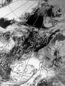
- September 13–15, 1993 – A pressure of 960 mbar (28 inHg) was measured as the remnants of Hurricane Floyd struck France. Off the coast of the British Isles and France, a few vessels became stranded in high seas and 113 km/h (70 mph) winds. The Meteorological Office and the National Rivers Authority stated that tides from the storm could be among the highest of the century. In France, gusts reached 129 km/h (80 mph).[46] Heavy rains around London triggered flooding that closed a few major roads and inundated 50 homes.[47]
- August 25, 1995 – The extratropical remnants of Hurricane Felix dissipated near the Faroe Islands.[26]
- September 7–9, 1995 – After becoming a powerful mid-latitude cyclone, with a pressure of 957 mbar (28.3 inHg) and a core of hurricane-force winds, the remnants of Hurricane Iris struck the British Isles and France.[48] The storm produced wind gusts up to 129 km/h (80 mph) in France and 97 km/h (60 mph) in Britain. More than 2.5 cm (1 in) of rain fell in parts of Devon.[49]
- October 16, 1996 – The remnants of Tropical Storm Josephine merged with another extratropical low near Iceland.[50]
- October 28, 1996 – As an extratropical storm, Hurricane Lili moved across Ireland and the United Kingdom, producing winds up to 148 km/h (92 mph) in Swansea in Wales. The storm left thousands without power and damaged about 500 cottages. A storm surge flooded areas along the River Thames, and high waves nearly grounded an oil rig in Somerset. Damage was estimated at $300 million (1996 USD, £150 million in 1996 pound sterlings),[1] and there were six deaths.[51]
- September 8, 1998 – The extratropical remnants of Hurricane Danielle merged with another storm north of Ireland, which produced strong waves and high winds in Great Britain that forced some evacuations.[52] The storm also spawned a tornado in England.
- September 27, 1998 – Tropical Storm Ivan became extratropical near the Azores,[26] and later affected portions of Europe.
- September 29, 1998 – Ireland and the United Kingdom experienced rains and gusty winds from the remnants of Hurricane Karl.[53]
- October 3, 1998 – Former Hurricane Jeanne dissipated over Spain after striking Portugal.[54]
- November 9, 1998 – The extratropical remnants of Hurricane Mitch produced 145 km/h (90 mph) wind gusts that left over 30,000 homes without power in Ireland. The winds also knocked down trees, one of which severely injured a driver.[55]
2000s
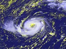
- August 24, 2000 – The extratropical remnants of Hurricane Alberto crossed western Iceland with gale-force winds.[56]
- October 3, 2000 – As an extratropical storm, Hurricane Isaac moved across Northern Ireland and Scotland with gale-force winds,[57] which swept the blue-winged warbler bird to the continent for the first time on record.[58]
- October 10, 2000 – The National Hurricane Center tracked the remnants of Tropical Storm Leslie to a position just off the west coast of Ireland.[59] It proceeded to move across the British Isles.[60]
- October 23, 2002 – An extratropical storm absorbed Hurricane Kyle and later passed near the British Isles, causing one death due to rough seas.[61]
- April 28, 2003 – After being absorbed by a cold front, the remnants of Tropical Storm Ana crossed the British Isles and dropped rainfall.[62]
- October 10, 2003 – Former Hurricane Kate produced 110 km/h (68 mph) in Scotland after passing south of Iceland the previous day.[63]
- August 8, 2004 – The remnants of Hurricane Alex produced 30 mm (1.2 in) of rainfall in portions of County Down in Northern Ireland.[64]
- August 16, 2004 – Heavy rainfall from former Tropical Storm Bonnie, reaching 35 mm (1.4 in), caused flooding in Derry, Northern Ireland.[64]
- August 23, 2004 – The third storm to affect Northern Ireland in the month, former Hurricane Charley, dropped about 25 mm (1 in) of rainfall.[64]
- September 28, 2004 – The extratropical remnants of Hurricane Karl dissipated after striking northwestern Norway,[65] producing high winds and surf but little damage.[1]
- October 3, 2004 – Light rainfall of around 25 mm (1 in), associated with former Hurricane Lisa, affected Northern Ireland,[66] and a tornado related to the system was reported in England.
- September 14, 2005 – The remnants of Hurricane Maria merged with an extratropical storm in the far northeastern Atlantic Ocean,[67] dropping 130 mm (5.1 in) of rainfall on the island of Skye in Scotland. The system produced an atmospheric river over Norway, in combination with moisture from former Hurricane Nate.[68] The systems dropped heavy rainfall, reaching about 150 mm (6 in) of rainfall in some areas.[69] The rains amounted to about 5% of the annual precipitation total in just 12 hours.[70] In Bergen – the second largest city in the country – the rains caused a mudslide that destroyed several homes,[69] injured seven, and killed three people.[70] This was the first heavy precipitation event named by The Norwegian Meteorological Institute, who named it extreme weather Kirstin.[71]

- September 22, 2005 – Former Hurricane Ophelia moved across the Faroe Islands.[26]
- September 29 – October 6, 2005 – Former Hurricane Rita moved across Northern Europe bringing fronts all over the continent.
- October 11, 2005 – Tropical Depression Vince made landfall near Huelva, Spain and dissipated shortly thereafter, making it the first tropical cyclone on record to reach the Iberian Peninsula. Vince previously formed near Madeira, and intensified into a hurricane before weakening. Vince produced wind gusts as strong as 77 km/h (48 mph) in Rota, Cádiz, and rainfall reached 84 mm (3.3 in) in Córdoba province.[72] The rains caused minor roadway flooding.[73]
- June 19, 2006 – As an extratropical cyclone, former Tropical Storm Alberto crossed the British Isles and was absorbed by a frontal system.[74] Winds were unusually strong for the month of June, with a peak gust of 100 km/h (62 mph) recorded at Capel Curig in Wales.[75]
- September 21, 2006 – Hurricane Gordon became extratropical about 440 km (270 mi) west of the coast of Portugal and proceeded to pass just north of the Spanish province of Galicia before turning to the north and looping off western Ireland. In Spain, the former hurricane produced wind gusts of 183 km/h (114 mph) at Punta Candieira in Galicia,[76] and waves of 7 m (23 ft) in height along the coast.[77] The winds left about 100,000 people without power in Spain and caused four injuries there. High winds also left 126,000 people without power in Northern Ireland, where one injury occurred.[76] The storm brought moist air that contributed to record warm temperatures across portions of the United Kingdom.[78]
- September 28, 2006 – The remnants of Hurricane Helene merged with an extratropical storm over Scotland, producing 118 km/h (73 mph) wind gusts in the Outer Hebrides of Scotland.[79]
- October 4, 2008 – A large extratropical storm absorbed former Tropical Storm Laura to the south of Iceland,[80] which later caused road flooding in Great Britain.[81]
- August 27, 2009 – The remnants of Hurricane Bill dropped 31 mm (1.2 in) of rainfall in Shap, England.[82]
- October 6, 2009 – Tropical Storm Grace, which formed farther northeast than any other storm since 1972, became extratropical about 370 km (230 mi) southwest of Cork, Ireland.[83] When the remnants moved over Wales and Great Britain, they dropped locally heavy rainfall, reaching 36.6 mm (1.44 in) in Sennybridge, Wales in a 24‑hour period.[84]
2010s
- September 12, 2011 – An extratropical cyclone, formerly Hurricane Katia, moved across northern Scotland,[85] producing strong wind gusts that reached 158 km/h (98 mph) at the top of the Cairngorms mountain.[86] The winds left thousands of houses without power,[85] while heavy rainfall caused localized flooding.[86] A falling tree killed a bus driver in County Durham, and the unsettled weather from Katia contributed to a car accident on the M54 motorway that killed one person.[85] Katia was absorbed by a larger extratropical storm on September 13,[85] which subsequently caused high winds and power outages in Estonia[2] and Russia.[3]
- October 6, 2011 – The remnants of Hurricane Ophelia combined with a cold front to produce 105 km/h (65 mph) winds and snowfall in Scotland.[87]
- September 12, 2012 – The remnants of Hurricane Leslie struck Iceland with gusty winds,[88] which left about 30,000 people without power after ice-laden lines were blown down.[89]
- September 23, 2012 – Tropical Storm Nadine regenerated southeast of the Azores after having become extratropical a few days prior. The storm would become one of the longest-lasting Atlantic tropical cyclones.[90] While it was nearly stationary, Nadine produced a plume of moisture that dropped heavy rainfall over the United Kingdom, reaching 130 mm (5.1 in) in Ravensworth. The rains flooded houses and disrupted roads and rails.[91] In early October, the remnants of Nadine dropped heavy rainfall in Wales.[92]
- October 26–27, 2012 – After moving ashore in central Portugal, the extratropical cyclone that was formerly Hurricane Rafael dissipated.[93] In mountainous areas of southern France, wind gusts reached 168 km/h (104 mph). Just offshore Barcelona, Spain, three waterspouts formed, though all remained offshore.[94]
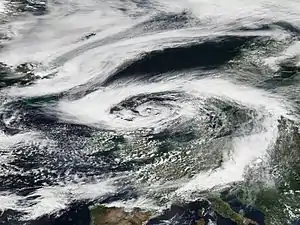
- August 10–11, 2014 – The remnants of Hurricane Bertha brought heavy rainfall and high winds for the time of year to Ireland, the UK and northern France.[95][96][97]
- August 31 – September 1, 2014 – The remnants of Hurricane Cristobal caused gusty winds and heavy rainfall in Iceland, especially in Reykjavík. The fire department received many calls of flooded buildings, while Reykjavík's airport recorded wind gusts as high as 100 km/h (62 mph).[98]
- October 21–24, 2014 – The extratropical remnants of Hurricane Gonzalo reached Europe with wind gusts of 110 km/h (68 mph) recorded in Wales and the Isle of Wight. Downed trees blocked roads and strong winds disrupted transportation. In Southwick, West Sussex three people were injured by falling trees with one woman killed in London. Two men also died in separate accidents in Essex and Merseyside.[99][100] The remnants then proceeded to batter Central Europe. Stuttgart had gusts up to 122 km/h (76 mph), Munich Airport up to 108 km/h (67 mph). Much snow fell in the Alps.[101] As of October 23, Gonzalo's remnants had moved to the Aegean Sea. On October 24, rainfall "tied to the remnants of Hurricane Gonzalo" caused intense flooding in Athens, Greece.[102]
- June 25–27, 2015 – Tropical Storm Bill's remnants caused flash flooding in North East England and brought warm temperatures across England and Wales.[103]
- September 14–17, 2015 – Tropical Storm Henri's remnants left severe thunderstorms in Germany and France, bringing winds as gusty as 120 km/h (75 mph), and killing two people.[104]
- October 11–15, 2015 – Hurricane Joaquin's remnants bought heavy rain across Iberia.[105]
- November 15–16, 2015 – Hurricane Kate's remnants brought heavy rain and high winds to Wales.
- September 13–16, 2016 – Storm Stephanie, cyclonically looped across the Bay of Biscay, exhibited tropical characteristics on Sep 15, first reported example of a "Biscane" (in analogy with Medicane (Mediterranean hurricanes)).[106]
- October 16–17, 2017 – The remnants of Hurricane Ophelia hit Ireland, causing 3 deaths and power outages in Ireland, Northern Ireland, and Wales, with winds reaching almost 100 miles per hour.[107] Over 1000 homes went without power in Scotland as well as causing winds of 76 miles per hour [108]
- November 10–20, 2017 – The remnants of Tropical Storm Rina hit the United Kingdom and Ireland on the night of November 10 and into the following day.[109]
- August 18–19, 2018 – The remnants of Tropical Storm Ernesto brought rainfall to Ireland and the United Kingdom.[110] After undergoing an extratropical transition, Ernesto accelerated towards the British Isles.[111] Storm Ernesto brought heavy rain,[112] which caused some flooding,[113] and wind gusts of up to 30–40 miles per hour (48–64 km/h).[114][115] Ernesto's warmth humidity brought muggy conditions to the British Isles.[116]
- September 17–18, 2018 – The remnants of Hurricane Helene brought strong winds to Ireland, the United Kingdom and Norway.
- October 13, 2018 – Hurricane Leslie transitioned to an extratropical cyclone,[117] and on the same day made landfall in Portugal, causing damage throughout the country's central coast.[118]
- October 16, 2018 – Hurricane Michael's remnants reached Portugal and Spain as an extratropical cyclone.
- On September 12, 2019 – The remnants of Tropical Storm Gabrielle struck Ireland. Later, it struck Great Britain.
- September 24, 2019 – The extratropical remnants of Hurricane Humberto (2019) struck the British Isles.
- October 2–4, 2019 – The extratropical remnants of Hurricane Lorenzo affects the Azores and the United Kingdom.
- November 27–28, 2019 – The extratropical remnants of late-season storm Tropical Storm Sebastien strike England causing gale-force winds and triggering many flood alerts across the country.[119]
2020s
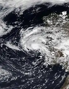
- July 9-11, 2020 – The remnants of Tropical Storm Edouard affected the British Isles and northern Europe before dissipating over the Baltic Sea near Western Russia.
- September 9, 2020 – The remnants of Tropical Storm Omar briefly affected northern Scotland before finally dissipating.
- September 18, 2020 – Subtropical Storm Alpha made landfall in Portugal at peak intensity.[120]
- November 1-2, 2020 - The remnants of Hurricane Zeta affected the British Isles. [121]
- November 15, 2020 - weakening Tropical Storm Theta passes close to Madeira. [122]
See also
- List of South America hurricanes
- List of United States hurricanes
- European windstorm (fully extratropical) – the main type of storms that occur in Europe
- Mediterranean tropical-like cyclone (partially-tropical) – storms that show a varying degree of similarity to Atlantic tropical cyclones
Notes
- For the purposes of the article, mainland Europe is defined as the continent of Europe, including the British Isles and Iceland, but excluding the outermost regions of the European Union, such as the offshore archipelagos of the Azores and the Canary Islands.
References
- David Longshore (1998). Encyclopedia of Hurricanes, Typhoons, and Cyclones, New Edition. New York: Facts on File. p. 110. ISBN 9781438118796. Retrieved 2013-06-19.
- Ingrid Teesalu (September 14, 2011). "Gales Leave 900 Households Blacked Out". err.ee. Retrieved September 9, 2020.
- Ослабевший ураган "Катя" добрался до Санкт-Петербурга (in Russian). KM Онлайн. September 15, 2011. Retrieved September 9, 2020.
- M. Tous & R. Romero (2011-12-13). "Meteorological environments associated with medicane development". International Journal of Climatology. 33 (1): 1–14. Bibcode:2013IJCli..33....1T. doi:10.1002/joc.3428. Retrieved 2013-06-29.
- L. Fita; R. Romero; A. Luque; Kerry Emmanuel & R. Ramis (2007-01-15). "Analysis of the environments of seven Mediterranean tropical-like storms using an axisymmetric, nonhydrostatic, cloud resolving model" (PDF). Natural Hazards and Earth System Sciences. 7 (1): 41–56. Bibcode:2007NHESS...7...41F. doi:10.5194/nhess-7-41-2007.
- Haarsma, R J (2013-03-18). "More hurricanes to hit western Europe due to global warming". Geophysical Research Letters. 40 (9): 1783-1788. doi:10.1002/grl.50360.
- Masters, Jeff (2013-04-08). "Europe expected to see a large increase in Hurricane Sandy-like hybrid storms". Weather Underground. Retrieved 2020-09-03.
- Wheeler, D.; García-Herrera, R.; Vaquero, J. M.; Chenoweth, M.; Mock, C. J. (2009). "Reconstructing The Trajectory of The August 1680 Hurricane From Contemporary Records". Bulletin of the American Meteorological Society. 90 (7): 971–978. Bibcode:2009BAMS...90..971W. doi:10.1175/2009BAMS2649.1.
- Liberato, Margarida L.R. (2014). "The 19 January 2013 windstorm over the north Atlantic: Large-scale dynamics and impacts on Iberia". Weather and Climate Extremes. 5–6: 16–28. doi:10.1016/j.wace.2014.06.002.
- Domínguez-Castro, F.; Trigo, R. M.; Vaquero, J. M. (21 November 2012). "The first meteorological measurements in the Iberian Peninsula: evaluating the storm of November 1724". Climatic Change. 118 (2): 443–455. doi:10.1007/s10584-012-0628-9. hdl:10.1007/s10584-012-0628-9. S2CID 56398071.
- J.Vaquero M.García-Herrera, R.; Wheeler, D.; Chenoweth, M.; Mock, C. J. (2008-02-01). "A Historical Analog of 2005 Hurricane Vince". Bulletin of the American Meteorological Society. 89 (2): 191–201. Bibcode:2008BAMS...89..191V. doi:10.1175/BAMS-89-2-191.
- "Hurricane of August and September 1848". National Oceanic & Atmospheric Administration. Retrieved 2013-06-14.
- José Fernández Partagás (2003). Year 1883 (PDF) (Report). National Oceanic and Atmospheric Administration. Retrieved 2013-06-14.
- José Fernández Partagás (2003). Year 1884 (PDF) (Report). National Oceanic and Atmospheric Administration. Retrieved 2013-06-14.
- José Fernández Partagás (2003). Year 1887 a (PDF) (Report). National Oceanic and Atmospheric Administration. Retrieved 2013-06-14.
- José Fernández Partagás (2003). Year 1887 b (PDF) (Report). National Oceanic and Atmospheric Administration. Retrieved 2013-06-14.
- José Fernández Partagás (2003). Year 1906 (PDF) (Report). National Oceanic and Atmospheric Administration. Retrieved 2013-06-14.
- "Storm Three 1917 Metadata". National Hurricane Center. National Oceanic and Atmospheric Administration. 2008. Retrieved 2013-06-12.
- "Storm Two 1922 Metadata". National Hurricane Center. National Oceanic and Atmospheric Administration. 2009. Retrieved 2013-06-12.
- "Storm One 1927 Metadata". National Hurricane Center. National Oceanic and Atmospheric Administration. 2009. Retrieved 2013-06-12.
- Mitchell, Charles L. (September 1932). "The Tropical Storm of August 30 – September 15, 1932" (PDF). Monthly Weather Review. 60 (9): 177–178. Bibcode:1932MWRv...60..177.. doi:10.1175/1520-0493(1932)60<177:TTSOAI>2.0.CO;2. Retrieved 2013-06-12.
- "Storm Four 1932 Metadata". National Hurricane Center. National Oceanic and Atmospheric Administration. 2013. Retrieved 2013-06-12.
- "Storm Four 1932 Raw Data" (.XLS). National Hurricane Center. National Oceanic and Atmospheric Administration. 2013. Retrieved 2013-06-12.
- "Storm Nine 1944 Metadata". National Hurricane Center. National Oceanic and Atmospheric Administration. 2013. Retrieved 2013-06-19.
- "Storm Twelve 1944 Metadata". National Hurricane Center. National Oceanic and Atmospheric Administration. 2013. Retrieved 2013-06-19.
- "Atlantic hurricane best track (HURDAT version 2)" (Database). United States National Hurricane Center. May 25, 2020.
- Moore, Paul L. (1957-12-01). "The Hurricane Season of 1957" (PDF). Monthly Weather Review. 85 (12): 401–408. Bibcode:1957MWRv...85..401M. doi:10.1175/1520-0493(1957)085<0401:THSO>2.0.CO;2. Retrieved 2013-06-12.
- "World Briefs". The Owosso Argus-Press. London, United Kingdom. Associated Press. 1957-09-25. p. 21. Retrieved 2013-06-12.
- Hurricane Debbie — September 7–15, 1961 Preliminary Report (PDF). National Weather Bureau (Report). National Oceanic and Atmospheric Administration. 1961. Retrieved 2013-01-01.
- "Gale Killed Fifteen". Irish Independent. September 18, 1961. p. 3. – via Irish Newspaper Archives (subscription required)
- "Man Hurt In Storm Dies". Irish Press. October 2, 1961. p. 7. – via Irish Newspaper Archives (subscription required)
- "Ferry Boat Captain Credits Luck". Edmonton Journal. Associated Press. 1966-09-08. p. 41. Retrieved 2013-06-21.
- Lars Andreas Roald (2008). Rainfall Floods and Weather Patterns (PDF) (Report). Norwegian Water Resources and Energy Directorate. pp. 31 and 34. Archived from the original (PDF) on 2013-10-05. Retrieved 2013-02-14.
- Arnold L. Sugg (March 1967). The Hurricane Season of 1966 (PDF) (Report). National Hurricane Center. pp. 137 and 138. Retrieved 2013-02-27.
- Arnold L. Sugg & Joseph M. Pelissier (April 1968). "The Hurricane Season of 1967" (PDF). Monthly Weather Review. 96 (4): 248. Bibcode:1968MWRv...96..242S. doi:10.1175/1520-0493(1968)096<0242:THSO>2.0.CO;2. Retrieved 2013-06-21.
- "MV Fiete Schulze (+1967)". Wreck Site. Retrieved August 26, 2013.
- John R. Hope (1973). "Hurricane Fran (Bravo) Preliminary Report". National Hurricane Center. p. 3. Retrieved 2013-06-21.
- Hurricane Irene Preliminary Report (GIF) (Report). National Hurricane Center. 1981-10-20. Retrieved 2013-06-21.
- Miles B. Lawrence (1985-11-03). Hurricane Gloria Preliminary Report (GIF) (Report). National Hurricane Center. p. 2. Retrieved 2013-08-11.
- Irish Meteorological Service (1986). "August 1986 Monthly Weather Bulletin". Archived from the original on 2011-06-17. Retrieved 2008-10-25.
- Mary C. Bourke (1990). "The effect of Hurricane Charley on the Cloghoge River, Ireland". Planetary Science Institute. Archived from the original on 2007-02-22. Retrieved 2008-10-26.
- National Meteorology Library and Archive (1986). "Charley comes to Wales: 25 August 1986". Government of the United Kingdom.
- Staff Writer (1986-08-26). "Tail End of Hurricane Charley Kills At Least 11 in Britain and Ireland". Associated Press. – via LexisNexis (subscription required)
- Harold P. Gerrish (1987-10-16). "Hurricane Arlene Preliminary Report: Page Two". National Hurricane Center. Retrieved 2011-06-12.
- J.G. Pinto, M. Klawa, U. Ulbrich, R.Rudari and P. Speth (October 2001). "Extreme Precipitation Events Over Northwest Italy" (PDF). Centro di Ricerca Interuniversitario in Monitoraggio Ambientale. Archived from the original (PDF) on 2011-10-05. Retrieved 2013-06-12.CS1 maint: multiple names: authors list (link)
- Ian Murray (1993-09-14). "Nimrod rescues plane hit by lightning in mid-Atlantic". The Times. – via LexisNexis (subscription required)
- Barbara Mcmahon & David Taylor (1993-09-14). "Mountain Rescue for Cadets as Storms Rage". Evening Standard. p. 1. – via LexisNexis (subscription required)
- Chris Thorncrof; Sarah C. Jones (April 2000). "The Extratropical Transitions of Hurricanes Felix and Iris in 1995". Monthly Weather Review. 128 (4): 947–972. Bibcode:2000MWRv..128..947T. doi:10.1175/1520-0493(2000)128<0947:TETOHF>2.0.CO;2. ISSN 1520-0493.
- Chris Court & Andrew Woodcock (1995-09-07). "Hurricane Iris Blows Into Britain". Press Association. – via LexisNexis (subscription required)
- Richard Pasch (1997-02-21). Tropical Storm Josephine Preliminary Report (Report). National Hurricane Center. Retrieved 2013-06-21.
- Miles B. Lawrence (1996-11-18). Hurricane Lili Preliminary Report (Report). National Hurricane Center. Retrieved 2013-06-17.
- Richard Pasch (1999-01-19). Hurricane Danielle Preliminary Report (Report). National Hurricane Center. Retrieved 2013-06-17.
- Andy Gales (1998-09-29). "Hurricane is set to storm into Britain". The Evening Chronicle. Newcastle, United Kingdom. (accessed via Lexis Nexis on 2013-06-10)
- Richard J. Pasch (1999-02-08). Hurricane Jeanne Tropical Cyclone Report (Report). National Hurricane Center. Retrieved 2013-06-17.
- Lynne Kelleher (1998-11-10). "Hurricane Mitch leaves 30,000 homes in dark out after night of chaos". The Mirror. London. Retrieved 2013-06-10.
- Jack Beven (2000-12-08). Hurricane Alberto Tropical Cyclone Report (Report). National Hurricane Center. Retrieved 2013-06-09.
- Richard J. Pasch (2000-12-18). Hurricane Isaac Tropical Cyclone Report (Report). National Hurricane Center. Retrieved 2013-06-09.
- Chuck Kruger (2000). "Tail-end of Hurricane Sets A Record On Cape". Surfbirds.com. Archived from the original on January 7, 2009. Retrieved 2011-05-26.
- James Franklin; Daniel Brown (2000-11-05). Tropical Storm Leslie Tropical Cyclone Report (Subtropical Depression One) (Report). National Hurricane Center. Retrieved 2013-06-09.
- Brett Israel (2011-09-12). "Article: How Often Does Britain Get Hit by Hurricanes?". LiveScience.com. Retrieved 2013-06-09.
- Kevin Boyle; Gary Padgett (2002). "October 2002 Worldwide Tropical Summary". Australian Severe Weather. Retrieved 2013-06-09.
- Gary Padgett (2003). "April 2003 Global Tropical Cyclone Summary". Retrieved 2013-06-09.
- Kevin Boyle (2003). "Monthly Global Tropical Cyclone Summary September 2003". Gary Padgett. Retrieved 2013-06-11.
- August 2004 Weather Summary (Report). United Kingdom Met Office. 2013-02-27. Retrieved 2013-06-14.
- Jack Beven (2004-12-17). Hurricane Karl Tropical Cyclone Report (Report). National Hurricane Center. Retrieved 2013-06-09.
- October 2004 Weather Summary (Report). United Kingdom Met Office. 2013-02-27. Retrieved 2013-06-14.
- Richard J. Pasch; Eric S. Blake (2006-02-08). Hurricane Maria Tropical Cyclone Report (PDF) (Report). National Hurricane Center. Retrieved 2013-06-14.
- A. Stohl; C. Forster; H. Sodemann (2008). "Remote sources of water vapor forming precipitation on the Norwegian west coast at 60ºN–a tale of hurricanes and an atmospheric river" (PDF). Journal of Geophysical Research. 113 (D5): n/a. Bibcode:2008JGRD..113.5102S. doi:10.1029/2007jd009006.
- "Weakened Hurricane Maria Leaves One Dead In Norway". Terra Daily. Agence France-Presse. 2005-09-14. Retrieved 2013-06-14.
- Ove Langeland; Per Medby; Bjørg Langset (2011-05-31). Climate Change and Territorial Effects on Regions and Local Economies (PDF) (Report). European Observation Network. Archived from the original (PDF) on 2014-01-09. Retrieved 2013-06-14.
- "Norske ekstremvær får navn" (in Norwegian). Norwegian Meteorological Institute. Retrieved 9 January 2014.
- James L. Franklin (2006-02-22). Hurricane Vince Tropical Cyclone Report (PDF) (Report). National Hurricane Center. Retrieved 2013-06-10.
- "Problemas en varias carreteras de la provincia" (in Spanish). Diario Cordoba. 2005-10-13. Archived from the original on 2008-09-16. Retrieved 2013-06-10.
- Lixion Avila; Daniel Brown (2006-08-11). Tropical Storm Alberto Tropical Cyclone Report (PDF) (Report). National Hurricane Center. Retrieved 2013-06-14.
- June 2006 Weather Summary (Report). United Kingdom Met Office. 2013-02-27. Retrieved 2013-06-14.
- Eric Blake (2006-11-14). Hurricane Gordon Tropical Cyclone Report (PDF) (Report). National Hurricane Center. Retrieved 2011-05-03.
- Agencia Estatal de Meteorología. "Las Consecuencias de Gordon en Espana" (PDF) (in Spanish). Government of Spain. Archived from the original on October 4, 2006. Retrieved 2011-05-09.CS1 maint: unfit URL (link)
- Lewis Smith & Paul Simons (2006-09-22). "Gordon keeps the forecasters guessing". The Sunday Times. Retrieved 2011-05-10.
- Daniel P. Brown (2006-11-15). Hurricane Helene Tropical Cyclone Report (PDF) (Report). National Hurricane Center. Retrieved 2013-06-14.
- Richard J. Pasch (2009-02-04). Tropical Storm Laura Tropical Cyclone Report (PDF) (Report). National Hurricane Center. Retrieved 2013-06-10.
- "Tropical storm brings floods". The Westmorland Gazette. 2008-10-04. Retrieved 2013-06-11.
- Laura Harding (2009-08-27). "More rain expected in parts of UK". The Independent. Retrieved 2013-06-10.
- Robbie Berg (2009-11-28). Tropical Storm Grace Tropical Cyclone Report (PDF) (Report). National Hurricane Center. Retrieved 2013-06-10.
- October 2009 Weather Summary (Report). United Kingdom Met Office. 2013-02-27. Retrieved 2013-06-14.
- Stacy Stewart (2012-01-16). Hurricane Katia Tropical Cyclone Report (PDF) (Report). National Hurricane Center. Retrieved 2013-06-10.
- Post-tropical storm Katia – September 2011 (Report). United Kingdom Met Office. 2011-11-15. Retrieved 2013-06-10.
- "Snow and high winds forecast as hurricane and Arctic air combine to blast Scotland". The Daily Record. 2011-10-06. Retrieved 2013-06-10.
- Fred Campagna (2012-09-12). "Remnants of Leslie follow freak snow storm in Iceland". Right Weather. Retrieved 2013-06-11.
- "Worked to become 3 am". Mbl.is. 2012-09-11. Retrieved 2013-06-14.
- Daniel P. Brown (2013-01-08). Hurricane Nadine Tropical Cyclone Report (PDF) (Report). National Hurricane Center. Retrieved 2013-06-11.
- "Tropical Storm Nadine finally breaks up". BBC. 2012-10-05. Retrieved 2013-06-11.
- October 2012 Weather Summary (Report). United Kingdom Met Office. 2013-02-27. Retrieved 2013-06-14.
- Lixion Avila (2013-01-14). Hurricane Rafael Tropical Cyclone Report (PDF) (Report). National Hurricane Center. Retrieved 2013-06-10.
- "European Severe Weather Database". European Severe Storms Laboratory. 2013. Retrieved 2013-06-22.
- "UK weather still affected by ex-hurricane Bertha". BBC News. 11 August 2014. Retrieved 11 August 2014.
- "Coup de vent en Manche". Météo-France/CMS. 10 August 2014. Retrieved 11 August 2014.
- "Impacts of ex-hurricane Bertha". Met Office. 12 August 2014. Retrieved 26 August 2014.
- "Iceland in the eye of the storm (Translated from Icelandic)". Visir.
- BBC editorial staff (October 21, 2014). "Hurricane Gonzalo: Woman hit by tree in London dies". The British Broadcasting Corporation. Retrieved October 21, 2014.
- "Hurricane Gonzalo live: two dead as winds batter Britain". Telegraph.co.uk. 21 October 2014. Retrieved 21 October 2014.
- "Wetter-News für Deutschland, Europa und weltweit – Wetter24.de". Wetter24.de. Archived from the original on 24 October 2014. Retrieved 16 October 2018.
- Greece Flooding, Caused By Slow-Moving Remnants of Hurricane Gonzalo, Covers Athens Streets Archived 2014-11-15 at the Wayback Machine
- "A mini heatwave is on its way to the UK". Retrieved 16 October 2018.
- "TD 9 Forms in Central Atlantic".
- "More severe weather forecast for southern and eastern Europe but calmer conditions here in the UK". Retrieved 16 October 2018.
- Maier‐Gerber, Michael; Pantillon, Florian; Muzio, Enrico Di; Riemer, Michael; Fink, Andreas H.; Knippertz, Peter (1 August 2017). "Birth of the Biscane". Weather. 72 (8): 236–241. doi:10.1002/wea.2995.
- "Three killed as storm sweeps into Ireland". 17 October 2017. Retrieved 16 October 2018 – via www.bbc.com.
- "Clear-up after Ophelia wind damage". 17 October 2017. Retrieved 16 October 2018 – via www.bbc.com.
- "Rina to bring rain and wind to Ireland and UK into early Saturday".
- "Tropical storm Ernesto looks set to reach Ireland on Saturday night". 18 August 2018. Retrieved 16 October 2018.
- Laud, Georgina (17 August 2018). "Storm Ernesto path update: Where is Storm Ernesto now? When will it hit UK?". Express.co.uk. Retrieved 2 October 2018.
According to the NHC: “Ernesto is moving quickly toward the northeast near 25 mph (41 km/h), and an even faster motion toward the northeast or east-northeast is expected during the next day or two.”
- Godlewski, Nina (18 August 2018). "Tropical storm Ernesto looks set to reach Ireland on Saturday night". Newsweek. Retrieved 2 October 2018.
But the storm was still set to bring heavy rains and some wind gusts to the islands off the coast of Ireland and the country itself by Saturday night and continuing into Sunday. Heavy rain was expected in some areas and was expected to lighten through the day Sunday to a drizzle, according to the Met Service. The storm could even bring rain to Scotland, Northern Ireland and other parts of the United Kingdom after passing over Ireland.
- Godlewski, Nina (18 August 2018). "Tropical storm Ernesto looks set to reach Ireland on Saturday night". Newsweek. Retrieved 2 October 2018.
About an inch of rain was expected to fall in most places as the storm traveled across the U.K. though some areas could see higher rainfall totals, AccuWeather reported. Areas where more rain falls could potentially cause flash flooding.
- Godlewski, Nina (18 August 2018). "Tropical storm Ernesto looks set to reach Ireland on Saturday night". Newsweek. Retrieved 2 October 2018.
The strongest gusts of winds were expected to be between 30 and 40 mph
- "Storm Ernesto on course for the UK and Ireland this weekend". Sky News. Retrieved 2 October 2018.
Western Ireland will also see "thicker cloud, stronger winds and persistent rain", according to Sky News weather presenter Jo Edwards.
- "Storm Ernesto on course for the UK and Ireland this weekend". Sky News. Retrieved 2 October 2018.
Ernesto will leave behind a legacy of overcast and muggy conditions when it eventually clears into the North Sea late on Sunday.
- Avila, Lixion. Post-Tropical Cyclone Leslie Tropical Cyclone Update. National Hurricane Center (Report). National Oceanic and Atmospheric Administration. Retrieved 13 October 2018.
- "A tempestade Leslie entrou pela Figueira da Foz e fustigou o Centro" (in Portuguese). Diário de Notícias. October 14, 2018. Retrieved October 14, 2018.
- "UK weather forecast: Storm Sebastian strikes with heavy rain and high winds as Met Office issues yellow warnings". INews UK. November 27, 2019.
- https://www.nhc.noaa.gov/text/refresh/MIATCDAT4+shtml/182055.shtml
- "Hurricane Zeta path: How UK weather will be affected by US tropical storm – and latest Met Office forecast".
- https://www.nhc.noaa.gov/archive/2020/al30/al302020.discus.021.shtml?