Vérargues
Vérargues is a former commune in the Hérault department in the Occitanie region in southern France. On 1 January 2019, it was merged into the new commune Entre-Vignes.[2]
Vérargues | |
|---|---|
Part of Entre-Vignes | |
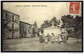
 An old postcard view of Vérargues | |
 Coat of arms | |
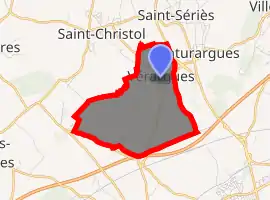
Location of Vérargues 
| |
 Vérargues  Vérargues | |
| Coordinates: 43°43′02″N 4°06′01″E | |
| Country | France |
| Region | Occitanie |
| Department | Hérault |
| Arrondissement | Montpellier |
| Canton | Lunel |
| Commune | Entre-Vignes |
| Area 1 | 5.51 km2 (2.13 sq mi) |
| Population (2017)[1] | 747 |
| • Density | 140/km2 (350/sq mi) |
| Time zone | UTC+01:00 (CET) |
| • Summer (DST) | UTC+02:00 (CEST) |
| Postal code | 34400 |
| Elevation | 15–65 m (49–213 ft) (avg. 80 m or 260 ft) |
| 1 French Land Register data, which excludes lakes, ponds, glaciers > 1 km2 (0.386 sq mi or 247 acres) and river estuaries. | |
Climate
The climate is hot-summer Mediterranean (Köppen: Csa).[3] On 28 June 2019, during the 2019 European heat wave, a temperature of 46.0 °C (114.8 °F) was recorded in Vérargues, the highest in French meteorological history.[4]
Population
| Year | Pop. | ±% |
|---|---|---|
| 1962 | 178 | — |
| 1968 | 308 | +73.0% |
| 1975 | 348 | +13.0% |
| 1982 | 291 | −16.4% |
| 1990 | 524 | +80.1% |
| 1999 | 446 | −14.9% |
| 2008 | 696 | +56.1% |
See also
References
- Téléchargement du fichier d'ensemble des populations légales en 2017, INSEE
- Arrêté préfectoral 13 December 2018 (in French)
- "Climat Gallargues-le-Montueux: Température moyenne Gallargues-le-Montueux, diagramme climatique pour Gallargues-le-Montueux - Climate-Data.org". fr.climate-data.org. Retrieved 2019-06-29.
- http://www.meteofrance.fr/actualites/74345599-c-est-officiel-on-a-atteint-les-46-c-en-france-en-juin
| Wikimedia Commons has media related to Vérargues. |
This article is issued from Wikipedia. The text is licensed under Creative Commons - Attribution - Sharealike. Additional terms may apply for the media files.