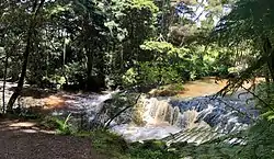
Waitakaruru Stream
The Waitakaruru Stream is a major tributary of the Piako River, within the Waikato region of New Zealand's North Island. It should not be confused with the similarly named Waitakaruru River, which is also in the Waikato Region.
| Waitakaruru Stream | |
|---|---|
 Waterfall on the Waitakaruru Stream, beside the Morrinsville River Walk | |
| Location | |
| Country | New Zealand |
| Physical characteristics | |
| Source | |
| • location | Te Miro-Tahuroa Hills |
| • elevation | 350 m (1,150 ft) |
| Mouth | |
• location | Piako River, at Morrinsville |
• elevation | 20 m (66 ft) |
| Length | 25 km (16 mi) |
| Basin size | 175 km2 (68 sq mi) |
| Discharge | |
| • average | 1.5 m3/s (53 cu ft/s) |
The Waitakaruru Stream has its origin in the Te Miro-Tahuroa Hills south of Morrinsville, within the Waikato District. Initially the stream flows south and south-west through Scotsman's Valley before turning northwards at Tauwhare flowing roughly parallel to the Pakaroa Range as it passes the boundary of Eureka before entering the Matamata-Piako District. The stream passes through the settlement of Motumaoho, progressively turning a more easterly direction towards Morrinsville, where it has a 1.8 km (1.1 mi) walkway beside it[1] and converges with the larger Piako River on southern outskirts of the town.
The stream catchment is highly modified by agriculture, ranging from sheep, beef and dairy farming. Parts of the middle catchment are prone to minor flooding due to a natural constriction in the stream channel between Eureka and Motumaoho. The stream is part of the Eureka Drainage Scheme, managed by the Waikato Regional Council.[2]
The Waitakaruru Stream is notable in that it forms part of the catchment boundary between the Piako River catchment and the Waikato River catchment. The Piako River drains into the Firth of Thames, and ultimately the Pacific Ocean, while the Waikato River drains into the Tasman Sea. The bordering sub-catchment which feeds the Waikato River is the Mangaonua Stream.[3] It also has a tributary named Waitakaruru Stream.[4][5]
Near its source, in the Scotsman Valley area, the stream has short- and long-fin eels, common bully, torrentfish and koura.[6]
See also
References
"Place name detail: Waitakaruru Stream". New Zealand Gazetteer. New Zealand Geographic Board. Retrieved 28 February 2013.
- "Morrinsville River Walk". www.mpdc.govt.nz. Retrieved 29 December 2018.
- http://www.waikatoregion.govt.nz/Environment/Environmental-information/REDI/911500/
- "Mangaonua Stream, Waikato". NZ Topo Map. Retrieved 29 December 2018.
- "Regional rivers water quality monitoring programme: Data report 2016" (PDF). Waikato Regional Council. June 2018.
- "Waitakaruru Stream, Waikato". NZ Topo Map. Retrieved 30 December 2018.
- NIWA (March 2017). "Waihou and Piako ecological monitoring" (PDF). Waikato Regional Council.