Waterpocket Fold
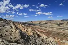
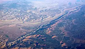
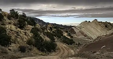
The Waterpocket Fold is a geologic landform that extends from southern Wayne through Garfield and ending in northern Kane counties of southern Utah, United States.[1] The geologic structure is a south-southeast trending fold in which the east side is dropped relative to the west side. This monoclinal fold extends for nearly 100 miles (160 km) in the semi-arid plateau of the central part of the state. The structure defines the Capitol Reef National Park in southern Utah.[2][3]


The feature can be observed in three scenic routes in the park. One route leads to a famous landmark known as the Golden Throne. The northern portion of the Waterpocket Fold lies north and east of the town of Fruita, three miles (4.8 km) west and just southeast of the Middle Desert.[4] Utah State Route 24 crosses the fold east of Fruita and Notom Road runs south through Notom and runs parallel to the east (downdropped) side of the structure to its intersection with Utah State Route 276 just north of Lake Powell. The southern end of the structure extends to the Colorado River just southwest of Halls Crossing.[1]


See also
References
- Utah Atlas & Gazeteer, DeLorme, 9th ed., 2014, pp. 44, 52, 60-1 ISBN 0899332552
- National Park Service: Geology of Capital Reef
- U.S. Geological Survey Geographic Names Information System: Waterpocket Fold
- "Capitol Reef: Geology". National Park Service.
External links
 Media related to Waterpocket Fold at Wikimedia Commons
- Photo gallery of the Fold
- Geologic Maps and Images of the Waterpocket Fold, Remote sensing tutorial at USGS