Whiting Ranch Wilderness Park
Whiting Ranch Wilderness Park is a public regional park in southern Orange County, California. Whiting Ranch features riparian, oak woodland, grassland, chaparral, and coastal sage scrub environments throughout various canyons and hillscapes.[1] The 2,500 acre park mostly encompasses unincorporated land just outside of Lake Forest. The park is home to over 17 miles of trail spread out over 23 different paths, making the location a popular destination for mountain bikers, hikers, and horseback riders.[1]
| Whiting Ranch Wilderness Park | |
|---|---|
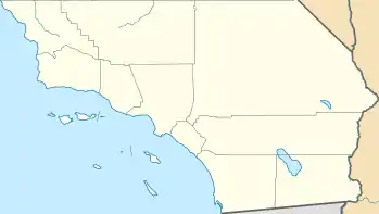
 Location of Whiting Ranch Wilderness Park in California | |
| Location | Orange County, California, United States |
| Nearest city | Lake Forest |
| Coordinates | 33°40′29″N 117°38′32″W |
| Area | 2,500 acres (10 km2) |
| Max. elevation | Vista Lookout 33°32′01″N 117°39′21″W 1,500 ft (460 m) |
| Named for | Dwight Whiting |
| Operator | OC Parks |
| Website | OC Parks |
The park is close to Cleveland National Forest. Mountain lions frequent the park, searching for deer and small animals. While attacks on people are rare, they do occur and visitors are warned to be alert and not approach the animals.[2][3][4]
History
Whiting Ranch was first part of a 10,000 acre ranch named Rancho Canada de Los Alisos that was granted to Jose Serrano in 1842. Following a period of cattle and crop farming, Serrano had to foreclose the property in 1864 due to a drought. Dwight Whiting bought most of the land in 1885 after it was divided up by land developer J. S. Slauson. Whiting developed a large portion of the property into the city of El Toro, now known as Lake Forest. Whiting Ranch was left mostly untouched until a 1959 sale of the area to V.P. Baker and Associates, who have since built homes near the site.[5]
Amenities
Trails
Whiting Ranch is home to 23 different trails, 16 of which are currently open:[6]
- Cactus Hill Trail
- Concourse Road
- Coyote Brush Road (staging area on Glenn Ranch Road in Foothill Ranch)
- Dreaded Hill Road
- Edison Road
- Line Shack Road
- Live Oak Trail
- Raptor Road
- Sage Scrub Trail
- Santiago Ranch Road
- Serrano Cow Trail
- Serrano Road
- Sleepy Hollow Trail
- Vulture View Road
- Whiting Road
- Whiting Spur Road
As of January 2021, the following trails are temporarily closed due to the Silverado Fire:
- Billy Goat Trail
- Borrego Canyon Trail (cyclists one-way, staging area on Portola Parkway in Foothill Ranch)
- Cattle Pond Loop Trail
- Mustard Road
- Red Rock Canyon Trail
- Vista Lookout Road
- Water Tank Road
Borrego Canyon
Borrego Canyon is a portion of the park that features an entrance point at Portola Parkway and the Borrego Canyon Trail. The lower portion of Borrego Canyon is tightly situated between two Foothill Ranch housing tracts and is covered with a swath of oak trees. Snakes, deer, and birds can be found living in this area.[7]
Red Rock Canyon
Red Rock Canyon is an area at the north end of the park that has become a popular location for visitors. The red sandstone cliffs are unique to the area and thus have become one of the most notable features of the park. Due to the gradual erosion of the canyon, fossils have been discovered there.[8][9] As of January 2021, the canyon is inaccessible due to damages from the Silverado Fire.[6]
Serrano Creek
The 7.5 mile long Serrano Creek travels through Whiting Ranch.[10]
Wildfires
Due to the dry climate in much of the park, Whiting Ranch has been subject to numerous wildfires. The 2007 Santiago Fire devastated the area, burning 90% of the property and leaving a lasting effect over a decade later.[1]
The Silverado Fire, which took place in October 2020, burned a similar path to the Santiago Fire and burned through much of the park.[12] The Bond Fire, another wildfire that took place in the same vicinity in December 2020, did not cause much further damage to the park. According to the Orange County Fire Authority, the forward progress of the Bond Fire was largely hampered by the Silverado Fire burn scar,[13] much of which covers Whiting Ranch.
See also
References
- "Whiting Ranch Wilderness Park". OC Parks. Retrieved December 31, 2020.
- "Mountain lion spotted three times Monday at Whiting Ranch". Orange County Register. September 20, 2016. Retrieved December 31, 2020.
- "Mountain lions force closure of Whiting Ranch – Orange County Register". Retrieved January 1, 2021.
- "Mountain lion attacks, injures 3-year-old boy at Lake Forest wilderness park – Orange County Register". Retrieved January 1, 2021.
- "History". OC Parks. Retrieved December 31, 2020.
- "Whiting Ranch Closure Map". OC Parks. November 23, 2020. Retrieved January 1, 2021.
- McKinney, John. "Borrego Canyon Trail". Hiking Project. Retrieved January 1, 2021.
- "Whiting Ranch Hiking: Red Rock Canyon". Hiking Guy. Retrieved January 1, 2021.
- "Whiting Ranch Wilderness Park". Run/Bike/Hike Trails. Retrieved January 1, 2021.
- Hester, Jeff (June 11, 2013). "Whiting Ranch: Dreaded Hill & Red Rock Canyon". SoCal Hiker. Retrieved January 1, 2021.
- "Borrego Canyon to Vista Look Out Trail". AllTrails. Retrieved January 1, 2021.
- "Silverado Fire: More Than 13,000 Acres; Containment At 25%; Some Evacuation Orders Lifted". LAist. October 29, 2020. Retrieved December 31, 2020.
- Johnson, R. J. (December 3, 2020). "House Fire Sparks Brush Fire in Silverado Canyon, 7,200 Acres Burned". KFI AM 640. Retrieved December 31, 2020.
External links
- David Whiting (July 11, 2012). "Whiting: Ranch offers family mystery – Orange County Register". The Orange County Register. Retrieved December 31, 2020.